Skip to search
Skip to main content
Skip to first result
Digital Commonwealth
Folders
Sign Up / Log In
Search for
Search
Search
Search
Basic
Advanced
Explore
Map
Collections
Institutions
Formats
For Educators
Primary Source Sets
Lesson Plans
Using Primary Sources
Searching Digital Commonwealth
For Institutions
Join Digital Commonwealth
Conferences, Trainings, & Events
How to Contribute Collections
Digitization Services
Board & Committees
Frequently Asked Questions
About
About Digital Commonwealth
News & Announcements
Copyright & Terms of Use
Harmful Content Statement
Partners
API
Contact Us
Search
Search Constraints
Start Over
Save Search
Your search:
More Like
commonwealth-oai:z029pk45q
✖
Remove constraint More Like: commonwealth-oai:z029pk45q
« Prev.
|
81
-
100
of
1,415
|
Next »
Sort
by relevance
relevance
title
date (asc)
date (desc)
Number of results to display per page
20
per page
per page
10
per page
20
per page
50
per page
100
per page
View results as:
List
list view
Maps
map view
Gallery
grid view
Search Results
81.
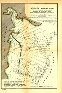
Duxbury Harbor, Mass. Showing Proposed Improvements
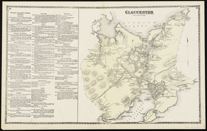
82.
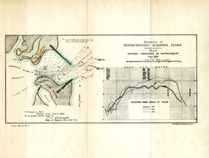
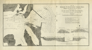
Entrance of Newburyport Harbor, Mass.: Plan Showing Condition of Improvement
83.
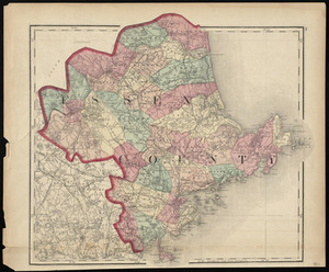
Essex County
84.
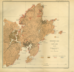
Geologic Map of Cape Ann, Mass.: Showing Distribution of Dikes, etc.
85.
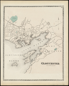
Gloucester
86.
Gloucester
87.
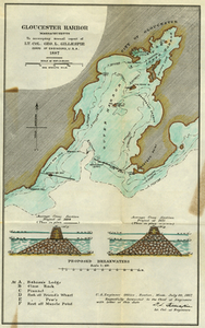
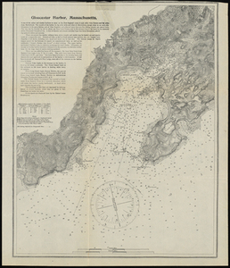
Gloucester Harbor, Massachusetts
88.
Gloucester Harbor, Massachusetts
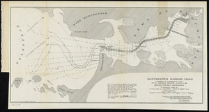
89.
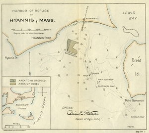
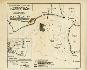
Harbor of Refuge at Hyannis, Mass.
90.
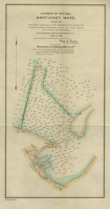
Harbor of Refuge, Nantucket, Mass., Plat B Proposed Location of the Eastern Jetty in Case the Channel is to Be Excavated Partly...
91.
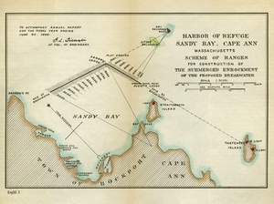
Harbor of Refuge, Sandy Bay, Cape Ann, Massachusetts: Scheme of Ranges for the Construction of the Submerged Enrockment of the...
92.
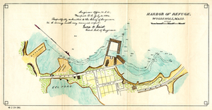
Harbor of Refuge, Woods Holl, Mass.
93.
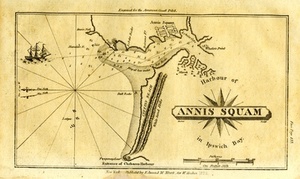
Harbour of Annis Squam in Ipswich Bay.
94.
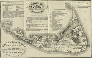
Historical Map of Nantucket
95.
Hyannis Harbor, Mass.: Surveyed in Accordance With an Act of Congress of July 5 1884, Under the Direction of George H. Elliot,...
96.
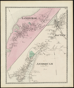
Lanesville, Bay View, Annisquam
97.
Manchester Harbor, Mass.Suveyed in Accordance with Act of Congress Approved August 5, 1886 Showing Proposed Improvements.
98.
Map of Entrance to Newburyport Harbor, Mass. Showing the Adopted Plan of Jetties
99.
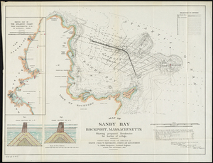
Map of Sandy Bay, Rockport, Massachusetts Showing Proposed Breakwater for Harbor of Refuge.
100.
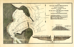
Map of Scituate Harbor: Showing the Plan Adopted For Making it a Harbor of Refuge
« Previous
Next »
1
2
3
4
5
6
7
8
9
…
70
71
Limit your search
Subject
Coastal
812
Regional Studies
734
Massachusetts
472
Boston
192
Pbs Newshour
162
Washington
156
Macneil Lehrer
131
Jeffrey Brown
126
more
Subject
»
Place
North and Central America
1,100
United States
1,079
Massachusetts
774
Dukes (county)
699
Martha's Vineyard
605
Chilmark
161
West Tisbury
123
Essex (county)
103
more
Place
»
Format
Photographs
670
Maps/Atlases
410
Film/Video
236
Objects/Artifacts
125
Documents
18
Albums/Scrapbooks
8
Posters
6
Letters/Correspondence
5
more
Format
»
Available to use
Creative Commons license
763
No known restrictions
47
Date
View distribution
Current results range from
1631
to
2019
Date range begin
Date range end
View larger »
Unknown
13
Collection
Harvard Forest Martha's Vineyard Collection
740
Historic Maps
278
American Archive of Public Broadcasting Collection
177
Oral Histories
57
Norman B. Leventhal Map Center Collection
54
Boston and New England Maps (Collection of Distinction)
52
Photographic Collection
17
Parker Collection
14
more
Collection
»
Institution
Harvard University
734
Salem State University Archives and Special Collections
278
Internet Archive
177
Yiddish Book Center
57
Boston Public Library
46
Williams College
41
University of Massachusetts Boston, Joseph P. Healey Library
20
Thomas Crane Public Library
14
more
Institution
»