Skip to search
Skip to main content
Skip to first result
Digital Commonwealth
Folders
Sign Up / Log In
Search for
Search
Search
Search
Basic
Advanced
Explore
Map
Collections
Institutions
Formats
For Educators
Primary Source Sets
Lesson Plans
Using Primary Sources
Searching Digital Commonwealth
For Institutions
Join Digital Commonwealth
Conferences, Trainings, & Events
How to Contribute Collections
Digitization Services
Board & Committees
Frequently Asked Questions
About
About Digital Commonwealth
News & Announcements
Copyright & Terms of Use
Harmful Content Statement
Partners
API
Contact Us
Search
Search Constraints
Start Over
Save Search
Your search:
More Like
commonwealth-oai:pc289r30k
✖
Remove constraint More Like: commonwealth-oai:pc289r30k
« Prev. |
1
-
20
of
202
|
Next »
Sort
by date (desc)
relevance
title
date (asc)
date (desc)
Number of results to display per page
20
per page
per page
10
per page
20
per page
50
per page
100
per page
View results as:
List
list view
Maps
map view
Gallery
grid view
Search Results
1.
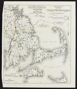
Plan accompanying report of the Board of Harbor & Land Commissioners relative to a...
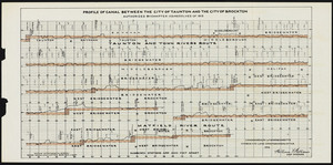
2.
Plan accompanying report of the Board of Harbor & Land Commissioners relative to a...
3.
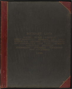
Atlas of the boundaries of the town of Alford, Becket, Egremeont, Great Barrington,...
4.
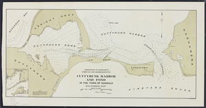
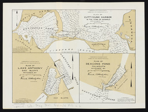
Cuttyhunk Harbor and Pond in the town of Gosnold
5.
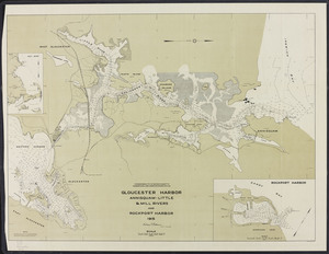
Gloucester Harbor: Annisquam-Little & Mill Rivers and Rockport Harbor
6.
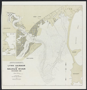
Lynn Harbor and Saugus River
7.
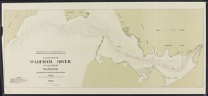
Plan of part of Wareham River: in the town of Wareham
8.
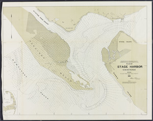
Plan of Stage Harbor, Chatham
9.
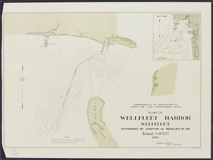
Plan of Wellfleet Harbor, Wellfleet
10.
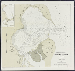
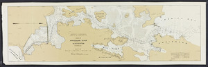
Scituate Harbor
11.
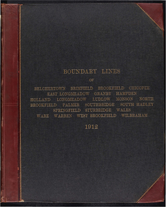
Atlas of the boundaries of the city of Holyoke and towns of Agawam, Blandford,...
12.
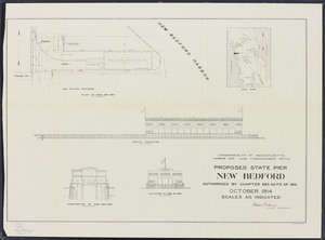
Proposed state pier, New Bedford
13.
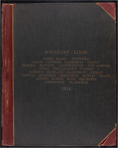
Atlas of the boundaries of the cities of North Adams and Pittsfield and towns of...
14.
Atlas of the boundaries of the cities of Chicopee and Springfield and towns of...
15.
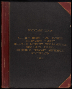
Atlas of the boundaries of the towns of Amherst, Enfield, Greenwich, Hadley, Pelham,...
16.
Plan of Cuttyhunk Harbor: in the town of Gosnold
17.
Plan of Annisquam River in the city of Gloucester
18.
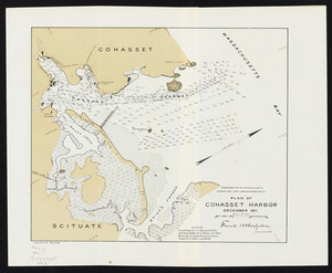
Plan of Cohasset Harbor
19.
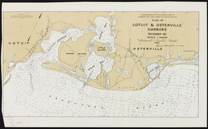
Plan of Cotuit and Osterville Harbors
20.
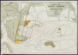
Plan of northerly portion of Boston Harbor: showing possible improvement of East...
« Previous
Next »
1
2
3
4
5
…
10
11
Limit your search
Subject
Harbors--Massachusetts--Boston--Maps
58
Boston (Mass.)--Maps
10
Massachusetts--Maps
10
Boston Harbor (Mass.)--Maps
8
Charles River (Mass.)--Maps
7
Connecticut River--Maps
7
Connecticut--Maps
7
New England Railroad--Maps
6
more
Subject
»
Place
North and Central America
202
United States
202
Massachusetts
200
Suffolk (county)
82
Boston
78
Plymouth (county)
30
Middlesex (county)
24
Barnstable (county)
23
more
Place
»
Format
Maps/Atlases
159
Books
41
Photographs
2
Date
View distribution
Current results range from
1839
to
1916
Date range begin
Date range end
View larger »
Unknown
1
Collection
Massachusetts Board of Harbor and Land Commissioners
202
Institution
State Library of Massachusetts
202