Skip to search
Skip to main content
Skip to first result
Digital Commonwealth
Folders
Sign Up / Log In
Search for
Search
Search
Search
Basic
Advanced
Explore
Map
Collections
Institutions
Formats
For Educators
Primary Source Sets
Lesson Plans
Using Primary Sources
Searching Digital Commonwealth
For Institutions
Join Digital Commonwealth
Conferences, Trainings, & Events
How to Contribute Collections
Digitization Services
Board & Committees
Frequently Asked Questions
About
About Digital Commonwealth
News & Announcements
Copyright & Terms of Use
Harmful Content Statement
Partners
API
Contact Us
Search
Search Constraints
Start Over
Save Search
Your search:
More Like
commonwealth:vh53xt67t
✖
Remove constraint More Like: commonwealth:vh53xt67t
« Prev.
|
801
-
820
of
826
|
Next »
Sort
by relevance
relevance
title
date (asc)
date (desc)
Number of results to display per page
20
per page
per page
10
per page
20
per page
50
per page
100
per page
View results as:
List
list view
Maps
map view
Gallery
grid view
Search Results
801.
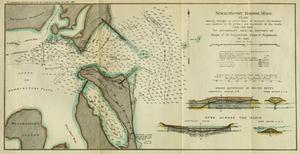
Newburyport Harbor, Mass. Plan Showing Changes in Shore Lines at Entrance, the...
802.
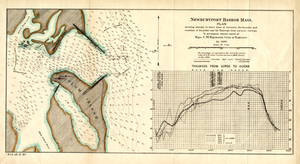
Newburyport Harbor, Mass.: Plan Showing Changes in Shore Lines at Entrance, the...
803.
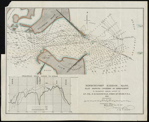
Newburyport Harbor, Mass. Plan Showing Condition of Improvement
804.
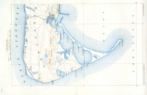
Part of Nantucket (Mass.)
805.
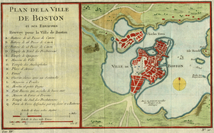
Plan De La Ville De Boston et ses environs
806.
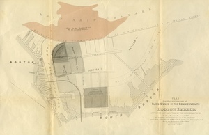
Plan for the Occupation of Flats Owned by the Commonwealth in Boston Harbor
807.
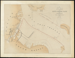
Plan For the Occupation of the South Boston Flats by the Commissioners on the Harbors...
808.
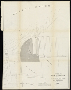
Plan of South Boston Flats Showing Location of Sea Walls and Area of Excavations and...
809.
Plan of the First Section for the Occupation of the South Boston Flats by the...
810.
Plan of the U.S. Navy Yard, Boston, Mass. Showing It's Present Condition, June 10, 1883
811.
Preliminary Chart of Stellwagen's Bank, Masachusetts Bay: Discovered in October, 1854,...
812.
Preliminary Chart of Stellwagen's Bank, Massachusetts Bay Discovered in October, 1854,...
813.
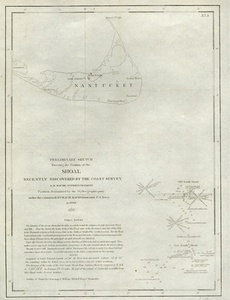
Preliminary Sketch Showing the Position of the Shoal Recently Discovered by the Coast...
814.
Progress Map for 1893: Canapitsit Channel, Mass. From 1. July 1892 to 30 June 1893.
815.
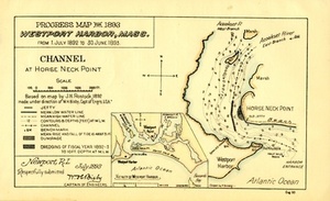
Progress Map for 1893, Westport Harbor, Mass.: From 1. July 1892 to 30. June 1893.
816.
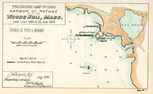
Progress Map for 1895, Harbor of Refuge Woods Holl, Mass.: from 1. July 1894 to 30....
817.
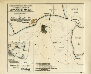
Proposed Work, Harbor of Refuge at Hyannis, Mass.
818.
Proposed Work, Martha's Vineyard Inner Harbor at Edgartown, Mass.: Middle Ground Shoal
819.
Proposed Work, Wareham, Mass.
820.
Rockport
« Previous
Next »
1
2
…
37
38
39
40
41
42
Limit your search
Subject
Coastal
812
Regional Studies
738
Agriculture
71
Massachusetts
70
Hurricanes
27
Conservation and Management
23
Historic and Retrospective Studies
21
Birds
20
more
Subject
»
Place
North and Central America
816
United States
795
Dukes (county)
698
Martha's Vineyard
604
Massachusetts
556
Chilmark
161
West Tisbury
123
Chappaquiddick Island
90
more
Place
»
Format
Photographs
630
Maps/Atlases
139
Objects/Artifacts
121
Postcards/Cards
1
Drawings/Illustrations
1
Available to use
Creative Commons license
747
No known restrictions
5
Date
View distribution
Current results range from
1764
to
2016
Date range begin
Date range end
View larger »
Unknown
1
Collection
Harvard Forest Martha's Vineyard Collection
744
Historic Maps
73
Project DOCUMERICA Photographs by Ernst Halberstadt
4
Milan P. Warner Photograph Collection
2
Parker Collection
2
The Massachusetts WPA Federal Art Project Photograph Collection
1
Institution
Harvard University
738
Salem State University Archives and Special Collections
73
Boston Public Library
5
Martha's Vineyard Museum
4
Holyoke Public Library
2
The Vineyard Gazette
2
Thomas Crane Public Library
2