Skip to search
Skip to main content
Skip to first result
Digital Commonwealth
Folders
Sign Up / Log In
Search for
Search
Search
Search
Basic
Advanced
Explore
Map
Collections
Institutions
Formats
For Educators
Primary Source Sets
Lesson Plans
Using Primary Sources
Searching Digital Commonwealth
For Institutions
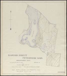
Join Digital Commonwealth
Conferences, Trainings, & Events
How to Contribute Collections
Digitization Services
Board & Committees
Frequently Asked Questions
About
About Digital Commonwealth
News & Announcements
Copyright & Terms of Use
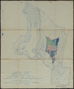
Harmful Content Statement
Partners
API
Contact Us
Search
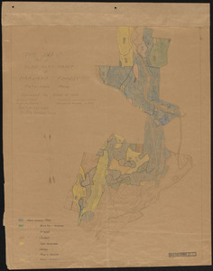
Search Constraints
Start Over
Save Search
Your search:
More Like
commonwealth:qv33t937t
✖
Remove constraint More Like: commonwealth:qv33t937t
« Prev. |
1
-
50
of
647
|
Next »
Sort
by date (asc)
relevance
title
date (asc)
date (desc)
Number of results to display per page
50
per page
per page
10
per page
20
per page
50
per page
100
per page
View results as:
List
list view
Maps
map view
Gallery
grid view
Search Results
1.
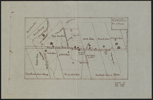
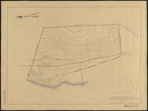
Map of the North Part of Petersham with Part of Poquage
2.
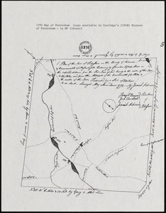
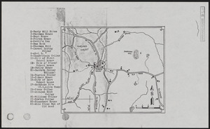
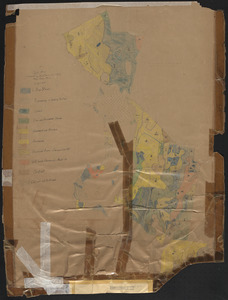
Plan of the town of Petersham, 1795, showing roads, mills, etc.
3.
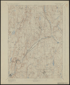
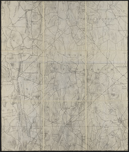
Topographic Maps of the Barre Sheet
4.
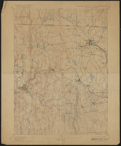
Topographic Maps of the Winchendon Sheet
5.
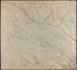
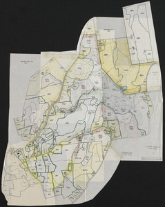
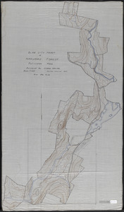
Blow up of USGS Map of Petersham Showing Harvard and Petersham State Forests
6.
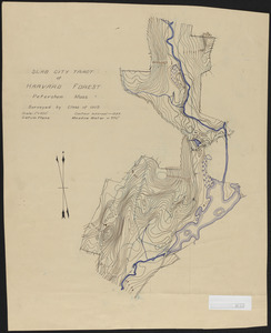
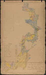
Cellar Holes of Pirate Valley, Sherman Hill, Swift River, Harvard Forest and Vicinity
7.
Harvard Forest Tom Swamp Block
8.
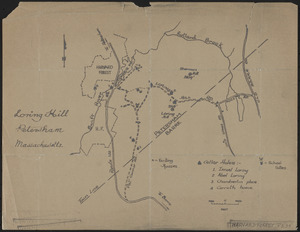
Loring Hill
9.
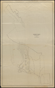
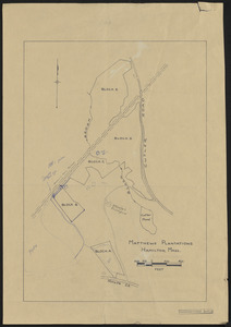
Matthews Plantations Hamilton Mass - Black Brook Plantations
10.
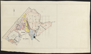
Nathan Matthews Plantations Block C Stand Map
11.
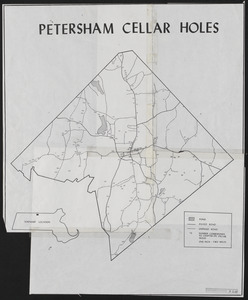
Petersham Cellar Holes
12.
Pisgah Tract
13.
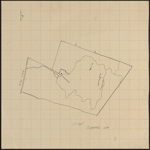
Schwarz Lot
14.
Schwarz Lot
15.
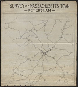
Survey of a Massachusetts Town - Petersham
16.
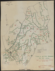
Timing of Old Field Abandonment and Early Logging on Prospect Hill
17.
Timing of Old Field Abandonment and Early Logging on Prospect Hill
18.
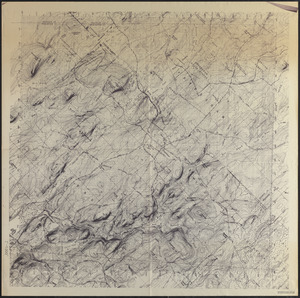
Topographic Map of Petersham
19.
Topographic Map of Petersham
20.
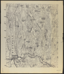
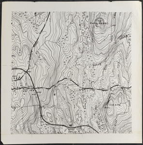
Topography of Prospect Hill, including Camel's Hump and vicinity
21.
Harvard College Forestry - Tom Swamp I-VIII
22.
Harvard College Forestry - Slab City 1907
23.
Topographic map of Meadow-water Tract (TS I-VII)
24.
Harvard College Forestry, Northwest tract - Meadow Water Tract
25.
Harvard Forest Prospect Hill Tract Petersham and Phillipston as recorded in Worcester Registry of Deeds
26.
Harvard Forest Slab City 1908
27.
Meadow-Water Tract Harvard Forest stand map with transects of TS I-VI
28.
Topographic map of Meadow-water Tract (TS I-VII)
29.
Topographic map of Meadow-water Tract (TS I-VII)
30.
Meadow-Water Tract Harvard Forest topographic map of TS I-VI and working plan for Compartment V
31.
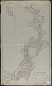
Slab City 1909 Topographic Map of Compartments III - VII
32.
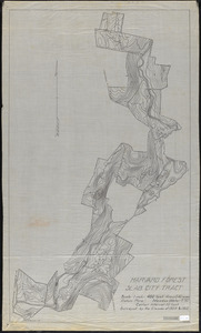
Type Map of Slab City Tract Compartments III - VIII
33.
Meadow-Water Tract stand map of TS I-VI
34.
Plan of land of John Lincoln Waldo (TS X)
35.
Prospect Hill Tract 1910 Topographic map
36.
Harvard Forest Slab City - 1908
37.
Harvard Forest Slab City 1911
38.
Higginson Tract 1911 Stand Map
39.
Meadow-Water Tract index to operations 1908-1911
40.
Topographic map of Meadow-water Tract (TS I-VIII)
41.
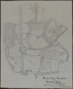
Plane Table Traverse of Harvard Farm 1911
42.
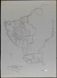
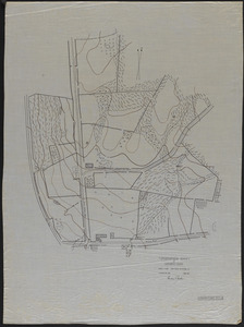
Topographical Survey of Harvard Farm - 1911
43.
Topographical Survey of Harvard Farm - 1911
44.
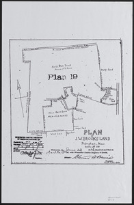
Plan of J. W. Brooks Land
45.
Slab City Tract of Harvard Forest Topographic Map of Compartments II - X
46.
Slab City Tract Stand Map Surveyed by the Class of 1909-1912 Compartments II - X
47.
Slab City Tract Topographic Map of Compartments II - X
48.
Slab City Tract Topographic Map of Compartments II - X
49.
Harvard Forest School Transit Survey of Whitney Lot (Slab City I) August 12, 1912
50.
Meadow-Water Tract stand map of TS I-VIII
« Previous
Next »
1
2
3
4
5
…
12
13
Limit your search
Subject
Boundaries
151
Forest operations
47
1937
44
1938
41
Hurricanes
37
Land use
37
1946
31
Forest Operations
27
more
Subject
»
Place
North and Central America
647
United States
647
Massachusetts
624
Worcester (county)
597
Petersham
588
Tom Swamp
158
Prospect Hill
153
Tom Swamp Tract
97
more
Place
»
Format
Maps/Atlases
646
Manuscripts
4
Photographs
1
Available to use
Creative Commons license
647
Date
View distribution
Current results range from
1755
to
2016
Date range begin
Date range end
View larger »
Collection
The Harvard Forest Map Collection
647
Institution
Harvard University
647