Skip to search
Skip to main content
Skip to first result
Digital Commonwealth
Folders
Sign Up / Log In
Search for
Search
Search
Search
Basic
Advanced
Explore
Map
Collections
Institutions
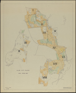
Formats
For Educators
Primary Source Sets
Lesson Plans
Using Primary Sources
Searching Digital Commonwealth
For Institutions
Join Digital Commonwealth
Conferences, Trainings, & Events
How to Contribute Collections
Digitization Services
Board & Committees
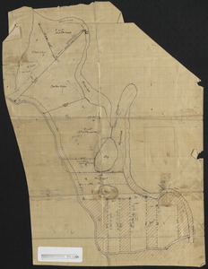
Frequently Asked Questions
About
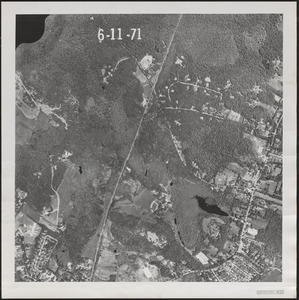
About Digital Commonwealth
News & Announcements
Copyright & Terms of Use
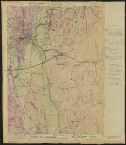
Harmful Content Statement
Partners
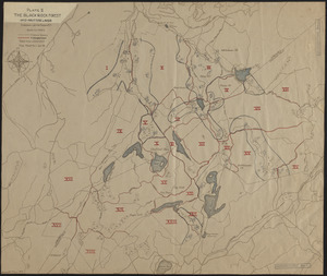
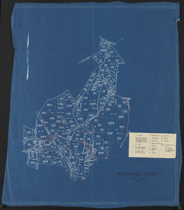
API
Contact Us
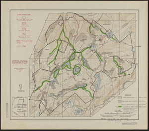
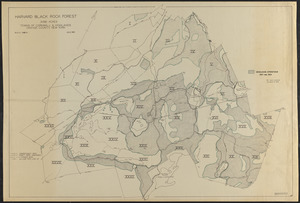
Search
Search Constraints
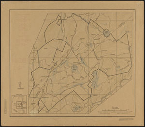
Start Over
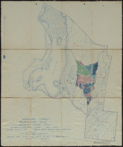
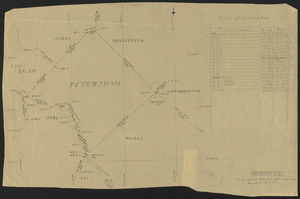
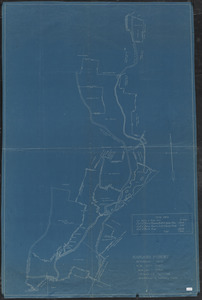
Save Search
Your search:
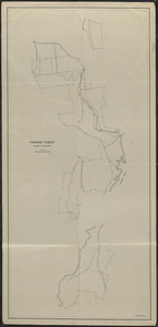
More Like
commonwealth:qv33sz946
✖
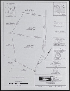
Remove constraint More Like: commonwealth:qv33sz946
« Prev. |
1
-
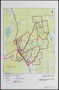
100
of
647
|
Next »
Sort
by relevance
relevance
title
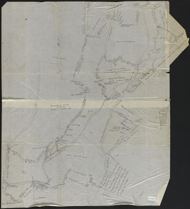
date (asc)
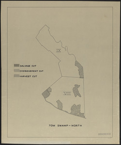
date (desc)
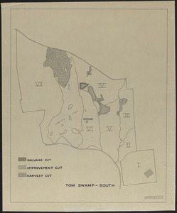
Number of results to display per page
100
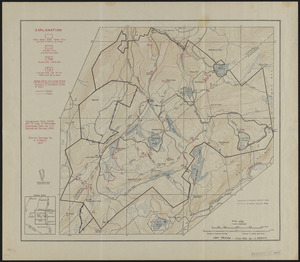
per page
per page
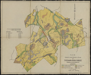
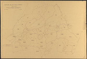
10
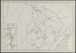
per page
20
per page
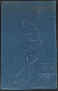
50
per page
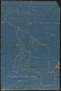
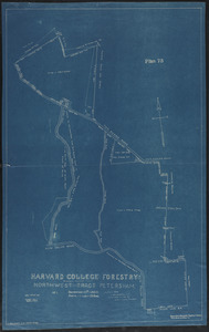
100
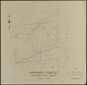
per page
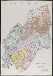
View results as:
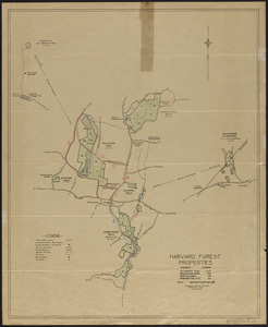
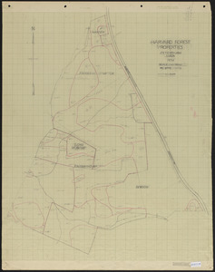
List
list view
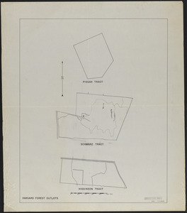
Maps
map view
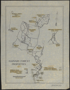
Gallery
grid view
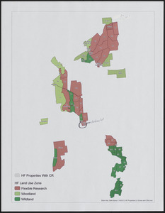
Search Results
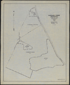
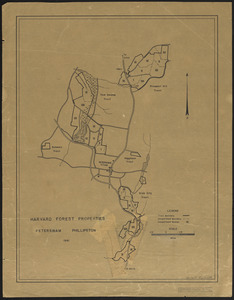
1.
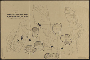
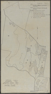
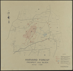
Harvard Forest 1945 Areas with 10 or more cords of poor quality wood/acre to cut
2.
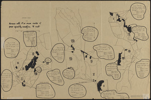
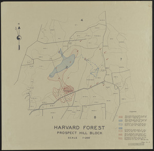
Harvard Forest 1945 Areas with 5 or more cords of poor quality wood/acre to cut
3.
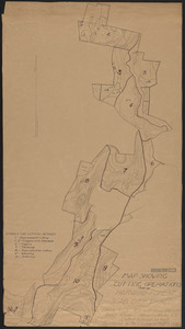
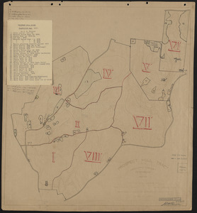
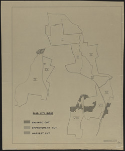
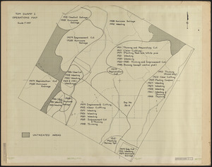
Harvard Forest Slab City Cutting Operations 1908-21
4.
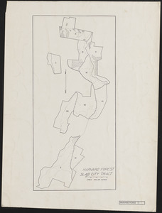
Harvard Forest Slab City Tract Forest Operations
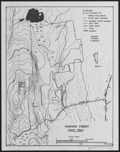
5.
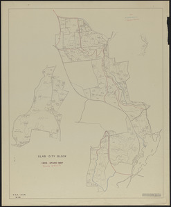
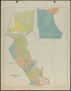
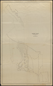
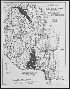
Meadow-Water Tract Harvard Forest topographic map of TS I-VI and working plan for Compartment V
6.
Meadow-Water Tract index to operations 1908-1911
7.
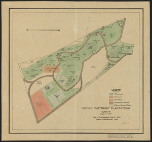
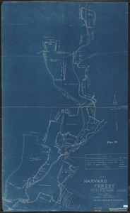
Nathan Matthews Plantations Block A
8.
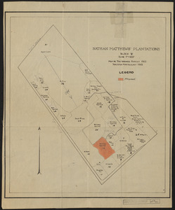
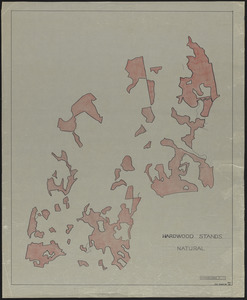
Nathan Matthews Plantations Block B
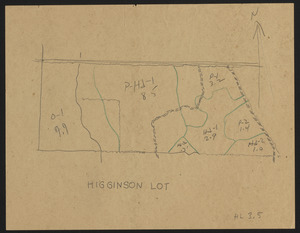
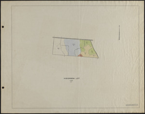
9.
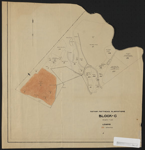
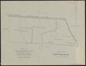
Nathan Matthews Plantations Block C
10.
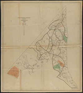
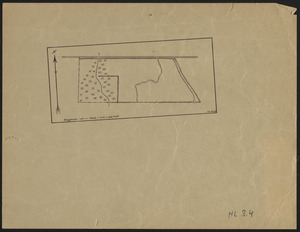
Nathan Matthews Plantations Block C-D
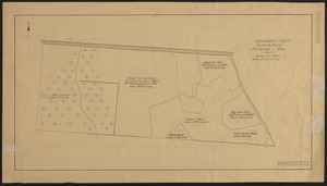
11.
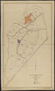
Nathan Matthews Plantations Block E
12.
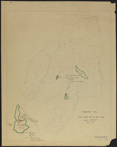
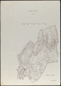
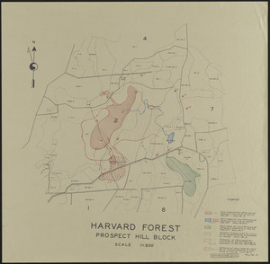
Prospect Hill Block-Plantations - 1915
13.
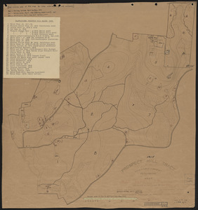
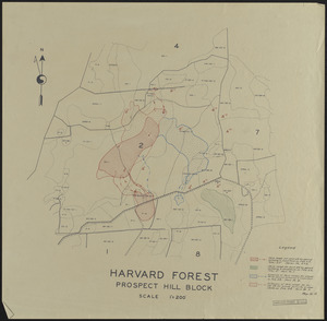
Prospect Hill Block-Plantations - 1917
14.
Prospect Hill IX - Forest Operations
15.
Prospect Hill Map of Cutting Operations - 1916
16.
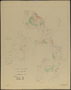
Slab City Block 1946 Stand Map Open Areas, Plantations and Other Land
17.
Slab City Block Forest Operations 1960
18.
Slab City Block Operations of 1947
19.
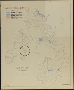
Slab City Block Plantation Reassessment
20.
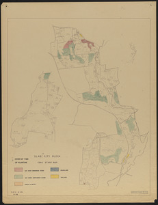
Slab City Block Stand Map 1946 Plantations
21.
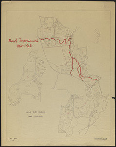
Slab City Block Stand Map Road Improvement - 1962-1963
22.
Slab City Block Trail Mowing Operations Roads-Trails
23.
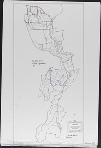
Slab City Forest Operations Periods 1-3
24.
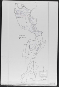
Slab City Forest Operations Periods 4-7
25.
Tom Swamp IX stand map 1934 and experimental reproduction cutting operations
26.
Type and reproduction cutting map of TS IX 1934
27.
1956 Cruise of Timber, Prospect Hill Block - 1956
28.
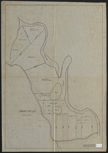
3-cut shelterwood. Adams-Fay Lot (TS IX) 1934
29.
Adams-Fay Lot (TS IX) 1929 stand map
30.
Aerial Photograph of Matthews Plantation
31.
Aeromagnetic Map of the Athol Quadrangle, Worcester and Franklin Counties, MA
32.
Base Map of Prospect Hill, Tom Swamp, and Slab City Tracts
33.
Bedrock Geology of the Athol Quadrangle
34.
Beirne B. Brues Property Deeded to President and Fellows of Harvard College – Tall Timbers
35.
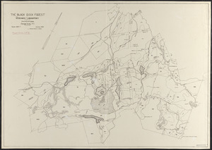
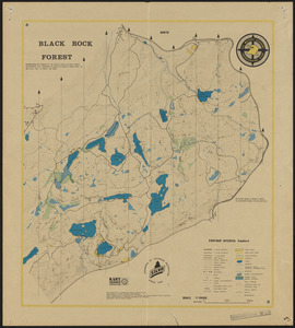
The Black Rock Forest
36.
Black Rock Forest Map of Inoperable Land, Wetlands and Protection Forests
37.
The Black Rock Forest Research Plots and Activities
38.
Black Rock Forest Standing Timber - 1981
39.
Black Rock Forest Topography and Natural Features
40.
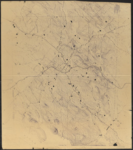
Blow up of USGS Map of Petersham Showing Harvard and Petersham State Forests
41.
Boundary Survey of the Town of Petersham
42.
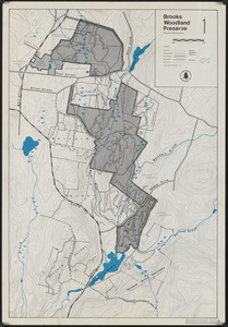
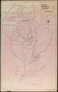
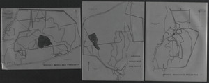
Brooks Woodland Preserve
43.
Brooks Woodland Preserve
44.
Brooks Woodland Preserve
45.
Bruce E. Laboffa and Steven Lange Land
46.
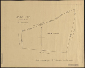
Bryant Lots Petersham
47.
Cellar Holes of Pirate Valley, Sherman Hill, Swift River, Harvard Forest and Vicinity
48.
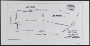
Clarence C. Harris Land
49.
Compartments on Prospect Hill - 2008
50.
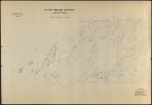
Composite of USGS Topographic Maps of Petersham ('Natural Resource Inventory')
51.
Conservation Easements in the Town of Petersham
52.
Estate of Nathan Matthews Hamilton Mass
53.
Experimental reproduction cuttings, Adams-Fay Lot (TS IX)
54.
Experimental reproduction cuttings, Adams-Fay Lot (TS IX)
55.
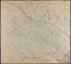
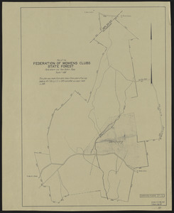
Federation of Women's Clubs State Forest
56.
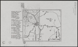
Fire Ponds of Petersham
57.
Forest Operations 1962-1963, Prospect Hill
58.
Forest operations, Tom Swamp I, 1909-1956
59.
Forest operations, Tom Swamp North
60.
Forest operations, Tom Swamp South
61.
Forest Type, Size, and Stocking Map of the Federation Forest
62.
Glacial Geology and Topography of Black Rock Forest
63.
Glacial Geology and Topography of Black Rock Forest - revised 1982
64.
Growth and Density Plan of the Black Rock Forest
65.
Harvard Black Rock Forest - Trail Map
66.
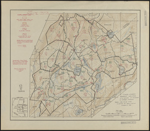
Harvard Black Rock Forest 1951
67.
Harvard Black Rock Forest Woodlands Operations 1927-1984
68.
Harvard College Forestry - Slab City 1907
69.
Harvard College Forestry - Tom Swamp I-VIII
70.
Harvard College Forestry, Northwest tract - Meadow Water Tract
71.
Harvard Forest 1945 Prospect Hill Block
72.
Harvard Forest 1945 Prospect Hill Block soils and vegetation
73.
Harvard Forest Compartments and Properties
74.
Harvard Forest Meadow-Water Tract forest operations 1920
75.
Harvard Forest outlots
76.
Harvard Forest Properties - Prospect Hill IX 1934
77.
Harvard Forest Properties 1937
78.
Harvard Forest Properties (compartment IX)
79.
Harvard Forest Properties Land Use Zones and CRs
80.
Harvard Forest Properties Petersham and Phillipston 1941
81.
Harvard Forest Prospect Hill Block Hare Range Maps
82.
Harvard Forest Prospect Hill Block Hare Range Maps
83.
Harvard Forest Prospect Hill Block Hare Range Maps
84.
Harvard Forest Prospect Hill Block Hare Range Maps
85.
Harvard Forest Prospect Hill Block Hare Range Maps
86.
Harvard Forest Prospect Hill Tract Petersham and Phillipston as recorded in Worcester Registry of Deeds
87.
Harvard Forest School Transit Survey of Whitney Lot (Slab City I) August 12, 1912
88.
Harvard Forest Simes Tract
89.
Harvard Forest Slab City - 1908
90.
Harvard Forest Slab City - 1944
91.
Harvard Forest Slab City 1908
92.
Harvard Forest Slab City 1911
93.
Harvard Forest Tom Swamp Block
94.
Harvard Forest Tom Swamp Tract
95.
Harvard Stands Natural Forest Prospect Hill -overlays
96.
Higginson Lot
97.
Higginson Lot 1929 Stand Map
98.
Higginson Lot 1937 Stand map
99.
Higginson Tract
100.
Higginson Tract 1911 Stand Map
« Previous
Next »
1
2
3
4
5
6
7
Limit your search
Subject
Boundaries
151
Forest operations
47
1937
44
1938
41
Hurricanes
37
Land use
37
1946
31
Forest Operations
26
more
Subject
»
Place
North and Central America
647
United States
647
Massachusetts
623
Worcester (county)
596
Petersham
587
Tom Swamp
158
Prospect Hill
153
Tom Swamp Tract
97
more
Place
»
Format
Maps/Atlases
646
Manuscripts
4
Photographs
1
Available to use
Creative Commons license
647
Date
View distribution
Current results range from
1755
to
2016
Date range begin
Date range end
View larger »
Collection
The Harvard Forest Map Collection
647
Institution
Harvard University
647