Search
Search Results
- Creator:
- Massachusetts. Metropolitan District Water Supply Commission; Snow, Russell, 1902-1969
- Format:
- Photographs
- Collection:
- Massachusetts Metropolitan District Water Supply Commission, Quabbin Reservoir, Photographs of Real Estate in the Swift River Valley, and of General Engineering of Quabbin Reservoir, 1927-1950
- Date:
- September 22, 1942
- Institution:
- Massachusetts Archives
- Creator:
- Massachusetts. Metropolitan District Water Supply Commission; Barbier, Ernest E., 1912-2007
- Format:
- Photographs
- Collection:
- Massachusetts Metropolitan District Water Supply Commission, Quabbin Reservoir, Photographs of Real Estate in the Swift River Valley, and of General Engineering of Quabbin Reservoir, 1927-1950
- Date:
- December 23, 1940
- Institution:
- Massachusetts Archives
- Creator:
- Massachusetts. Metropolitan District Water Supply Commission; Snow, Russell, 1902-1969
- Format:
- Photographs
- Collection:
- Massachusetts Metropolitan District Water Supply Commission, Quabbin Reservoir, Photographs of Real Estate in the Swift River Valley, and of General Engineering of Quabbin Reservoir, 1927-1950
- Date:
- September 22, 1942
- Institution:
- Massachusetts Archives
- Creator:
- Massachusetts. Metropolitan District Water Supply Commission; Barbier, Ernest E., 1912-2007
- Format:
- Photographs
- Collection:
- Massachusetts Metropolitan District Water Supply Commission, Quabbin Reservoir, Photographs of Real Estate in the Swift River Valley, and of General Engineering of Quabbin Reservoir, 1927-1950
- Date:
- August 8, 1940
- Institution:
- Massachusetts Archives
- Creator:
- Massachusetts. Metropolitan District Water Supply Commission; Snow, Russell, 1902-1969
- Format:
- Photographs
- Collection:
- Massachusetts Metropolitan District Water Supply Commission, Quabbin Reservoir, Photographs of Real Estate in the Swift River Valley, and of General Engineering of Quabbin Reservoir, 1927-1950
- Date:
- September 25, 1942
- Institution:
- Massachusetts Archives
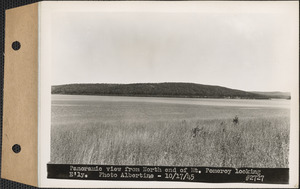
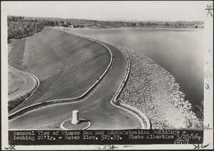
- Creator:
- Massachusetts. Metropolitan District Water Supply Commission; Albertine, Louis G., 1908-1998
- Format:
- Photographs
- Collection:
- Massachusetts Metropolitan District Water Supply Commission, Quabbin Reservoir, Photographs of Real Estate in the Swift River Valley, and of General Engineering of Quabbin Reservoir, 1927-1950
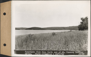
- Date:
- October 17, 1945
- Institution:
- Massachusetts Archives
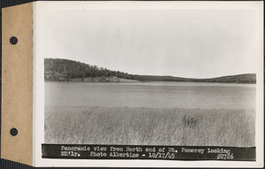
- Creator:
- Massachusetts. Metropolitan District Water Supply Commission; Albertine, Louis G., 1908-1998
- Format:
- Photographs
- Collection:
- Massachusetts Metropolitan District Water Supply Commission, Quabbin Reservoir, Photographs of Real Estate in the Swift River Valley, and of General Engineering of Quabbin Reservoir, 1927-1950
- Date:
- October 17, 1945
- Institution:
- Massachusetts Archives
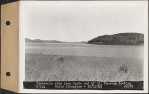
- Creator:
- Massachusetts. Metropolitan District Water Supply Commission; Albertine, Louis G., 1908-1998
- Format:
- Photographs
- Collection:
- Massachusetts Metropolitan District Water Supply Commission, Quabbin Reservoir, Photographs of Real Estate in the Swift River Valley, and of General Engineering of Quabbin Reservoir, 1927-1950
- Date:
- October 17, 1945
- Institution:
- Massachusetts Archives
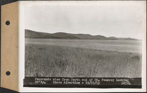
- Creator:
- Massachusetts. Metropolitan District Water Supply Commission; Albertine, Louis G., 1908-1998
- Format:
- Photographs
- Collection:
- Massachusetts Metropolitan District Water Supply Commission, Quabbin Reservoir, Photographs of Real Estate in the Swift River Valley, and of General Engineering of Quabbin Reservoir, 1927-1950
- Date:
- October 17, 1945
- Institution:
- Massachusetts Archives
- Creator:
- Massachusetts. Metropolitan District Water Supply Commission; Albertine, Louis G., 1908-1998
- Format:
- Photographs
- Collection:
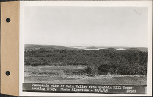
- Massachusetts Metropolitan District Water Supply Commission, Quabbin Reservoir, Photographs of Real Estate in the Swift River Valley, and of General Engineering of Quabbin Reservoir, 1927-1950
- Date:
- October 4, 1945
- Institution:
- Massachusetts Archives
- Creator:
- Massachusetts. Metropolitan District Water Supply Commission; Albertine, Louis G., 1908-1998
- Format:
- Photographs
- Collection:
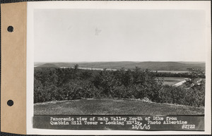
- Massachusetts Metropolitan District Water Supply Commission, Quabbin Reservoir, Photographs of Real Estate in the Swift River Valley, and of General Engineering of Quabbin Reservoir, 1927-1950
- Date:
- October 4, 1945
- Institution:
- Massachusetts Archives
- Creator:
- Massachusetts. Metropolitan District Water Supply Commission; Albertine, Louis G., 1908-1998
- Format:
- Photographs
- Collection:
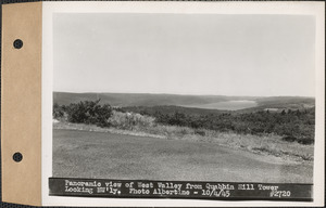
- Massachusetts Metropolitan District Water Supply Commission, Quabbin Reservoir, Photographs of Real Estate in the Swift River Valley, and of General Engineering of Quabbin Reservoir, 1927-1950
- Date:
- October 4, 1945
- Institution:
- Massachusetts Archives
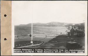
- Creator:
- Massachusetts. Metropolitan District Water Supply Commission; Snow, Russell, 1902-1969
- Format:
- Photographs
- Collection:
- Massachusetts Metropolitan District Water Supply Commission, Quabbin Reservoir, Photographs of Real Estate in the Swift River Valley, and of General Engineering of Quabbin Reservoir, 1927-1950
- Date:
- November 24, 1943
- Institution:
- Massachusetts Archives
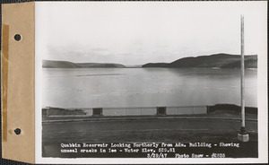
- Creator:
- Massachusetts. Metropolitan District Water Supply Commission; Snow, Russell, 1902-1969
- Format:
- Photographs
- Collection:
- Massachusetts Metropolitan District Water Supply Commission, Quabbin Reservoir, Photographs of Real Estate in the Swift River Valley, and of General Engineering of Quabbin Reservoir, 1927-1950
- Date:
- March 29, 1947
- Institution:
- Massachusetts Archives
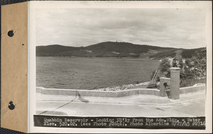
- Creator:
- Massachusetts. Metropolitan District Water Supply Commission; Albertine, Louis G., 1908-1998
- Format:
- Photographs
- Collection:
- Massachusetts Metropolitan District Water Supply Commission, Quabbin Reservoir, Photographs of Real Estate in the Swift River Valley, and of General Engineering of Quabbin Reservoir, 1927-1950
- Date:
- January 13, 1947
- Institution:
- Massachusetts Archives
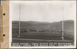
- Creator:
- Massachusetts. Metropolitan District Water Supply Commission; Snow, Russell, 1902-1969
- Format:
- Photographs
- Collection:
- Massachusetts Metropolitan District Water Supply Commission, Quabbin Reservoir, Photographs of Real Estate in the Swift River Valley, and of General Engineering of Quabbin Reservoir, 1927-1950
- Date:
- November 24, 1943
- Institution:
- Massachusetts Archives
- Creator:
- Massachusetts. Metropolitan District Water Supply Commission; Albertine, Louis G., 1908-1998
- Format:
- Photographs
- Collection:
- Massachusetts Metropolitan District Water Supply Commission, Quabbin Reservoir, Photographs of Real Estate in the Swift River Valley, and of General Engineering of Quabbin Reservoir, 1927-1950
- Date:
- August 27, 1945
- Institution:
- Massachusetts Archives
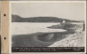
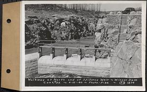
- Creator:
- Massachusetts. Metropolitan District Water Supply Commission; Pike, Stuart D., 1910-1978
- Format:
- Photographs
- Collection:
- Massachusetts Metropolitan District Water Supply Commission, Quabbin Reservoir, Photographs of Real Estate in the Swift River Valley, and of General Engineering of Quabbin Reservoir, 1927-1950
- Date:
- August 24, 1939
- Institution:
- Massachusetts Archives
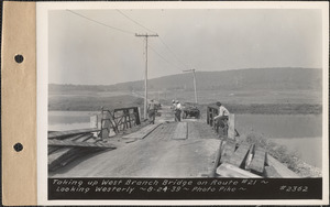
- Creator:
- Massachusetts. Metropolitan District Water Supply Commission; Pike, Stuart D., 1910-1978
- Format:
- Photographs
- Collection:
- Massachusetts Metropolitan District Water Supply Commission, Quabbin Reservoir, Photographs of Real Estate in the Swift River Valley, and of General Engineering of Quabbin Reservoir, 1927-1950
- Date:
- April 5, 1940
- Institution:
- Massachusetts Archives
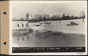
- Creator:
- Massachusetts. Metropolitan District Water Supply Commission; Pike, Stuart D., 1910-1978
- Format:
- Photographs
- Collection:
- Massachusetts Metropolitan District Water Supply Commission, Quabbin Reservoir, Photographs of Real Estate, Sanitary Conditions, and Flooding in the Ware River Watershed, and of General Engineering, 1928-1948
- Date:
- February 5, 1935
- Institution:
- Massachusetts Archives
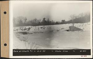
- Creator:
- Massachusetts. Metropolitan District Water Supply Commission; Pike, Stuart D., 1910-1978
- Format:
- Photographs
- Collection:
- Massachusetts Metropolitan District Water Supply Commission, Quabbin Reservoir, Photographs of Real Estate, Sanitary Conditions, and Flooding in the Ware River Watershed, and of General Engineering, 1928-1948
- Date:
- February 5, 1935
- Institution:
- Massachusetts Archives
- Creator:
- Massachusetts. Metropolitan District Water Supply Commission; Pike, Stuart D., 1910-1978
- Format:
- Photographs
- Collection:
- Massachusetts Metropolitan District Water Supply Commission, Quabbin Reservoir, Photographs of Real Estate in the Swift River Valley, and of General Engineering of Quabbin Reservoir, 1927-1950
- Date:
- September 28, 1938
- Institution:
- Massachusetts Archives
- Creator:
- Massachusetts. Metropolitan District Water Supply Commission; Pike, Stuart D., 1910-1978
- Format:
- Photographs
- Collection:
- Massachusetts Metropolitan District Water Supply Commission, Quabbin Reservoir, Photographs of Real Estate in the Swift River Valley, and of General Engineering of Quabbin Reservoir, 1927-1950
- Date:
- April 5, 1940
- Institution:
- Massachusetts Archives
- Creator:
- Massachusetts. Metropolitan District Water Supply Commission; Pike, Stuart D., 1910-1978
- Format:
- Photographs
- Collection:
- Massachusetts Metropolitan District Water Supply Commission, Quabbin Reservoir, Photographs of Real Estate in the Swift River Valley, and of General Engineering of Quabbin Reservoir, 1927-1950
- Date:
- April 1, 1940
- Institution:
- Massachusetts Archives
- Creator:
- Massachusetts. Metropolitan District Water Supply Commission; Barbier, Ernest E., 1912-2007
- Format:
- Photographs
- Collection:
- Massachusetts Metropolitan District Water Supply Commission, Quabbin Reservoir, Photographs of Real Estate, Sanitary Conditions, and Flooding in the Ware River Watershed, and of General Engineering, 1928-1948
- Date:
- September 17, 1941
- Institution:
- Massachusetts Archives
- Creator:
- Massachusetts. Metropolitan District Water Supply Commission; Pike, Stuart D., 1910-1978
- Format:
- Photographs
- Collection:
- Massachusetts Metropolitan District Water Supply Commission, Quabbin Reservoir, Photographs of Real Estate, Sanitary Conditions, and Flooding in the Ware River Watershed, and of General Engineering, 1928-1948
- Date:
- February 5, 1935
- Institution:
- Massachusetts Archives
- Creator:
- Massachusetts. Metropolitan District Water Supply Commission; Snow, Russell, 1902-1969
- Format:
- Photographs
- Collection:
- Massachusetts Metropolitan District Water Supply Commission, Quabbin Reservoir, Photographs of Real Estate, Sanitary Conditions, and Flooding in the Ware River Watershed, and of General Engineering, 1928-1948
- Date:
- November 14, 1944
- Institution:
- Massachusetts Archives
- Creator:
- Massachusetts. Metropolitan District Water Supply Commission; Snow, Russell, 1902-1969
- Format:
- Photographs
- Collection:
- Massachusetts Metropolitan District Water Supply Commission, Quabbin Reservoir, Photographs of Real Estate, Sanitary Conditions, and Flooding in the Ware River Watershed, and of General Engineering, 1928-1948
- Date:
- October 30, 1944
- Institution:
- Massachusetts Archives
- Creator:
- Massachusetts. Metropolitan District Water Supply Commission; Barbier, Ernest E., 1912-2007
- Format:
- Photographs
- Collection:
- Massachusetts Metropolitan District Water Supply Commission, Quabbin Reservoir, Photographs of Real Estate, Sanitary Conditions, and Flooding in the Ware River Watershed, and of General Engineering, 1928-1948
- Date:
- September 15, 1941
- Institution:
- Massachusetts Archives
- Creator:
- Massachusetts. Metropolitan District Water Supply Commission; Barbier, Ernest E., 1912-2007
- Format:
- Photographs
- Collection:
- Massachusetts Metropolitan District Water Supply Commission, Quabbin Reservoir, Photographs of Real Estate in the Swift River Valley, and of General Engineering of Quabbin Reservoir, 1927-1950
- Date:
- March 25, 1941
- Institution:
- Massachusetts Archives
- Creator:
- Massachusetts. Metropolitan District Water Supply Commission; Barbier, Ernest E., 1912-2007
- Format:
- Photographs
- Collection:
- Massachusetts Metropolitan District Water Supply Commission, Quabbin Reservoir, Photographs of Real Estate in the Swift River Valley, and of General Engineering of Quabbin Reservoir, 1927-1950
- Date:
- November 25, 1940
- Institution:
- Massachusetts Archives
- Creator:
- Massachusetts. Metropolitan District Water Supply Commission; Barbier, Ernest E., 1912-2007
- Format:
- Photographs
- Collection:
- Massachusetts Metropolitan District Water Supply Commission, Quabbin Reservoir, Photographs of Real Estate in the Swift River Valley, and of General Engineering of Quabbin Reservoir, 1927-1950
- Date:
- June 17, 1941
- Institution:
- Massachusetts Archives
- Creator:
- Massachusetts. Metropolitan District Water Supply Commission
- Format:
- Photographs
- Collection:
- Massachusetts Metropolitan District Water Supply Commission, Quabbin Reservoir, Photographs of Real Estate in the Swift River Valley, and of General Engineering of Quabbin Reservoir, 1927-1950
- Date:
- [ca. 1946]
- Institution:
- Massachusetts Archives
- Creator:
- Massachusetts. Metropolitan District Water Supply Commission; Albertine, Louis G., 1908-1998
- Format:
- Photographs
- Collection:
- Massachusetts Metropolitan District Water Supply Commission, Quabbin Reservoir, Photographs of Real Estate in the Swift River Valley, and of General Engineering of Quabbin Reservoir, 1927-1950
- Date:
- May 23, 1946
- Institution:
- Massachusetts Archives
- Creator:
- Massachusetts. Metropolitan District Water Supply Commission
- Format:
- Photographs
- Collection:
- Massachusetts Metropolitan District Water Supply Commission, Quabbin Reservoir, Photographs of Real Estate in the Swift River Valley, and of General Engineering of Quabbin Reservoir, 1927-1950
- Date:
- [ca. 1928]
- Institution:
- Massachusetts Archives
- Creator:
- Massachusetts. Metropolitan District Water Supply Commission; Pike, Stuart D., 1910-1978
- Format:
- Photographs
- Collection:
- Massachusetts Metropolitan District Water Supply Commission, Quabbin Reservoir, Photographs of Contract Construction (selections from), 1928-1947
- Date:
- April 10, 1940
- Institution:
- Massachusetts Archives
- Creator:
- Massachusetts. Metropolitan Water and Sewerage Board; Tryon, Oliver, 1883-1922
- Format:
- Photographs
- Collection:
- Massachusetts Metropolitan Water Works Photograph Collection, 1876-1930 (bulk, 1895-1921)
- Date:
- May 12, 1908
- Institution:
- Massachusetts Archives
- Creator:
- Massachusetts. Metropolitan District Water Supply Commission; Pike, Stuart D., 1910-1978
- Format:
- Photographs
- Collection:
- Massachusetts Metropolitan District Water Supply Commission, Quabbin Reservoir, Photographs of Real Estate, Sanitary Conditions, and Flooding in the Ware River Watershed, and of General Engineering, 1928-1948
- Date:
- October 3, 1938
- Institution:
- Massachusetts Archives
- Creator:
- Massachusetts. Metropolitan District Water Supply Commission; Pike, Stuart D., 1910-1978
- Format:
- Photographs
- Collection:
- Massachusetts Metropolitan District Water Supply Commission, Quabbin Reservoir, Photographs of Real Estate, Sanitary Conditions, and Flooding in the Ware River Watershed, and of General Engineering, 1928-1948
- Date:
- July 7, 1936
- Institution:
- Massachusetts Archives
- Creator:
- Massachusetts. Metropolitan District Water Supply Commission; Pike, Stuart D., 1910-1978
- Format:
- Photographs
- Collection:
- Massachusetts Metropolitan District Water Supply Commission, Quabbin Reservoir, Photographs of Real Estate, Sanitary Conditions, and Flooding in the Ware River Watershed, and of General Engineering, 1928-1948
- Date:
- September 22, 1938
- Institution:
- Massachusetts Archives
- Creator:
- Massachusetts. Metropolitan District Water Supply Commission; Pike, Stuart D., 1910-1978
- Format:
- Photographs
- Collection:
- Massachusetts Metropolitan District Water Supply Commission, Quabbin Reservoir, Photographs of Real Estate, Sanitary Conditions, and Flooding in the Ware River Watershed, and of General Engineering, 1928-1948
- Date:
- October 1, 1938
- Institution:
- Massachusetts Archives
- Creator:
- Massachusetts. Metropolitan District Water Supply Commission; Pike, Stuart D., 1910-1978
- Format:
- Photographs
- Collection:
- Massachusetts Metropolitan District Water Supply Commission, Quabbin Reservoir, Photographs of Real Estate, Sanitary Conditions, and Flooding in the Ware River Watershed, and of General Engineering, 1928-1948
- Date:
- September 24, 1938
- Institution:
- Massachusetts Archives
- Creator:
- Massachusetts. Metropolitan District Water Supply Commission; Pike, Stuart D., 1910-1978
- Format:
- Photographs
- Collection:
- Massachusetts Metropolitan District Water Supply Commission, Quabbin Reservoir, Photographs of Real Estate, Sanitary Conditions, and Flooding in the Ware River Watershed, and of General Engineering, 1928-1948
- Date:
- April 1, 1932
- Institution:
- Massachusetts Archives
- Creator:
- Massachusetts. Metropolitan District Water Supply Commission; Pike, Stuart D., 1910-1978
- Format:
- Photographs
- Collection:
- Massachusetts Metropolitan District Water Supply Commission, Quabbin Reservoir, Photographs of Real Estate, Sanitary Conditions, and Flooding in the Ware River Watershed, and of General Engineering, 1928-1948
- Date:
- October 1, 1938
- Institution:
- Massachusetts Archives
- Creator:
- Massachusetts. Metropolitan District Water Supply Commission; Troland, Edwin Parker, 1914-2004
- Format:
- Photographs
- Collection:
- Massachusetts Metropolitan District Water Supply Commission, Quabbin Reservoir, Photographs of Contract Construction (selections from), 1928-1947
- Date:
- May 29, 1940
- Institution:
- Massachusetts Archives
- Creator:
- Massachusetts. Metropolitan District Water Supply Commission; Troland, Edwin Parker, 1914-2004
- Format:
- Photographs
- Collection:
- Massachusetts Metropolitan District Water Supply Commission, Quabbin Reservoir, Photographs of Contract Construction (selections from), 1928-1947
- Date:
- January 5, 1940
- Institution:
- Massachusetts Archives
- Creator:
- Massachusetts. Metropolitan Water and Sewerage Board; Tryon, Oliver, 1883-1922
- Format:
- Photographs
- Collection:
- Massachusetts Metropolitan Water Works Photograph Collection, 1876-1930 (bulk, 1895-1921)
- Date:
- April 28, 1910
- Institution:
- Massachusetts Archives
- Creator:
- Massachusetts. Metropolitan Water and Sewerage Board; Tryon, Oliver, 1883-1922
- Format:
- Photographs
- Collection:
- Massachusetts Metropolitan Water Works Photograph Collection, 1876-1930 (bulk, 1895-1921)
- Date:
- April 28, 1910
- Institution:
- Massachusetts Archives
- Creator:
- Massachusetts. Metropolitan Water and Sewerage Board; Tryon, Oliver, 1883-1922
- Format:
- Photographs
- Collection:
- Massachusetts Metropolitan Water Works Photograph Collection, 1876-1930 (bulk, 1895-1921)
- Date:
- April 28, 1910
- Institution:
- Massachusetts Archives
- Creator:
- Massachusetts. Metropolitan Water and Sewerage Board; Tryon, Oliver, 1883-1922
- Format:
- Photographs
- Collection:
- Massachusetts Metropolitan Water Works Photograph Collection, 1876-1930 (bulk, 1895-1921)
- Date:
- April 28, 1910
- Institution:
- Massachusetts Archives
- Creator:
- Massachusetts. Metropolitan Water and Sewerage Board; Tryon, Oliver, 1883-1922
- Format:
- Photographs
- Collection:
- Massachusetts Metropolitan Water Works Photograph Collection, 1876-1930 (bulk, 1895-1921)
- Date:
- April 28, 1910
- Institution:
- Massachusetts Archives
- Creator:
- Massachusetts. Metropolitan Water and Sewerage Board; Tryon, Oliver, 1883-1922
- Format:
- Photographs
- Collection:
- Massachusetts Metropolitan Water Works Photograph Collection, 1876-1930 (bulk, 1895-1921)
- Date:
- April 28, 1910
- Institution:
- Massachusetts Archives
- Creator:
- Massachusetts. Metropolitan Water and Sewerage Board; Tryon, Oliver, 1883-1922
- Format:
- Photographs
- Collection:
- Massachusetts Metropolitan Water Works Photograph Collection, 1876-1930 (bulk, 1895-1921)
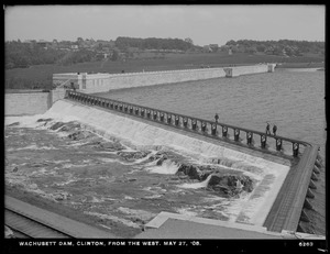
- Date:
- May 27, 1908
- Institution:
- Massachusetts Archives
- Creator:
- Massachusetts. Metropolitan Water and Sewerage Board; Tryon, Oliver, 1883-1922
- Format:
- Photographs
- Collection:
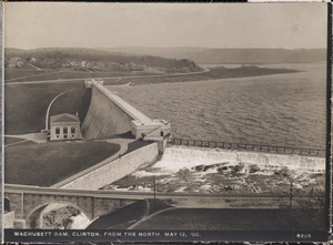
- Massachusetts Metropolitan Water Works Photograph Collection, 1876-1930 (bulk, 1895-1921)
- Date:
- May 12, 1908
- Institution:
- Massachusetts Archives
- Creator:
- Massachusetts. Metropolitan Water and Sewerage Board; Tryon, Oliver, 1883-1922
- Format:
- Photographs
- Collection:
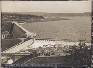
- Massachusetts Metropolitan Water Works Photograph Collection, 1876-1930 (bulk, 1895-1921)
- Date:
- May 27, 1908
- Institution:
- Massachusetts Archives
- Creator:
- Massachusetts. Metropolitan Water and Sewerage Board; Tryon, Oliver, 1883-1922
- Format:
- Photographs
- Collection:
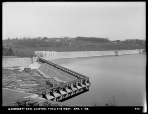
- Massachusetts Metropolitan Water Works Photograph Collection, 1876-1930 (bulk, 1895-1921)
- Date:
- April 1, 1908
- Institution:
- Massachusetts Archives
- Creator:
- Massachusetts. Metropolitan Water and Sewerage Board; Tryon, Oliver, 1883-1922
- Format:
- Photographs
- Collection:
- Massachusetts Metropolitan Water Works Photograph Collection, 1876-1930 (bulk, 1895-1921)
- Date:
- April 1, 1908
- Institution:
- Massachusetts Archives
- Creator:
- Massachusetts. Metropolitan Water and Sewerage Board; Tryon, Oliver, 1883-1922
- Format:
- Photographs
- Collection:
- Massachusetts Metropolitan Water Works Photograph Collection, 1876-1930 (bulk, 1895-1921)
- Date:
- May 12, 1908
- Institution:
- Massachusetts Archives
- Creator:
- Massachusetts. Metropolitan Water and Sewerage Board; Tryon, Oliver, 1883-1922
- Format:
- Photographs
- Collection:
- Massachusetts Metropolitan Water Works Photograph Collection, 1876-1930 (bulk, 1895-1921)
- Date:
- April 14, 1908
- Institution:
- Massachusetts Archives
- Creator:
- Massachusetts. Metropolitan Water and Sewerage Board; Tryon, Oliver, 1883-1922
- Format:
- Photographs
- Collection:
- Massachusetts Metropolitan Water Works Photograph Collection, 1876-1930 (bulk, 1895-1921)
- Date:
- May 12, 1908
- Institution:
- Massachusetts Archives
- Creator:
- Massachusetts. Metropolitan Water and Sewerage Board; Tryon, Oliver, 1883-1922
- Format:
- Photographs
- Collection:
- Massachusetts Metropolitan Water Works Photograph Collection, 1876-1930 (bulk, 1895-1921)
- Date:
- May 27, 1908
- Institution:
- Massachusetts Archives
- Creator:
- Massachusetts. Metropolitan Water and Sewerage Board; Tryon, Oliver, 1883-1922
- Format:
- Photographs
- Collection:
- Massachusetts Metropolitan Water Works Photograph Collection, 1876-1930 (bulk, 1895-1921)
- Date:
- May 27, 1908
- Institution:
- Massachusetts Archives
- Creator:
- Massachusetts. Metropolitan Water and Sewerage Board; Tryon, Oliver, 1883-1922
- Format:
- Photographs
- Collection:
- Massachusetts Metropolitan Water Works Photograph Collection, 1876-1930 (bulk, 1895-1921)
- Date:
- May 27, 1908
- Institution:
- Massachusetts Archives
- Creator:
- Massachusetts. Metropolitan District Water Supply Commission; Pike, Stuart D., 1910-1978
- Format:
- Photographs
- Collection:
- Massachusetts Metropolitan District Water Supply Commission, Quabbin Reservoir, Photographs of Real Estate, Sanitary Conditions, and Flooding in the Ware River Watershed, and of General Engineering, 1928-1948
- Date:
- January 4, 1940
- Institution:
- Massachusetts Archives
- Creator:
- Massachusetts. Metropolitan District Water Supply Commission; Pike, Stuart D., 1910-1978
- Format:
- Photographs
- Collection:
- Massachusetts Metropolitan District Water Supply Commission, Quabbin Reservoir, Photographs of Real Estate, Sanitary Conditions, and Flooding in the Ware River Watershed, and of General Engineering, 1928-1948
- Date:
- October 10, 1934
- Institution:
- Massachusetts Archives
- Creator:
- Massachusetts. Metropolitan District Water Supply Commission; Pike, Stuart D., 1910-1978
- Format:
- Photographs
- Collection:
- Massachusetts Metropolitan District Water Supply Commission, Quabbin Reservoir, Photographs of Real Estate, Sanitary Conditions, and Flooding in the Ware River Watershed, and of General Engineering, 1928-1948
- Date:
- October 20, 1932
- Institution:
- Massachusetts Archives
- Creator:
- Massachusetts. Metropolitan District Water Supply Commission; Pike, Stuart D., 1910-1978
- Format:
- Photographs
- Collection:
- Massachusetts Metropolitan District Water Supply Commission, Quabbin Reservoir, Photographs of Real Estate, Sanitary Conditions, and Flooding in the Ware River Watershed, and of General Engineering, 1928-1948
- Date:
- March 13, 1936
- Institution:
- Massachusetts Archives
- Creator:
- Massachusetts. Metropolitan District Water Supply Commission; Pike, Stuart D., 1910-1978
- Format:
- Photographs
- Collection:
- Massachusetts Metropolitan District Water Supply Commission, Quabbin Reservoir, Photographs of Real Estate, Sanitary Conditions, and Flooding in the Ware River Watershed, and of General Engineering, 1928-1948
- Date:
- April 13, 1934
- Institution:
- Massachusetts Archives
- Creator:
- Massachusetts. Metropolitan District Water Supply Commission; Pike, Stuart D., 1910-1978
- Format:
- Photographs
- Collection:
- Massachusetts Metropolitan District Water Supply Commission, Quabbin Reservoir, Photographs of Real Estate, Sanitary Conditions, and Flooding in the Ware River Watershed, and of General Engineering, 1928-1948
- Date:
- September 18, 1933
- Institution:
- Massachusetts Archives
- Creator:
- Massachusetts. Metropolitan District Water Supply Commission
- Format:
- Photographs
- Collection:
- Massachusetts Metropolitan District Water Supply Commission, Quabbin Reservoir, Photographs of Real Estate, Sanitary Conditions, and Flooding in the Ware River Watershed, and of General Engineering, 1928-1948
- Date:
- [ca. 1932–1947]
- Institution:
- Massachusetts Archives
- Creator:
- Massachusetts. Metropolitan District Water Supply Commission; Pike, Stuart D., 1910-1978
- Format:
- Photographs
- Collection:
- Massachusetts Metropolitan District Water Supply Commission, Quabbin Reservoir, Photographs of Real Estate, Sanitary Conditions, and Flooding in the Ware River Watershed, and of General Engineering, 1928-1948
- Date:
- March 31, 1936
- Institution:
- Massachusetts Archives
- Creator:
- Massachusetts. Metropolitan District Water Supply Commission; Pike, Stuart D., 1910-1978
- Format:
- Photographs
- Collection:
- Massachusetts Metropolitan District Water Supply Commission, Quabbin Reservoir, Photographs of Real Estate, Sanitary Conditions, and Flooding in the Ware River Watershed, and of General Engineering, 1928-1948
- Date:
- September 19, 1932
- Institution:
- Massachusetts Archives
- Creator:
- Massachusetts. Metropolitan District Water Supply Commission; Snow, Russell, 1902-1969
- Format:
- Photographs
- Collection:
- Massachusetts Metropolitan District Water Supply Commission, Quabbin Reservoir, Photographs of Real Estate, Sanitary Conditions, and Flooding in the Ware River Watershed, and of General Engineering, 1928-1948
- Date:
- August 28, 1931
- Institution:
- Massachusetts Archives
- Creator:
- Massachusetts. Metropolitan District Water Supply Commission; Chetwynd, Charles B., 1906-1994
- Format:
- Photographs
- Collection:
- Massachusetts Metropolitan District Water Supply Commission, Quabbin Reservoir, Photographs of Real Estate in the Swift River Valley, and of General Engineering of Quabbin Reservoir, 1927-1950
- Date:
- April 20, 1928
- Institution:
- Massachusetts Archives
- Creator:
- Massachusetts. Metropolitan District Water Supply Commission; Fitts, Charles A., 1905-1985
- Format:
- Photographs
- Collection:
- Massachusetts Metropolitan District Water Supply Commission, Quabbin Reservoir, Photographs of Real Estate in the Swift River Valley, and of General Engineering of Quabbin Reservoir, 1927-1950
- Date:
- July 24, 1928
- Institution:
- Massachusetts Archives
- Creator:
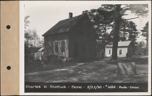
- Massachusetts. Metropolitan District Water Supply Commission; Snow, Russell, 1902-1969
- Format:
- Photographs
- Collection:
- Massachusetts Metropolitan District Water Supply Commission, Quabbin Reservoir, Photographs of Real Estate in the Swift River Valley, and of General Engineering of Quabbin Reservoir, 1927-1950
- Date:
- May 22, 1930
- Institution:
- Massachusetts Archives
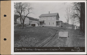
- Creator:
- Massachusetts. Metropolitan District Water Supply Commission; Remington, Carl A., 1902-1982
- Format:
- Photographs
- Collection:
- Massachusetts Metropolitan District Water Supply Commission, Quabbin Reservoir, Photographs of Real Estate in the Swift River Valley, and of General Engineering of Quabbin Reservoir, 1927-1950
- Date:
- February 28, 1930
- Institution:
- Massachusetts Archives