Skip to search
Skip to main content
Skip to first result
Digital Commonwealth
Folders
Sign Up / Log In
Search for
Search
Search
Search
Basic
Advanced
Explore
Map
Collections
Institutions
Formats
For Educators
Primary Source Sets
Lesson Plans
Using Primary Sources
Searching Digital Commonwealth
For Institutions
Join Digital Commonwealth
Conferences, Trainings, & Events
How to Contribute Collections
Digitization Services
Board & Committees
Frequently Asked Questions
About
About Digital Commonwealth
News & Announcements
Copyright & Terms of Use
Harmful Content Statement
Partners
API
Contact Us
Search
Search Constraints
Start Over
Save Search
Your search:
More Like
commonwealth:fn107c17h
✖
Remove constraint More Like: commonwealth:fn107c17h
« Prev.
|
10,501
-
10,600
of
11,222
|
Next »
Sort
by relevance
relevance
title
date (asc)
date (desc)
Number of results to display per page
100
per page
per page
10
per page
20
per page
50
per page
100
per page
View results as:
List
list view
Maps
map view
Gallery
grid view
Search Results
10501.
Territory of New Mexico
10502.
Territory of New Mexico
10503.
Territory of Utah
10504.
Territory of Utah
10505.
Territory of Wyoming
10506.
The territory over possession of which France and England are disputing
10507.
Tertia Affrice tabula continet Cyrenainaycam & Egyptum cum adiacentibus insulis
10508.
Tertia Africae tabula
10509.
Tertia Asiae tabula
10510.
Tertia Asie tabula continet Colchide, Iberia, Albania :& maiorem Armenia
10511.
Tertia Europae tabula
10512.
Teton National Forest, Wyoming
10513.
Tetrachia Ducatus Geldriae Neomagensis
10514.
Tetrachia ducatus Geldriae Ruremondana sive Hispanica
10515.
A Texan's map of the United States [of Texas]
10516.
Texas and Pacific Rail Way
10517.
Texas New Yorker travelers' railroad map of the State of Texas
10518.
Texas New Yorker's railroad map of Texas : showing all completed and proposed routes, with principal rivers, county boundaries...
10519.
Tezanos Pinto (Entre Rios)
10520.
[The natural shape of England with the names of rivers, seaports, sands, hills, moors, forrests, and many other remarks which...
10521.
[The south east coast of the island of St. John]
10522.
[The St. Lawrence River from the Chaudiere River to Pointe aux Coques]
10523.
[The World]
10524.
[The World]
10525.
Théatre de la guerre d'orient en 1854
10526.
Theatre de la guerre en Amerique
10527.
Théatre de la guerre en Amerique, avec les Isles Antilles : projetté et assujettie aux observations
10528.
Théatre de la guerre en Amerique, avec les Isles Antilles : projetté et assujettie aux observations
10529.
The theatre of war in North America, with the roads, and tables, of the superficial contents, distances, &ca
10530.
These United States : products & industries
10531.
Thirty-miles round Boston
10532.
This harbour of Boston
10533.
This harbour of Boston
10534.
This map of North America, according to ye newest and most exact observations is most humbly dedicated by your Lordship's most...
10535.
This map of Scotland
10536.
This map of South America, according to the newest and most exact observations
10537.
This map presents a Bostonian's idea of the United States of America
10538.
This plan contains about 1000 acres, of the Canton Company's Land
10539.
This plan of the city of Philadelphia and it's [sic] environs, (shewing the improved parts,) is dedicated to the mayor,...
10540.
Three Rivers, Mass
10541.
Thunder Bay, Lake Huron
10542.
Thun-Interlaken
10543.
Tierra nveva
10544.
Tilton, N.H., Belknap County : 1884
10545.
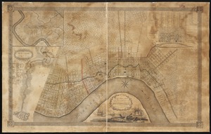
The Times-Picayune's map of New Orleans
10546.
Title page of Theatrum Orbis Terrarum
10547.
To General Andrew Jackson and his brave companions in arms on the 8th of Jany. 1815 this plan of the city of New Orleans is...
10548.
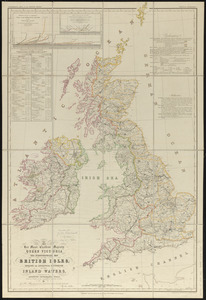
To her most excellent majesty Queen Victoria this hydrographical map of the British Isles, exhibiting the geographical...
10549.
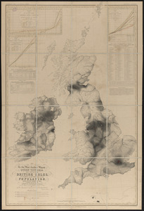
To her most excellent majesty Queen Victoria this map of the British Isles, elucidating the distribution of the population,...
10550.
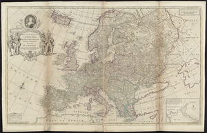
To Her most Sacred Majesty Carolina Queen of Great Britain, France & Ireland, this map of Europe, according to the newest and...
10551.
To his excellency the Count of Czernichew, Commander in Chief of her Majesty the Empress, of all the Russia's fleet and...
10552.
To his excellency William Shirley Esqr., Captain General and Commander in Chief, in and over his Majesty's province of the...
10553.
To His Most Serene and August Majesty Peter Alexovitz absolute lord of Russia &c. this map of Moscovy, Poland, Little Tartary,...
10554.
To the Great Czar of Moscovie this Map of Tartary &c. is humbly dedicated
10555.
To the Honourable Thomas Penn and Richard Penn, Esqrs., true & absolute proprietaries & Governours of the Province of...
10556.
To the honourable Walter Younge, barronet, one of the commissioners for his majestie's collonis : this description of New...
10557.
To the Right Honorable the Master, Wardens & Elder Brethren of the Trinity House, this Chart of Plymouth Sound is ... dedicated
10558.
To the right honorable the master, wardens & elder brethren of the Trinity House, this chart of Spithead is ... dedicated
10559.
To the Right Honorable the Master, Wardens, and Elder Brethren, of the Trinity House, this chart of the Downs and Margate Roads...
10560.
To the Right Honourable Charles, Earl of Peterborow, and Monmouth, &c. this map of Africa, according to ye newest and most...
10561.
To the Right Honourable, Charles Earl of Sunderland, and Baron Spencer of Wormleighton, one of Her Majesty's principal...
10562.
To the Right Honourable John Lord Sommers, Baron of Evesham in ye county of Worcester, president of Her Majesty's most...
10563.
To the Right Honourable the Master, Wardens, & Elder Bretham of the Trinity House, this chart of the entrances to The River...
10564.
To the Right Honourable William, Lord Cowper, Lord High Chancellor of Great Britain, this map of Asia : according to ye newest...
10565.
Tobago
10566.
Tobago from actual surveys and observations
10567.
Tomlinsons map of Petersburg : showing the scene of Genl. Grants operations
10568.
Tonto National Forest, Arizona
10569.
Topographia aug. Turon. ducatus et confinium Galliae celticae sinu complectitur cuius latitudo ab aequinoctiali versus...
10570.
Topographic map of Brighton and Allston
10571.
Topographic map of Clinton County, Illinois
10572.
Topographic map of Gallatin County, Illinois
10573.
Topographic map of Hardin County, Illinois
10574.
Topographic map of Lawrence County, Illinois
10575.
The topographic map of Manchoukuo
10576.
Topographic map of Massachusetts and Rhode Island
10577.
Topographic map of McDonough County, Illinois
10578.
Topographic map of Monroe County, Illinois
10579.
Topographic map of Randolph County, Illinois
10580.
Topographic map of the Island of Niihau, Kauai County, Hawaii
10581.
Topographic map of the Plattsburg Training Camp, New York
10582.
A topographical chart of the bay of Narraganset in the province of New England : with all the isles contained therein, among...
10583.
Topographical map, Gettysburg-Antietam
10584.
Topographical map of Blue Hills Reservation
10585.
Topographical map of Cedar Square, Roxbury
10586.
A topographical map of Essex County, Massachusetts : based upon the trigonometrical survey of the state
10587.
Topographical map of Fairmount Park, Philadelphia : excepting Wissahickon Valley
10588.
A topographical map of Hampshire County Massachusetts : based upon the trigonometrical survey of the state
10589.
Topographical map of Meekatharra
10590.
Topographical map of Middlesex Fells Reservation
10591.
Topographical map of Pittsfield, Berkshire Co., Mass : from actual surveys and records
10592.
A topographical map of Steuben Co., New York : from actual surveys
10593.
Topographical map of the approaches and defences of Knoxville, E. Tennessee, shewing the positions occupied by the United...
10594.
Topographical map of the City and County of New-York, and the adjacent country : with views in the border of the principal...
10595.
Topographical map of the counties of St. John and Kings, New Brunswick
10596.
Topographical map of the District of Columbia
10597.
Topographical map of the District of Columbia and a portion of Virginia
10598.
A topographical map of the island of Barbados : based upon Mayo's original survey in 1721 and corrected to the year 1846
10599.
A topographical map of the northn. part of New York Island, exhibiting the plan of Fort Washington, now Fort Knyphausen, with...
10600.
Topographical map of the province of lower Texas on the Gulf of Mexico
« Previous
Next »
1
2
…
102
103
104
105
106
107
108
109
110
…
112
113
Limit your search
Subject
Real property--Massachusetts--Boston--Maps
2,298
Boston (Mass.)--Maps
2,181
Landowners--Massachusetts--Boston--Maps
2,126
Roxbury (Boston, Mass.)--Maps
353
Dorchester (Boston, Mass.)--Maps
317
Cambridge (Mass.)--Maps
268
Brookline (Mass.)--Maps
237
Real property--Massachusetts--Cambridge--Maps
216
more
Subject
»
Place
North and Central America
8,036
United States
6,653
Suffolk (county)
3,555
Boston
3,415
Massachusetts
3,249
Europe
963
Middlesex (county)
619
Canada
427
more
Place
»
Format
Maps/Atlases
11,163
Manuscripts
215
Prints
51
Books
35
Objects/Artifacts
10
Drawings/Illustrations
8
Posters
4
Available to use
No known restrictions
11,048
Creative Commons license
67
Date
View distribution
Current results range from
1482
to
2023
Date range begin
Date range end
View larger »
Unknown
3
Collection
Norman B. Leventhal Map Center Collection
11,033
Boston and New England Maps (Collection of Distinction)
5,233
Urban Maps (Collection of Distinction)
4,967
Maritime Charts and Atlases (Collection of Distinction)
750
American Revolutionary War-Era Maps (Collection of Distinction)
625
Boston Redevelopment Authority Collection
190
Historic Maps
49
Mapping Boston Collection
20
more
Collection
»
Institution
Boston Public Library
11,116
Salem State University Archives and Special Collections
49
State Library of Massachusetts
27
Private Collection
20
American Antiquarian Society
9
Boston Athenaeum
1


![A Texan's map of the United States [of Texas]](https://bpldcassets.blob.core.windows.net/derivatives/images/commonwealth:fn107c388/image_thumbnail_300.jpg)


![[The south east coast of the island of St. John]](https://bpldcassets.blob.core.windows.net/derivatives/images/commonwealth:7h149v93n/image_thumbnail_300.jpg)
![[The St. Lawrence River from the Chaudiere River to Pointe aux Coques]](https://bpldcassets.blob.core.windows.net/derivatives/images/commonwealth:7h149v425/image_thumbnail_300.jpg)
![[The World]](https://bpldcassets.blob.core.windows.net/derivatives/images/commonwealth:9g54xj67p/image_thumbnail_300.jpg)
![[The World]](https://bpldcassets.blob.core.windows.net/derivatives/images/commonwealth:st74cx537/image_thumbnail_300.jpg)


![This plan of the city of Philadelphia and it's [sic] environs, (shewing the improved parts,) is dedicated to the mayor, aldermen and citizens thereof](https://bpldcassets.blob.core.windows.net/derivatives/images/commonwealth:4m90fd11j/image_thumbnail_300.jpg)