Skip to search
Skip to main content
Skip to first result
Digital Commonwealth
Folders
Sign Up / Log In
Search for
Search
Search
Search
Basic
Advanced
Explore
Map
Collections
Institutions
Formats
For Educators
Primary Source Sets
Lesson Plans
Using Primary Sources
Searching Digital Commonwealth
For Institutions
Join Digital Commonwealth
Conferences, Trainings, & Events
How to Contribute Collections
Digitization Services
Board & Committees
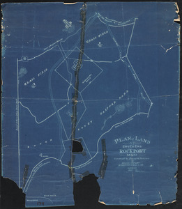
Frequently Asked Questions
About
About Digital Commonwealth
News & Announcements
Copyright & Terms of Use
Harmful Content Statement
Partners
API
Contact Us
Search
Search Constraints
Start Over
Save Search
Your search:
More Like
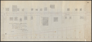
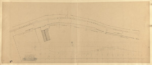
commonwealth:dz010z05n
✖
Remove constraint More Like: commonwealth:dz010z05n
« Prev. |
1
-
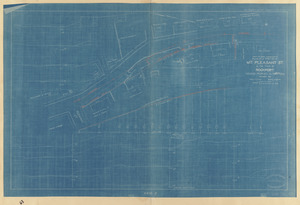
100
of
227
|
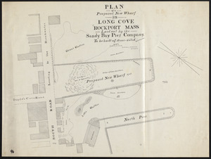
Next »
Sort
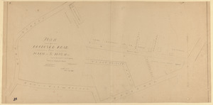
by relevance
relevance
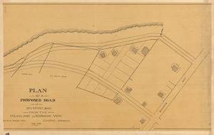
title
date (asc)
date (desc)
Number of results to display per page
100
per page
per page
10
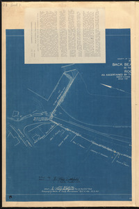
per page
20
per page
50
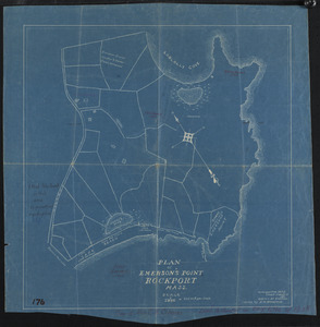
per page
100
per page
View results as:
List
list view
Maps
map view
Gallery
grid view
Search Results
1.
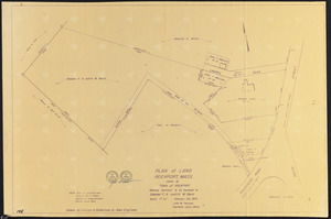
"A" sketch showing proposed changes of line at Beach & Granite Sts., Rockport, Mass.
2.
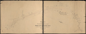
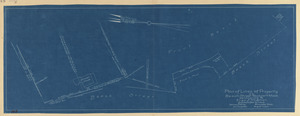
Bearskin Neck lots
3.
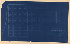
Cape Ann Tool Company
4.
Cogswell Farm Landing
5.
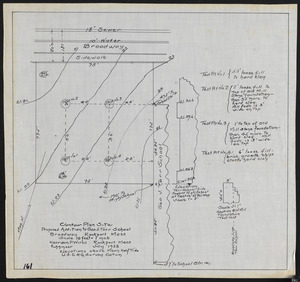
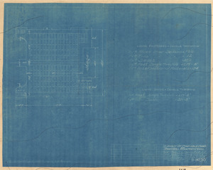
Contour plan site, proposed addition to Geo. J. Tarr School, Broadway, Rockport, Mass.
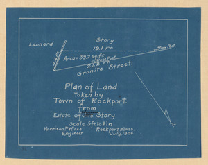
6.
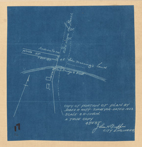
Copy of portion of plan by Jabez R. Gott
7.
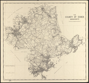
The County of Essex, Massachusetts
8.
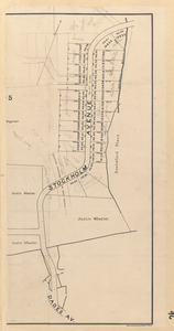
Detail plan, original ground, North End, Front Beach, Rockport, Mass.
9.
Drainage of the estate of Amos Rowe and of the adjacent neighborhood : System to carry drainage through Rowe Est. shown in red....
10.
Drainage of the estate of Amos Rowe and the adjacent neighborhood
11.
Existing parking with 2 and 2 parking between Mount Pleasant St. & Beach Street, Rockport, Mass.
12.
Form of complaint
13.
Goose Lane off Main St.
14.
Grandstand and field house in Evans Field, Town of Rockport, Mass.
15.
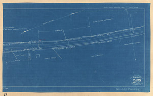
Granite St.
16.
Granite St., Pigeon Cove - Folly Cove
17.
Harvey Development at Old Garden Beach
18.
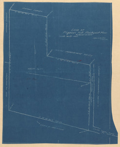
Land at Pigeon Hill, Rockport, Mass.
19.
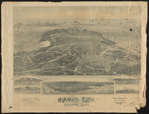
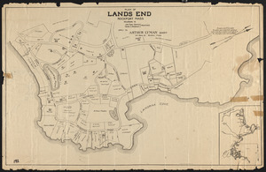
Lands End, Rockport, Mass.
20.
Layout of portable chairs for Town Hall, Rockport, Mass.
21.
Long Beach or Cape Pond Landing
22.
Long Cove and adjacent roads
23.
Lots along beach
24.
Map of Gloucester, Cape Ann : Showing the roads, harbours, rivers, coves, islands & ledges, surrounding that important cape,...
25.
Map of Gloucester, Cape Ann : Showing the roads, harbours, rivers, coves, islands & ledges, surrounding that important cape,...
26.
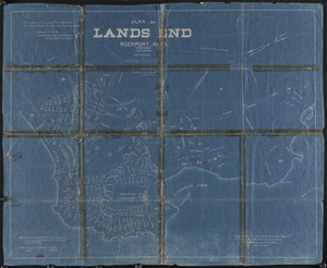
Map of Land's End, Rockport
27.
Map of road between Thos. Oake's old house and land of E. Rowe's heirs
28.
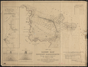
Map of Sandy Bay, Rockport, Massachusetts, showing proposed breakwater for harbor of refuge
29.
Mass. highway layout, Great Hill, Rockport
30.
"Ocean View" at Pigeon Cove in Town of Rockport, Mass., street location plan
31.
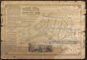
Ocean View, extreme end of Cape Ann, Pigeon Cove, Mass.
32.
Old Garden and Straitsmouth Cove Landing
33.
Part of Town of Rockport showing proposed locations on South St. and Wessex Rd.
34.
Pasture around Ruthern Way & Penzance Road Area
35.
Pigeon Hill St.
36.
Pillion Rocks
37.
Plan & elevations, walk & steps to town landing, Rockport, Mass.
38.
Plan & profile of 12 inch drain on Broadway, Rockport
39.
Plan & profile of extension to Pigeon Hill St., Rockport, Mass.
40.
Plan & profile of extension to Pigeon Hill St., Rockport, Mass.
41.
Plan and profile of Broadway from School St. to Cleaves St., showing locations and grade of proposed drain
42.
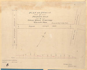
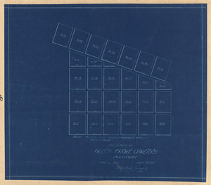
Plan and profile of proposed road in Locust Grove Cemetery, Gloucester, Mass.
43.
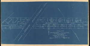
Plan and profile of proposed state highway in Rockport
44.
Plan and profile of proposed state highway in Rockport
45.
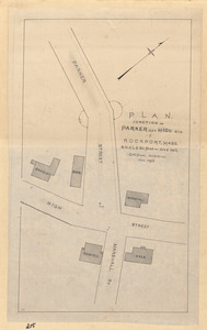
Plan, junction of Parker and High Sts. in Rockport, Mass.
46.
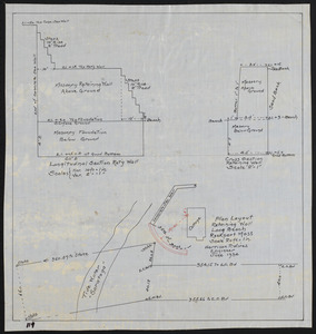
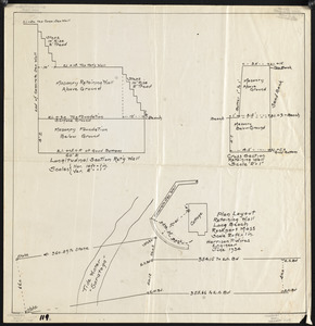
Plan layout retaining wall, Long Beach, Rockport, Mass.
47.
Plan layout retaining wall, Long Beach, Rockport, Mass.
48.
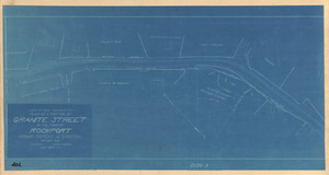
Plan of a portion of Granite Street in the town of Rockport showing proposed alterations
49.
Plan of a portion of Mt. Pleasant St. in the Town of Rockport showing proposed alterations
50.
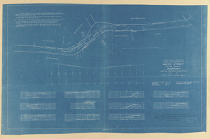
Plan of a portion of South Street from Thatcher's Road Northerly in the Town of Rockport as altered
51.
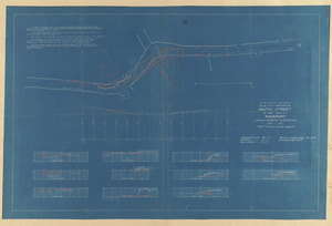
Plan of a portion of South Street in the Town of Rockport showing proposed alterations
52.
Plan of a portion of South Street in the Town of Rockport showing proposed alterations
53.
Plan of a proposed new wharf in Long Cove, Rockport, Mass., laid out by the Sandy Bay Pier Company
54.
Plan of a proposed road from King to North St., Rockport
55.
Plan of a proposed road from Main to High St., Rockport
56.
Plan of a proposed road from Main to High St., Rockport, Mass.
57.
Plan of a proposed road in Rockport, Mass. from the headland to Marmion Way
58.
Plan of a proposed town way Pigeon Cove, Rockport, Mass., as laid out by the Board of Selectmen
59.
Plan of a request of Electric Street Railroad
60.
Plan of a road, No. 1, Sandy Bay
61.
Plan of a town way in Rockport from Main St. to Broadway as laid out by the Selectmen
62.
Plan of a town way in Rockport, Mass., as laid out by the selectmen
63.
Plan of a town way in Rockport, Mass., from Main to High Street as laid out by the county commissioners
64.
Plan of a town way in Rockport, Mass., from Main to High Street as laid out by the county commissioners
65.
Plan of Back Beach Landing in the Town of Rockport as ascertained by the county commissioners
66.
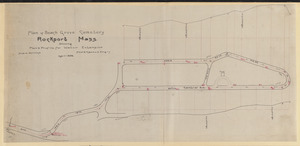
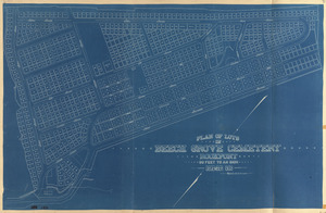
Plan of Beach Grove Cemetery, Rockport, Mass. showing plan & profile for water extension
67.
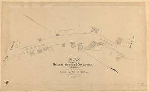
Plan of Beach Street, Rockport, Mass., from Main St. to King St.
68.
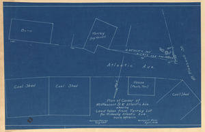
Plan of corner of Mt. Pleasant St. & Atlantic Ave. showing land taken from Torrey lot for widening Atlantic Ave.
69.
Plan of Emerson's Point, Rockport, Mass. : Enlarged from U.S.C.S chart-survey of 1851
70.
Plan of Garden Landing & Way in the Town of Rockport
71.
Plan of Haskins Hospital property, Pools Hill, Rockport, Mass.
72.
Plan of Haskins Hospital Property, Pools Hill, Rockport, Mass.
73.
Plan of headland
74.
Plan of headlands
75.
Plan of highway from Gloucester line to South St. in the Town of Rockport : Under authority of Chapter 218 of the General Acts...
76.
Plan of land at Pebble Beach, Rockport, Mass., conveyed by the heirs of Frances Wonson to the trustees under the will of Henry...
77.
Plan of land at South End, Rockport, Mass.
78.
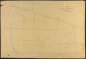
Plan of land belonging to Orren S. Poole, Rockport, Mass.
79.
Plan of land belonging to the Village Improvement Society, Pigeon Cove, Rockport, Mass.
80.
Plan of land from estate of Maria L. Phillips to Town of Rockport at Pigeon Cove, Mass.
81.
Plan of land in Rockport, Mass., owned by Town of Rockport, Mass.
82.
Plan of land in Rockport, Mass., showing exchange of land between Town of Rockport and Norwood H. Knowlton
83.
Plan of land in Rockport, Massachusetts, land of low value to be conveyed to Town of Rockport
84.
Plan of land in Rockport, property of John D. McNiff & Andrew A. Dominick Jr.
85.
Plan of land in Rockport, property of Stephen F. & Judith W. Davis
86.
Plan of land on Pool Hill, Rockport, Mass. : Compiled from town records
87.
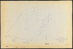
Plan of land owned by Caroline K. Delamater located in Rockport, Mass.
88.
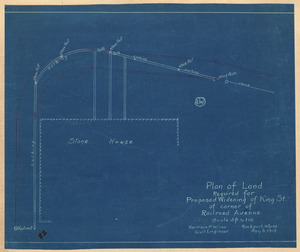
Plan of land required for proposed widening of King St. at corner of Railroad Avenue
89.
Plan of land, Rockport, Mass., owned by Town of Rockport, showing easement to be conveyed to Stephen F. & Judith W. Davis
90.
Plan of land taken by Town of Rockport from estate of Clarissa Story
91.
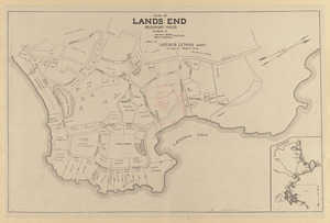
Plan of Lands End, Rockport, Mass. : Belonging to Lands End Association
92.
Plan of Lands End, Rockport, Mass. belonging to John Tudor Gardiner, Charles S. Rackemann, Trustees
93.
Plan of Lands End, Rockport, Mass. belonging to John Tudor Gardiner, Charles S. Rackemann, Trustees
94.
Plan of lines of property on Beach Street, Rockport, Mass. belonging to Eliza J. O'Connor
95.
Plan of lots at Pigeon Cove Highlands in Rockport, Mass. : Owned by Thos. Garfield
96.
Plan of lots at Saratoga Heihts, Rockport, Mass.
97.
Plan of lots in Beech Grove Cemetery, Rockport
98.
Plan of lots in Beech Grove Cemetery, Rockport
99.
Plan of lots in Beech Grove Cemetery, Rockport
100.
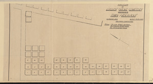
Plan of lots in Locust Grove Cemetery belonging to Town of Rockport
« Previous
Next »
1
2
3
Limit your search
Subject
Streets
76
Sewers
7
Beaches
6
Parks
6
Retaining walls
6
Piers & wharves
4
Land use
3
Bays (Bodies of water)
2
more
Subject
»
Place
Essex (county)
227
Massachusetts
227
North and Central America
227
United States
227
Rockport
186
Pigeon Cove
20
Pool Hill
7
Gloucester
4
more
Place
»
Format
Maps/Atlases
219
Manuscripts
99
Prints
5
Documents
1
Drawings/Illustrations
1
Photographs
1
Available to use
No known restrictions
227
Date
View distribution
Current results range from
1823
to
1974
Date range begin
Date range end
View larger »
Collection
Rockport Town Clerk, Street, Roads and Maps
227
Institution
Town of Rockport
227