Skip to search
Skip to main content
Skip to first result
Digital Commonwealth
Folders
Sign Up / Log In
Search for
Search
Search
Search
Basic
Advanced
Explore
Map
Collections
Institutions
Formats
For Educators
Primary Source Sets
Lesson Plans
Using Primary Sources
Searching Digital Commonwealth
For Institutions
Join Digital Commonwealth
Conferences, Trainings, & Events
How to Contribute Collections
Digitization Services
Board & Committees
Frequently Asked Questions
About
About Digital Commonwealth
News & Announcements
Copyright & Terms of Use
Harmful Content Statement
Partners
API
Contact Us
Search
Search Constraints
Start Over
Save Search
Your search:
More Like
commonwealth:9s161919k
✖
Remove constraint More Like: commonwealth:9s161919k
« Prev.
|
7,081
-
7,100
of
10,999
|
Next »
Sort
by relevance
relevance
title
date (asc)
date (desc)
Number of results to display per page
20
per page
per page
10
per page
20
per page
50
per page
100
per page
View results as:
List
list view
Maps
map view
Gallery
grid view
Search Results
7081.
Map of Westborough Mass
7082.
Map of White Pass & Yukon Route and connections
7083.
Map of Whitley County
7084.
Map of Wisconsin showing geology and roads
7085.
Map of Wiskonsin Territory, compiled from the public surveys
7086.
Map of Woods County, West Virginia
7087.
Map of Woodstock, Conn
7088.
Map of Worcester County, Mass
7089.
Map of Worcester County, Massachusetts : based upon the trigonometrical survey of the state
7090.
Map of Worcester County, Massachusetts
7091.
Map of Worcester Mass
7092.
Map of Yakima Region, Washington, Ter.
7093.
A map or plot of the twenty-five divisions of land ... late in the Township of Dorchester and now in the Township of Stoughton,...
7094.
A map plat or draught of the twelve divisions of land as they were laid out, bounded & measured to ye proprietors in...
7095.
Map railway route, Seward to Fairbanks : (including Matanuska - branch)
7096.
Map second division railway mail service
7097.
Map seventh division railway mail service
7098.
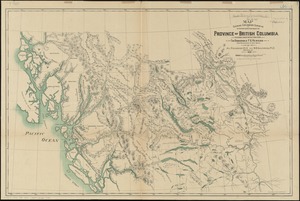
Map shewing exploratory surveys in the northern portion of the province of British Columbia
7099.
Map shewing the railways of Canada, to accompany annual report on railway statistics 1884
7100.
Map showing anchorage ground in the Port of New York and the Hudson and East Rivers
« Previous
Next »
1
2
…
351
352
353
354
355
356
357
358
359
…
549
550
Limit your search
Subject
Real property--Massachusetts--Boston--Maps
2,278
Landowners--Massachusetts--Boston--Maps
2,117
Boston (Mass.)--Maps
1,966
Roxbury (Boston, Mass.)--Maps
351
Dorchester (Boston, Mass.)--Maps
317
Cambridge (Mass.)--Maps
266
Brookline (Mass.)--Maps
236
Real property--Massachusetts--Cambridge--Maps
216
more
Subject
»
Place
North and Central America
7,813
United States
6,432
Suffolk (county)
3,337
Boston
3,197
Massachusetts
3,166
Europe
963
Middlesex (county)
616
Canada
427
more
Place
»
Format
Maps/Atlases
10,940
Manuscripts
215
Prints
51
Books
35
Objects/Artifacts
10
Drawings/Illustrations
8
Posters
4
Available to use
No known restrictions
10,931
Creative Commons license
46
Date
View distribution
Current results range from
1482
to
2023
Date range begin
Date range end
View larger »
Collection
Norman B. Leventhal Map Center Collection
10,999
Boston and New England Maps (Collection of Distinction)
5,104
Urban Maps (Collection of Distinction)
4,846
Maritime Charts and Atlases (Collection of Distinction)
750
American Revolutionary War-Era Maps (Collection of Distinction)
615
Boston Redevelopment Authority Collection
86
Institution
Boston Public Library
10,999