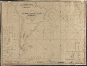
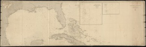
Skip to search
Skip to main content
Skip to first result
Digital Commonwealth
Folders
Sign Up / Log In
Search for
Search
Search
Search
Basic
Advanced
Explore
Map
Collections
Institutions
Formats
For Educators
Primary Source Sets
Lesson Plans
Using Primary Sources
Searching Digital Commonwealth
For Institutions
Join Digital Commonwealth
Conferences, Trainings, & Events
How to Contribute Collections
Digitization Services
Board & Committees
Frequently Asked Questions
About
About Digital Commonwealth
News & Announcements
Copyright & Terms of Use
Harmful Content Statement
Partners
API
Contact Us
Search
Search Constraints
Start Over
Save Search
Your search:
More Like
commonwealth:8s45qz745
✖
Remove constraint More Like: commonwealth:8s45qz745
« Prev.
|
101
-
120
of
3,082
|
Next »
Sort
by relevance
relevance
title
date (asc)
date (desc)
Number of results to display per page
20
per page
per page
10
per page
20
per page
50
per page
100
per page
View results as:
List
list view
Maps
map view
Gallery
grid view
Search Results
101.
From Monomoy and Nantucket Shoals to Muskeget Channel
102.
From Muskeget Channel to Buzzard's Bay and entrance to Vineyard Sound, Mass.
103.
Gaspar Strait
104.
General chart of the coast from Cape Hatteras to Cape Romain
105.
General chart of the coast from Cape Henry to Cape Lookout
106.
General chart of the coast from Cape Henry to Cape Lookout
107.
General chart of the coast from Cape Romain to Amelia Island
108.
General Chart of the coast, from Gay Head to Cape Henlopen
109.
General chart of the coast, No. IV, from Cape May to Cape Henry
110.
General chart of the coast, Straits of Florida
111.
General chart of the Mediterranean Sea and a portion of the Euxine or Black Sea with particular plans of the principal harbors
112.
General chart of the South Atlantic or [illegible]iopic Ocean [illegible] the Equator to 65° south latitude [illegible]ng to...
113.
A general chart of the southern Atlantic Ocean and western coast of South America
114.
Geo. W. Eldridge's chart A, Long Island Sound from New York to New London
115.
Geo. W. Eldridge's chart D, Massachusetts Bay and the coast from Chatham to Boston and Gloucester
116.
The Great Bahama Bank
117.
Gulf of Mexico
118.
Gulf of Mexico, West Indies, and Caribbean Sea
119.
Gulf of Siam
120.
Hatteras Shoals
« Previous
Next »
1
2
3
4
5
6
7
8
9
10
…
154
155
Limit your search
Subject
Harbors
2,966
Boats
972
Piers & wharves
537
Islands
272
Waterfronts
236
Ships
235
Harbors--Provincetown--Mass
201
Provincetown (Mass.)--History--20th century
184
more
Subject
»
Place
North and Central America
2,699
United States
2,648
Massachusetts
2,231
Essex (county)
796
Barnstable (county)
645
Suffolk (county)
380
Boston Harbor
276
Boston
269
more
Place
»
Format
Photographs
1,876
Postcards/Cards
621
Prints
242
Maps/Atlases
179
Documents
103
Newspapers
54
Paintings
33
Drawings/Illustrations
26
more
Format
»
Available to use
No known restrictions
1,050
Creative Commons license
994
Date
View distribution
Current results range from
1723
to
2002
Date range begin
Date range end
View larger »
Unknown
240
Collection
Boston Pictorial Archive (Collection of Distinction)
372
Samuel Chamberlain Photograph Negatives Collection, 1928-1971, undated
336
Falmouth Public Library Historical Postcard Collection
313
Bill Lane Photograph Collection
310
Tichnor Brothers Postcard Collection
214
Nautical Chart Collection of the Chatham Historical Society
167
John Dowd Althea Boxell Collection
161
Arthur Griffin Photographs
118
more
Collection
»
Institution
Boston Public Library
1,224
Phillips Library at the Peabody Essex Museum
364
Falmouth Public Library
313
Newburyport Public Library
310
Provincetown History Preservation Project
210
Atwood Museum of the Chatham Historical Society
167
Griffin Museum of Photography
118
New Bedford Free Public Library
84
more
Institution
»