Skip to search
Skip to main content
Skip to first result
Digital Commonwealth
Folders
Sign Up / Log In
Search for
Search
Search
Search
Basic
Advanced
Explore
Map
Collections
Institutions
Formats
For Educators
Primary Source Sets
Lesson Plans
Using Primary Sources
Searching Digital Commonwealth
For Institutions
Join Digital Commonwealth
Conferences, Trainings, & Events
How to Contribute Collections
Digitization Services
Board & Committees
Frequently Asked Questions
About
About Digital Commonwealth
News & Announcements
Copyright & Terms of Use
Harmful Content Statement
Partners
API
Contact Us
Search
Search Constraints
Start Over
Save Search
Your search:
More Like
commonwealth:70796k59f
✖
Remove constraint More Like: commonwealth:70796k59f
« Prev.
|
601
-
700
of
785
|
Next »
Sort
by relevance
relevance
title
date (asc)
date (desc)
Number of results to display per page
100
per page
per page
10
per page
20
per page
50
per page
100
per page
View results as:
List
list view
Maps
map view
Gallery
grid view
Search Results
601.
The Mount of the Holy Cross
602.
The Mount of the Holy Cross
603.
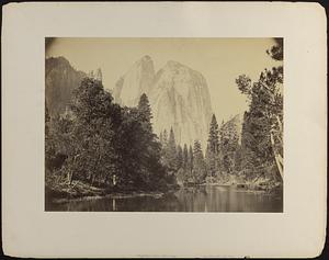
Mount of the Holy Cross
604.
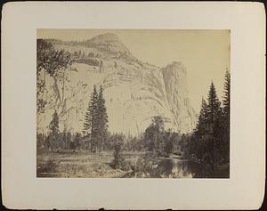
Mount Watkins, fully reflected in Mirror Lake, Yosemite
605.
Mount Whitney, California
606.
Mountain transportation, pack mule, pack and packers
607.
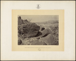
Mouth of Canon of El Rito, New Mexico, 900 miles west of Missouri River.
608.
The mouth of Kanab Creek
609.
The mouth of Kanab Creek
610.
Mouth of the Paria, Colorado River
611.
Mt. Starr King and Glacier Point, Yosemite
612.
A mud lodge
613.
Muddy Creek, Kansas, 162 miles west of Missouri River.
614.
Multnomah Falls, 700 ft. Columbia River scenery, Oregon
615.
Mushroom Rock on Alum Creek, Kansas, 211 miles west of Missouri River.
616.
Native painting on a buffalo skin
617.
Navajo boys and squaw
618.
Navajo brave and his mother
619.
Navajo Indian squaw and child
620.
Near Dunlap's Ranche, crossing of Sierra Nevada at Tehachapa Pass, California, 1,720 miles west of Missouri River.
621.
Nevada Fall, Yosemite
622.
New Mexican Ranche on the Rio Grande, below Albuquerque.
623.
North Dome, the Royal Arches, and Washington Column, Yosemite
624.
North Dome, the Royal Arches, and Washington Column, Yosemite
625.
North Dome, Yosemite
626.
North Fork Cañon, Sierra Blanca Creek, Arizona
627.
The northern wall of the Grand Cañon
628.
Oaks in Tehachapa Pass, crossing of the Sierra Nevadas, California, 1,720 miles from Missouri River.
629.
O-hun-ha-nuzke. Standing at the End
630.
The old carreta, Laguna, N. M.
631.
Old mission church, Zuni Pueblo, N.M. View from the plaza
632.
The oldest house in Santa Fe
633.
On the Great Plains, in Kansas, near Monument, 385 miles west of Missouri River.
634.
On the Great Plains, Kansas, 294 miles west of Missouri River.
635.
On the Great Plains, Kansas, September, 1867, 296 miles west of Missouri River.
636.
On the Kansas Plains, 185 miles west of Missouri River.
637.
On the Line, in California.
638.
On the mountains of Green River.
639.
On the Rio Grande, between Albuquerque and Fort Craig.
640.
One of the group of Pagosa Hot Springs, showing incrustation on the surface.
641.
Original drop front box for 50 stereograph set, "Geographical Explorations and Surveys West of the 100th Meridian"
642.
Overlooking Lawerence and the Kansas River.
643.
Pah-ge, a Ute Squaw
644.
Palmer Lake
645.
"Panoche," in the Coast Range, California, 1,850 miles west of Missouri River.
646.
A panoramic view of the front range of the Rocky Mountains, from near Gray's and Torrey's Peaks
647.
Park near head of Conejos Cañon, Col.
648.
Partridge Creek, Western Base of Mogoyon Range, Arizona; Mescal Plant in foreground. 1,280 miles west of Missouri River.
649.
Perched rock, Rocker Creek, Arizona
650.
Peta-la-sha-ra, man and chief
651.
Pikes Peak from the Garden of the Gods
652.
Pikes Peak from the mesa
653.
Placida or Interior Court of Mexican House, Las Lunas, New Mexico, on the Rio Grande, 890 miles west of Missouri River.
654.
Plaza de Armas, Aguascalientes, Mexico
655.
Popocatepetl, from Amecameca, Mexico
656.
Popocatepetl, from Tlamacas, Mexico
657.
Preface
658.
"Priest's Gap" in Chupaynas Ridge, foot hills of the Rocky Mountains, 758 miles from Missouri River.
659.
Pueblo de Taos
660.
Pueblo Laguna, N. M.
661.
The pyramid of Cholula, Mexico
662.
Queretero [i.e. Querétaro], Mexico
663.
Railroad Bridge across the Kaw at state line, Kansas.
664.
Rain sculpture, Salt Creek Cañon, Utah
665.
The Raton Mountains, Line of Southern Colorado and New Mexico.
666.
Residence of Brigham Young.
667.
River view, Cathedral Rock, Yosemite
668.
Rock carved by drifting sand, below Fortification Rock, Arizona
669.
Rock Great Eastern.
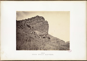
670.
Roman Catholic Church, Plaza of Guadaloupe, Guadaloupe Co., Colorado.
671.
The Royal Gorge, Grand Cañon of the Arkansas
672.
Ruins in ancient pueblo of San Juan, Colorado
673.
Ruins in Cañon de Chelle
674.
Runk's Division of the Engineer Corps on the Plains.
675.
Running the Line through the "Zuni Tollgate," near Aqua Frio, N.M., Eastern Base of Sierra Madre, (Main Range of Rocky...
676.
Russel's Tank, Western Arizona, 1,271 miles west of Missouri River.
677.
Salina, Kansas, September, 1867, 185 miles west of Missouri River.
678.
Salt Creek Valley, Kansas.
679.
Salt Lake City, from the top of the Tabernacle.
680.
San Francisco Mountains, Arizona
681.
Santa Fe Train passing through Ellsworth, Kansas, 1867.
682.
School building
683.
"Seal Rocks," in Pacific Ocean, near San Francisco, 1,955 miles west of Missouri River. "Last scene of all in this strange,...
684.
Section of south side of Zuni Pueblo, N.M.
685.
Section of south side of Zuni Pueblo, N.M.
686.
Section of the Grizzly Giant with Galen Clark, Mariposa Grove, Yosemite
687.
Sentinel Rock, Weber Valley.
688.
Sentinel Rock, Yosemite
689.
Shee-zah-nan-tan, Jicarilla Apache Brave
690.
Shipping Point for Texan Cattle, Abilene, Kansas, 162 miles west of Missouri River.
691.
Shoshone Falls, Snake River, Idaho
692.
Shoshone Falls, Snake River, Idaho
693.
Shoshone Falls, Snake River, Idaho
694.
Shoshone Falls, Snake River, Idaho, full lateral view on upper level
695.
Shoshone Falls, Snake River, Idaho, mid-day view, adjacent walls about 1000 feet in height
696.
Shoshone Falls, Snake River, Idaho, view across top of the Falls
697.
Sierra Clara, between Wagon Mountain and Apache Hill, 16 miles from Fort Union, New Mexico; 717 miles west of Missouri River.
698.
The Sierra Nevadas, at Tehachapa Pass, California, 1,700 miles from Missouri River.
699.
Sinks of Tehachapa, California.
700.
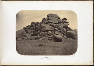
Skull Rock.
« Previous
Next »
1
2
3
4
5
6
7
8
Limit your search
Subject
Indians of North America
330
Indigenous peoples
140
Trans-Mississippi and International Exposition (1898 : Omaha, Neb.)
113
Mountains
80
Union Pacific Railroad Company
50
Rivers
45
Rock formations
32
Trees
31
more
Subject
»
Place
North and Central America
541
United States
496
Massachusetts
103
Arizona
76
California
75
Colorado
60
New Mexico
56
Western United States
50
more
Place
»
Format
Photographs
740
Prints
20
Books
6
Ephemera
5
Objects/Artifacts
5
Documents
4
Paintings
4
Letters/Correspondence
3
more
Format
»
Available to use
No known restrictions
599
Creative Commons license
17
Date
View distribution
Current results range from
1765
to
2019
Date range begin
Date range end
View larger »
Unknown
2
Collection
Photographs of the American West
570
Leslie Jones Collection
96
Stereograph Collection
56
Arthur Griffin Photographs
36
Plymouth Tercentenary Photographs
9
Social and Political Cartoons
9
Art and Artifacts Collection
7
Boston Children’s Museum Lantern Slides
6
more
Collection
»
Institution
Boston Public Library
685
Griffin Museum of Photography
36
Historical Society of Old Yarmouth
9
Plymouth Public Library
9
Nahant Public Library
7
Boston Children's Museum
6
Amherst College Archives & Special Collections
5
Special Collections and University Archives, University of Massachusetts Amherst Libraries
4
more
Institution
»
![Queretero [i.e. Querétaro], Mexico](https://bpldcassets.blob.core.windows.net/derivatives/images/commonwealth:7w62j619n/image_thumbnail_300.jpg)