Skip to search
Skip to main content
Skip to first result
Digital Commonwealth
Folders
Sign Up / Log In
Search for
Search
Search
Search
Basic
Advanced
Explore
Map
Collections
Institutions
Formats
For Educators
Primary Source Sets
Lesson Plans
Using Primary Sources
Searching Digital Commonwealth
For Institutions
Join Digital Commonwealth
Conferences, Trainings, & Events
How to Contribute Collections
Digitization Services
Board & Committees
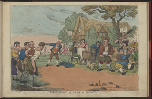
Frequently Asked Questions
About
About Digital Commonwealth
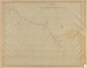
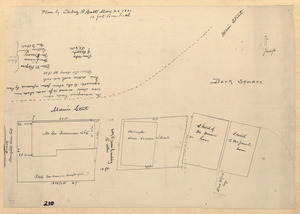
News & Announcements
Copyright & Terms of Use
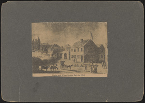
Harmful Content Statement
Partners
API
Contact Us
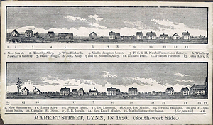
Search
Search Constraints
Start Over
Save Search
Your search:
More Like
commonwealth:1257dn336
✖
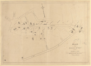
Remove constraint More Like: commonwealth:1257dn336
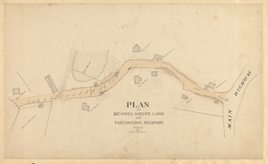
« Prev. |
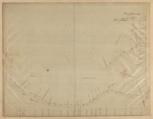
1
-
100
of
11,240
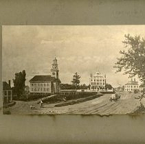
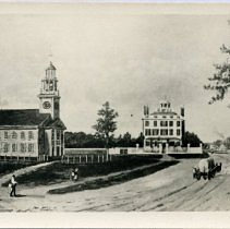
|
Next »
Sort
by date (asc)
relevance
title
date (asc)
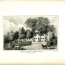
date (desc)
Number of results to display per page
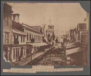
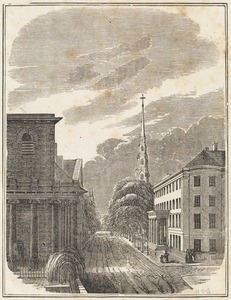
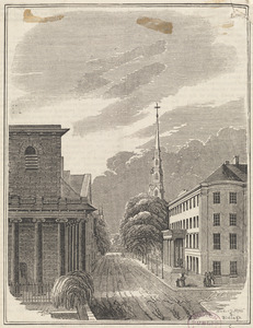
100
per page
per page
10
per page
20
per page
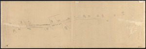
50
per page
100
per page
View results as:
List
list view
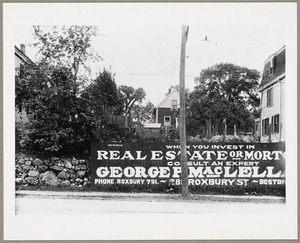
Maps
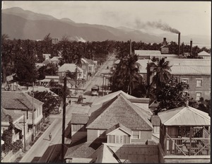
map view
Gallery
grid view
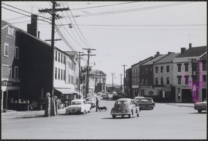
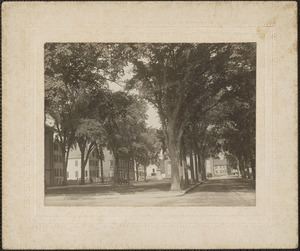
Search Results
1.
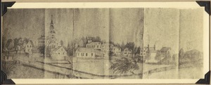
Historic Notes Records Trivia 1635 to 1930
2.
Postcard
3.
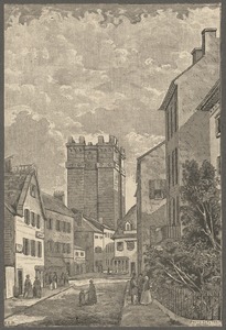
Parte dell'antica Via Appia in distanza da Porta S. Sebastiano cinque miglia in circa oggi coperta dalterreno
4.
Veduta dell'antica Via Appia, che passa sotto le mura, gia descritte nelle passate tavole dell'ustrino, oggi ricoperta nelle...
5.
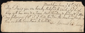
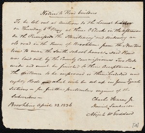
Notice to roadbuilders
6.
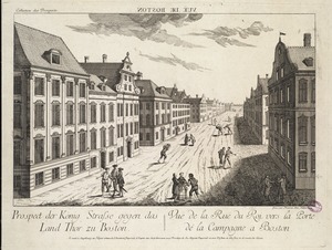
Prospect der König Strasse gegen das Land Thor zu Boston = Vuë de la Ruë du Roi, vers la Porte de la Campagnè a Boston
7.
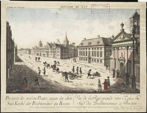
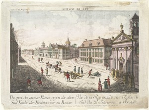
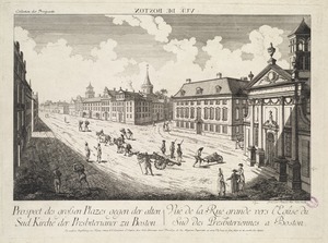
Prospect des grossen Plazes gegen der alten Sud Kirche der Presbiterianer zu Boston = Vuë de la Ruë grande vers l'Eglise du Sud...
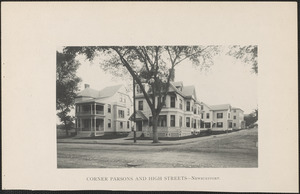
8.
Prospect des grossen Plazes gegen der alten Sud Kirche der Presbiterianer zu Boston = Vuë de la Ruë grande vers l'Eglise du Sud...
9.
Prospect des grossen Plazes gegen der alten Sud Kirche der Presbiterianer zu Boston = Vuë de la Ruë grande vers l'Eglise du Sud...
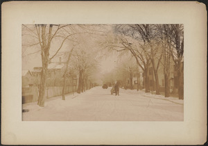
10.
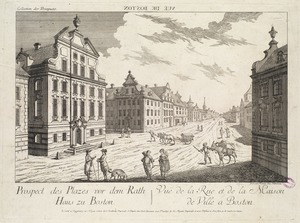
Prospect des Plazes vor dem Rath Haus zu Boston = Vuë de la Ruë et de la Maison de Ville a Boston
11.
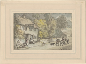
Country scene in Devonshire
12.
Promenade at Richmond : Overlooking the river
13.
Richmond
14.
Cuckfield
15.
Reigate
16.
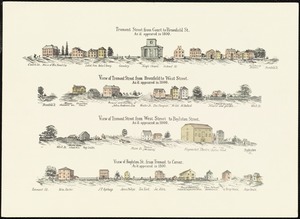
Tremont St. in 1796
17.
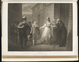
Shakspeare. Twelfth night, act V, scene I : The street : Duke, Viola, Antonio, officers, Olivia, Priest, & attendants
18.
Tremont Street in 1798
19.
Boston, Massachusetts. Tremont Street in 1799
20.
Boston, Massachusetts. Tremont Street early in the 19th century. From West Street looking towards King's Chapel
21.
Purchase Street in days gone by
22.
Report on guideposts and school funding
23.
Tremont & Boylston Street in 1800
24.
The World's End Inn
25.
Carlisle center before 1868
26.
Indenture town for Worcester Turnpike Corp to maintain turnpike without tolls
27.
Something about Worcester Turnpike
28.
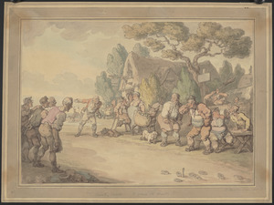
Country sports or game at quoits : A game of quoits
29.
Government Form
30.
Rural sports or game at quoits
31.
Plan of the new county road from Lincoln Meeting House to Watertown
32.
Print, Photographic
33.
Union and Water Streets back in 1814
34.
Union and Water Streets back in 1814
35.
Print, Photographic
36.
West Cambridge 1817
37.
Market Street, Lynn in 1820, south-west side
38.
Massachusetts. Boston. Bromfield Street (about 1820) formerly Bromfield Place
39.
Minutes of committee regarding road improvements
40.
Goose Lane off Main St.
41.
Granite St.
42.
Granite St., Pigeon Cove - Folly Cove
43.
Pigeon Hill St.
44.
Plan of Main Street
45.
Plan of Parker Street in Rockport, Mass.
46.
Plan of School House Lane at Pigeon-Cove, Rockport
47.
Plan of the highway in Rockport, Mass., from Long Cove to Todds'
48.
Plan with High St. and Main St.
49.
Roads adjacent to Back Beach (Beach - King - Granite)
50.
A view of the Back Bay - Charles Street to the Common
51.
Plan of section of South St.
52.
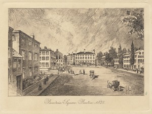
Bowdoin Square, Boston - 1825
53.
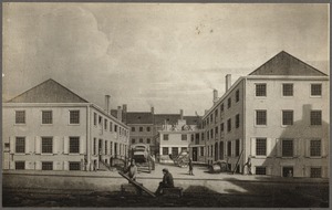
Boston, Massachusetts. Bromfield Place about 1830
54.
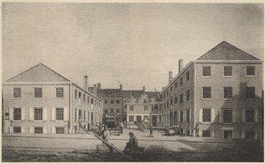
The northerly side of Bromfield Place, 1829. Now 11-29 Bromfield St.
55.
The northerly side of Bromfield Place (now Bromfield St.) in 1829. The building on the left is on the easterly corner of...
56.
Petition regarding a new road for South Brookline
57.
Road between B.M. House and Main Road
58.
Report of location of road near A. D. Welds
59.
Residence of Stephen Robbins
60.
Plan of Main Street at Dock Square
61.
View in Tremont Street, Boston
62.
View of Tremont Street, Boston
63.
Notice to roadbuilders
64.
Report of committee on road at south part of town
65.
Report on guideposts
66.
Long Cove and adjacent roads
67.
Notice of vote on roads
68.
Plan of a road, No. 1, Sandy Bay
69.
Albermarle Street
70.
Allen Street
71.
Appleton Street
72.
Bartlet Mall
73.
Bartlet Mall, east end
74.
Bartlet Mall, opposite Green St.
75.
Billboard on Massachusetts Avenue
76.
Birds-eye view of Harbour Street in Kingston, Jamaica; mountains in distance
77.
B&M R.R., Cary's Ave. over tunnel NE view
78.
B&M R.R. crossing, Washington St., looking west
79.
Bossy Gillis Gas Station
80.
Boston. Corner of Washington, Winter and Summer Sts.
81.
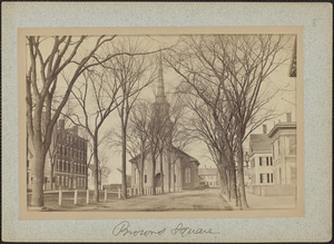
Brown Sq. looking west from Green St.
82.
Brown Square
83.
Brown Square, Garrison Statue, Garrison Inn, Central Church
84.
Brown Square Hotel, later the Garrison Inn
85.
Brown Square House
86.
Brown Square looking towards Green Street
87.
Charter St. toward State St.
88.
Chestnut and Medford Streets; St. Agnes School on the left
89.
Chestnut Street
90.
Christmas in Market Sq.
91.
Corner, Massachusetts and Churchill Avenues
92.
Corner of High and Allen?
93.
Corner of Liberty and Fair
94.
Corner Parsons and High Streets, Newburyport
95.
Crescent Hill Avenue under construction, looking northwest
96.
Crescent Hill Avenue under construction (looking northwest)
97.
Crescent Hill Avenue under construction, looking toward Mount Gilboa
98.
Federal St.
99.
Federal St. from High St.
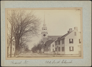
100.
Federal St., Old South Church
« Previous
Next »
1
2
3
4
5
…
112
113
Limit your search
Subject
Streets
9,794
Buildings
2,216
Houses
1,223
Cities & towns
839
Trees
731
Sewers
709
Automobiles
627
Stores & shops
543
more
Subject
»
Place
North and Central America
9,957
United States
9,905
Massachusetts
9,447
Essex (county)
3,652
Barnstable (county)
2,015
Suffolk (county)
1,741
Boston
1,573
Lawrence
1,549
more
Place
»
Format
Photographs
6,717
Postcards/Cards
2,699
Maps/Atlases
1,533
Manuscripts
1,527
Prints
318
Drawings/Illustrations
42
Albums/Scrapbooks
28
Ephemera
22
more
Format
»
Available to use
Creative Commons license
3,788
No known restrictions
3,548
Date
View distribution
Current results range from
1635
to
2018
Date range begin
Date range end
View larger »
Unknown
650
Collection
Falmouth Public Library Historical Postcard Collection
1,762
Bill Lane Photograph Collection
931
Lawrence, Mass. Engineering Department. City Sewers
720
Lawrence, Mass. Engineering Department. City Streets
667
Arlington Historical Society Collection
556
Samuel Chamberlain Photograph Negatives Collection, 1928-1971, undated
388
Boston Pictorial Archive (Collection of Distinction)
329
Lynn's Streets
229
more
Collection
»
Institution
Boston Public Library
2,006
Falmouth Public Library
1,762
Lawrence Public Library
1,536
Newburyport Public Library
931
Arlington Historical Society
659
Phillips Library at the Peabody Essex Museum
636
Boston City Archives
245
New Bedford Free Public Library
236
more
Institution
»