Skip to search
Skip to main content
Skip to first result
Digital Commonwealth
Folders
Sign Up / Log In
Search for
Search
Search
Search
Basic
Advanced
Explore
Map
Collections
Institutions
Formats
For Educators
Primary Source Sets
Lesson Plans
Using Primary Sources
Searching Digital Commonwealth
For Institutions
Join Digital Commonwealth
Conferences, Trainings, & Events
How to Contribute Collections
Digitization Services
Board & Committees
Frequently Asked Questions
About
About Digital Commonwealth
News & Announcements
Copyright & Terms of Use
Harmful Content Statement
Partners
API
Contact Us
Search
Search Constraints
Start Over
Save Search
Your search:
More Like
commonwealth:1257bw35v
✖
Remove constraint More Like: commonwealth:1257bw35v
« Prev.
|
10,951
-
11,000
of
11,305
|
Next »
Sort
by title
relevance
title
date (asc)
date (desc)
Number of results to display per page
50
per page
per page
10
per page
20
per page
50
per page
100
per page
View results as:
List
list view
Maps
map view
Gallery
grid view
Search Results
10951.
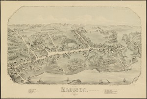
View of Madison, Conn : 1881
10952.
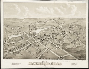
View of Mansfield, Mass : 1879
10953.
View of Marlborough, Mass : 1879
10954.
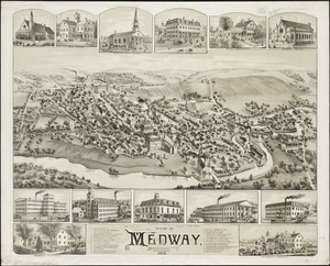
View of Medway, Massachusetts : 1887
10955.
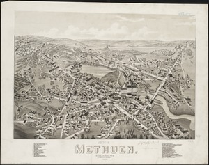
View of Methuen, Massachusetts : 1882
10956.
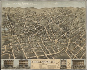
View of Middletown, N.Y : 1874
10957.
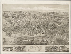
View of Milford, Conn : 1882
10958.
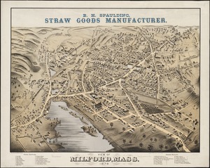
View of Milford, Mass : 1876
10959.
View of Mystic River & Mystic Bridge, Conn. 1879
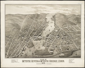
10960.
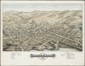
View of Natick, Mass : 1877, population about 8000
10961.
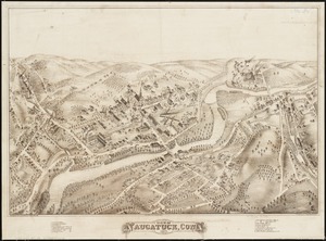
View of Naugatuck, Conn : 1877
10962.
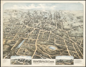
View of New Britain, Conn : 1875
10963.
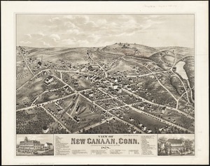
View of New Canaan, Conn : 1878
10964.
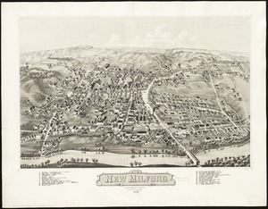
View of New Milford, Conn : 1882
10965.
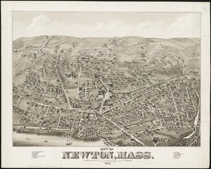
View of Newton, Mass : comprising Wards 1 & 7 & environs of the city of Newton
10966.
View of North Easton, Massachusetts, 1881
10967.
View of North Manchester, Connecticut : 1880
10968.
View of Northborough, Massachusetts : 1887
10969.
View of Oneida, N.Y : 1874
10970.
View of Palmer, Mass
10971.
A view of part of the town of Boston in New-England and Brittish [sic] ships of war landing their troops! 1768
10972.
View of Peabody, Mass : 1877
10973.
A view of Port Hood, sailing into the harbor : A view of the Plaister Cliffs, in George's Bay
10974.
A view of Portsmouth in Piscataqua River
10975.
View of Public Square, Atlanta, Ga.
10976.
View of Putnam, Conn : 1877
10977.
View of Randolph, Mass : 1882
10978.
View of Rockville, Conn : 1877
10979.
View of Saxonville, Mass
10980.
View of Sea Isle City : New Jersey
10981.
View of Seymour, Conn : 1879
10982.
View of Somerset, Massachusetts
10983.
View of South Braintree, Massachusetts : 1882
10984.
View of South Coventry, Conn : 1878
10985.
View of Southbridge, Mass : Center & Globe Village, 1878
10986.
View of SoWa food trucks
10987.
View of Springfield, Mass : 1875
10988.
View of Stafford Springs, Conn : 1878
10989.
View of Stamford, Conn : 1875
10990.
View of Stoneham, Mass : 1878
10991.
View of Stonington, Conn : 1879
10992.
A view of the castle of Belem and the city of Lisbon as it appears from thence ; A map of the mouth of the famous river Tagus...
10993.
View of the city of New Bedford, Mass : 1876
10994.
View of the city of St. Augustine, Fla : the oldest town in the United States, Juan de Ponce de Leon ldd [?] 1512
10995.
View of the city of Waterbury, Conn : 1876
10996.
A view of the country towards Dorchester, taken from the advanced works on Boston Neck : Long Island open on the north side of...
10997.
A view of the east end of the Isle Sable ... : The eastern end of the Isle Sable ... ; A view taken from the south side of the...
10998.
A view of the Rivers Kenebec and Chaudiere, with Colonel Arnold's route to Quebec
10999.
View of the South End
11000.
A view of the taking of Quebeck by the English forces commanded by Gen. Wolfe Sep. 13th 1759
« Previous
Next »
1
2
…
216
217
218
219
220
221
222
223
224
…
226
227
Limit your search
Subject
Real property--Massachusetts--Boston--Maps
2,355
Boston (Mass.)--Maps
2,181
Landowners--Massachusetts--Boston--Maps
2,153
Roxbury (Boston, Mass.)--Maps
363
Dorchester (Boston, Mass.)--Maps
325
Cambridge (Mass.)--Maps
268
Brookline (Mass.)--Maps
237
Real property--Massachusetts--Cambridge--Maps
216
more
Subject
»
Place
North and Central America
8,119
United States
6,736
Suffolk (county)
3,638
Boston
3,498
Massachusetts
3,251
Europe
963
Middlesex (county)
619
Canada
427
more
Place
»
Format
Maps/Atlases
11,246
Manuscripts
215
Prints
51
Books
35
Objects/Artifacts
10
Drawings/Illustrations
8
Posters
4
Available to use
No known restrictions
11,106
Creative Commons license
67
Date
View distribution
Current results range from
1482
to
2023
Date range begin
Date range end
View larger »
Unknown
4
Collection
Norman B. Leventhal Map Center Collection
11,029
Boston and New England Maps (Collection of Distinction)
5,291
Urban Maps (Collection of Distinction)
5,027
Maritime Charts and Atlases (Collection of Distinction)
750
American Revolutionary War-Era Maps (Collection of Distinction)
625
Boston Redevelopment Authority Collection
252
Historic Maps
49
Massachusetts Real Estate Atlases
38
more
Collection
»
Institution
Boston Public Library
11,174
State Library of Massachusetts
52
Salem State University Archives and Special Collections
49
Private Collection
20
American Antiquarian Society
9
Boston Athenaeum
1


![A view of part of the town of Boston in New-England and Brittish [sic] ships of war landing their troops! 1768](https://bpldcassets.blob.core.windows.net/derivatives/images/commonwealth:4m90f851p/image_thumbnail_300.jpg)


