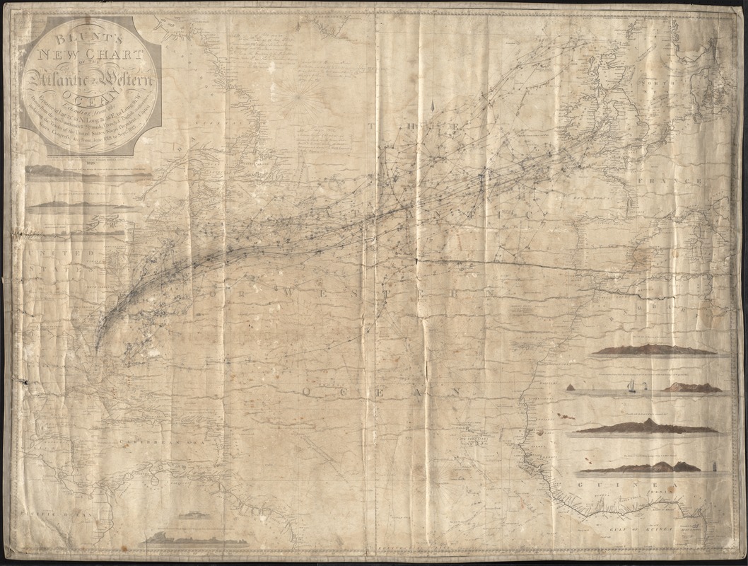
Blunt's new chart of the Atlantic or Western Ocean : Extending from the equator to lat. 74.40 N. long. 31.45 E. to long. 91 W., including the tracks of the United States ships President, United States, Congress, &cc from June 1812, to Sept. 1813
Item Information
- Title:
- Blunt's new chart of the Atlantic or Western Ocean : Extending from the equator to lat. 74.40 N. long. 31.45 E. to long. 91 W., including the tracks of the United States ships President, United States, Congress, &cc from June 1812, to Sept. 1813
- Description:
-
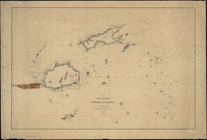
Shows area from equator to Latitude 71 degrees and 40 feet North. Longitude 31 degrees 45 feet East to Longitude 91 degrees West. Drawn from Spanish, French, English authorities. Tracks of U.S. ships, "President," "United States," and "Congress" from June 1812 to September 1813. Shows tracks of various unknown vessels from Florida to Europe following the gulf stream and returning. Note in upper left says, "Jose Hernandez, shoemaker, Havana."
- Name on Item:
-
Drawn from the most authentick Spanish, French, and English authorities
- Date:
-
1826
- Format:
-
Maps/Atlases
- Location:
-
New Bedford Whaling Museum
Research Library - Collection (local):
-
New Bedford Whaling Museum Research Library Cartography Collection
- Subjects:
-
President (Ship : 1811-1880)
- Places:
-
Atlantic Ocean
- Extent:
- 1 map ; on sheet 93 x 123 cm
- Permalink:
- https://ark.digitalcommonwealth.org/ark:/50959/zk51wb10k
- Terms of Use:
-
No known copyright restrictions. Contact host institution for more information.
This work is licensed for use under a Creative Commons Attribution Non-Commercial License (CC BY-NC).