Skip to search
Skip to main content
Digital Commonwealth
Sign Up / Log In
Search for
Search
Search
Search
Basic
Advanced
Explore
Map
Collections
Institutions
Formats
For Educators
Primary Source Sets
Lesson Plans
Using Primary Sources
Searching Digital Commonwealth
For Institutions
Join Digital Commonwealth
Conferences, Trainings, & Events
How to Contribute Collections
Digitization Services
Board & Committees
Frequently Asked Questions
About
About Digital Commonwealth
News & Announcements
Copyright & Terms of Use
Harmful Content Statement
Partners
API
Contact Us
American Antiquarian Society
American Revolutionary War-Era Maps (Collection of Distinction)
/
American Antiquarian Society Collection
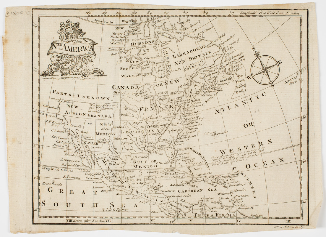
Nth. America
Nth. America
×
Item Information
Title:
Nth. America
Description:
Subject: Map of North America, divided into sections, with the northwestern part of the continent largely unknown.
Engraver:
Gibson, J. (John), active 1750-1792
Name on Item:
J. Gibson sculp.
Date:
[ca. 1800]
Format:
Maps/Atlases
Location:
American Antiquarian Society
Collection (local):
American Antiquarian Society Collection
Subjects:
North America--Maps
Places:
North America
(area)
Extent:
1 map : engraving ; 17 x 21 cm., on sheet 17 x 24 cm.
Permalink:
https://ark.digitalcommonwealth.org/ark:/50959/z603vg55k
Terms of Use:
Public Domain/No known restrictions on use. Contact host institution to download image.
Contact host institution for more information.
Publisher:
London? : [s.n.]
Scale:
Scale not given
Language:
English
Referenced by:
http://catalog.mwa.org/vwebv/holdingsInfo?bibId=506922
Notes:
Relief shown pictorially.
show more...
View MODS XML
More Like This
An accurate map of North America
Amerique Septentrionale
Carte de l'Amerique Septentrionale depuis le 28 degré de latitude ...
A General map of North America
Find More Like This >>
Tools
Share
Facebook
Pinterest
X
Reddit
Tumblr
Email
Copy link
Add to Folder
Questions/Comments
Cite This Item
IIIF Manifest