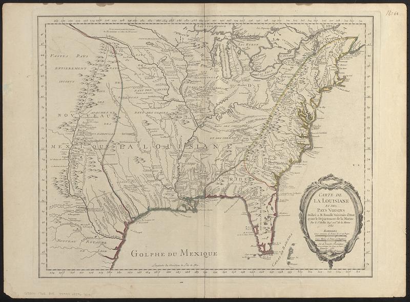
Relief shown pictorially.
Prime meridian: L'ile de Fer.
"Sur de nouvelles observations on a corrigé les lacs, et leurs environs, 1755."
Hand colored boundaries outlining British, French, and Spanish territories.
Notes (date):
This date is inferred.
Notes (citation):
LC Maps of North America, 1750-1789, 90
McCorkle, B.B. New England in early printed maps, 1513 to 1800, 755.3