Skip to search
Skip to main content
Digital Commonwealth
Sign Up / Log In
Search for
Search
Search
Search
Basic
Advanced
Explore
Map
Collections
Institutions
Formats
For Educators
Primary Source Sets
Lesson Plans
Using Primary Sources
Searching Digital Commonwealth
For Institutions
Join Digital Commonwealth
Conferences, Trainings, & Events
How to Contribute Collections
Digitization Services
Board & Committees
Frequently Asked Questions
About
About Digital Commonwealth
News & Announcements
Copyright & Terms of Use
Harmful Content Statement
Partners
API
Contact Us
Boston Public Library
Norman B. Leventhal Map & Education Center Collection
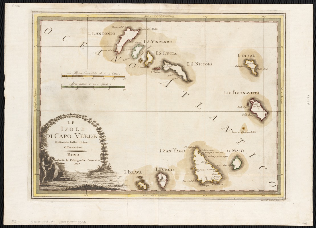
Le Isole di Capo Verde : delineate sulle ultime osservvazioni
Le Isole di Capo Verde
×
Item Information
Title:
Le Isole di Capo Verde : delineate sulle ultime osservvazioni
Creator:
Cassini, Gio. Ma. (Giovanni Maria), 1745-ca. 1824
Date:
1798
Format:
Maps/Atlases
Location:
Boston Public Library
Norman B. Leventhal Map & Education Center
Collection (local):
Norman B. Leventhal Map & Education Center Collection
Subjects:
Cape Verde--Maps--Early works to 1800
Places:
Cape Verde
Extent:
1 map : col. ; 33 x 46 cm.
Permalink:
https://ark.digitalcommonwealth.org/ark:/50959/wd376530s
Terms of Use:
No known copyright restrictions.
No known restrictions on use.
Publisher:
Rome : Presso la Calcografia Camerale
Scale:
Scale [ca. 1:900,000]
Language:
Italian
Notes:
Includes decorative cartouche.
Identifier:
06_01_002558
Call #:
G9160 1798 .C3
Barcode:
39999058995612
show more...
View MODS XML
More Like This
Archipelagus Atlanticus cum suis insulis Canariis, Hesperidibus et ...
Barbariae et Guineae maritimi à freto Gibraltar ad fluvium ...
Bocche del Fiume Negro et Isole di Cape Verde : possedute dà ...
The Cape Verd Islands : laid down from the remarks and ...
Find More Like This >>
Tools
Share
Facebook
Pinterest
X
Reddit
Tumblr
Email
Copy link
Add to Folder
Questions/Comments
Cite This Item
IIIF Manifest
Downloads
Primary (full resolution, uncompressed)
(TIF, 140 MB)
Large (full resolution)
(JPEG, 11.7 MB)
Medium
(JPEG, 258 KB)