Skip to search
Skip to main content
Digital Commonwealth
Folders
Sign Up / Log In
Search for
Search
Search
Search
Basic
Advanced
Explore
Map
Collections
Institutions
Formats
For Educators
Primary Source Sets
Lesson Plans
Using Primary Sources
Searching Digital Commonwealth
For Institutions
Join Digital Commonwealth
Conferences, Trainings, & Events
How to Contribute Collections
Digitization Services
Board & Committees
Frequently Asked Questions
About
About Digital Commonwealth
News & Announcements
Copyright & Terms of Use
Harmful Content Statement
Partners
API
Contact Us
Boston Public Library
Norman B. Leventhal Map & Education Center Collection
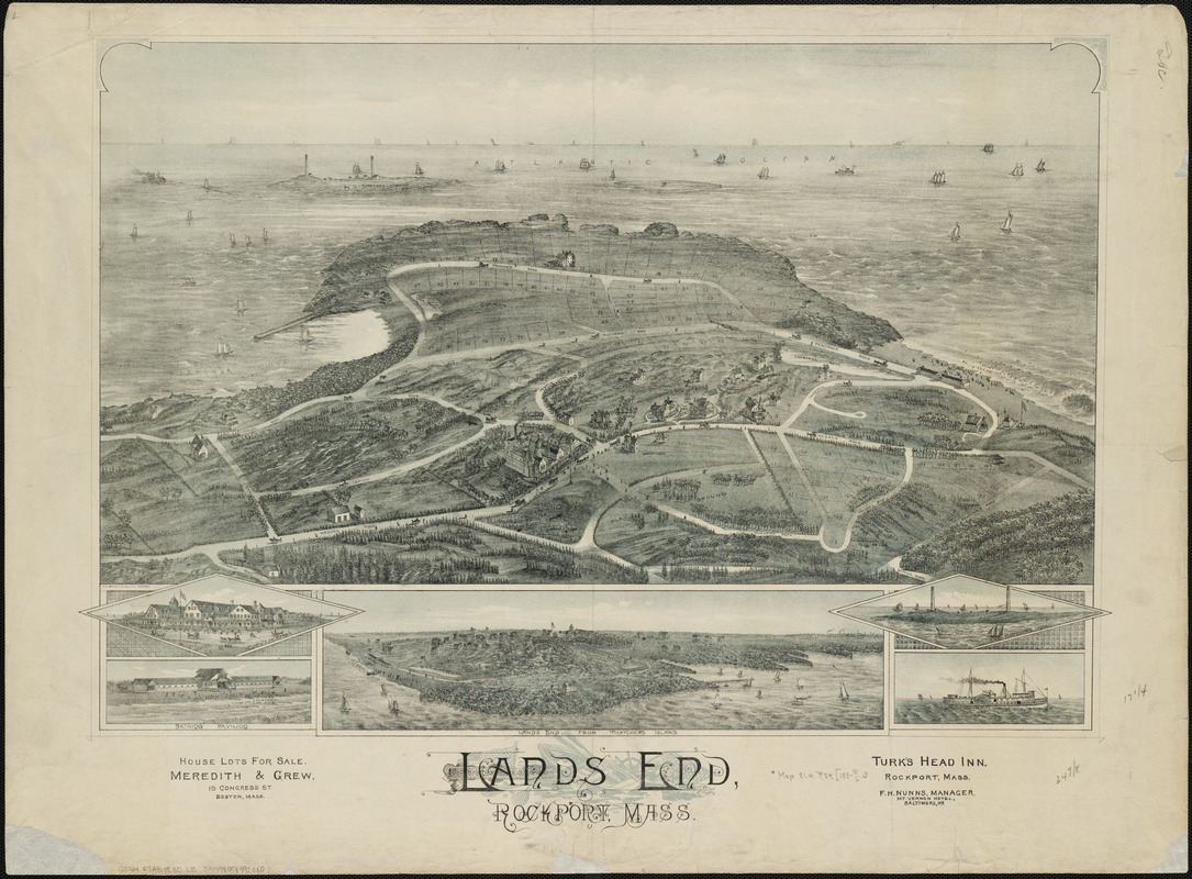
Lands End, Rockport, Mass
Lands End, Rockport, Mass
×
Item Information
Title:
Lands End, Rockport, Mass
Title (alt.):
Lands End, Rockport, Massachusetts
Date:
[1880?–1889?]
Format:
Maps/Atlases
Location:
Boston Public Library
Norman B. Leventhal Map & Education Center
Collection (local):
Norman B. Leventhal Map & Education Center Collection
Subjects:
Real estate development--Massachusetts--Rockport
Rockport (Mass.)--Aerial views
Places:
Massachusetts
>
Essex (county)
>
Rockport
Extent:
1 view : col. ; 45 x 64 cm.
Permalink:
https://ark.digitalcommonwealth.org/ark:/50959/wd375z97r
Terms of Use:
No known copyright restrictions.
No known restrictions on use.
Publisher:
S.l : s.n.
Scale:
Not drawn to scale.
Language:
English
Notes:
Brid's-eye view.
Includes ill. and inset of Lands End from Thatcher's Island.
Identifier:
06_01_002152
Call #:
G3764.R7A3 1880 .L3
Barcode:
39999058992080
show more...
View MODS XML
More Like This
Pigeon Cove, Rockport, Essex County, Mass
The 100th anniversary map of Abraham Lincoln's visit to ...
1630 shoreline
1879. Progress map of the U.S. Geographical Surveys west of the ...
Find More Like This >>
Tools
Share
Facebook
Pinterest
X
Reddit
Tumblr
Email
Copy link
Add to Folder
Questions/Comments
Cite This Item
IIIF Manifest
Downloads
Primary (full resolution, uncompressed)
(TIF, 199 MB)
Large (full resolution)
(JPEG, 16.7 MB)
Medium
(JPEG, 298 KB)