Skip to search
Skip to main content
Digital Commonwealth
Sign Up / Log In
Search for
Search
Search
Search
Basic
Advanced
Explore
Map
Collections
Institutions
Formats
For Educators
Primary Source Sets
Lesson Plans
Using Primary Sources
Searching Digital Commonwealth
For Institutions
Join Digital Commonwealth
Conferences, Trainings, & Events
How to Contribute Collections
Digitization Services
Board & Committees
Frequently Asked Questions
About
About Digital Commonwealth
News & Announcements
Copyright & Terms of Use
Harmful Content Statement
Partners
API
Contact Us
Boston Public Library
Norman B. Leventhal Map Center Collection
/
Urban Maps (Collection of Distinction)
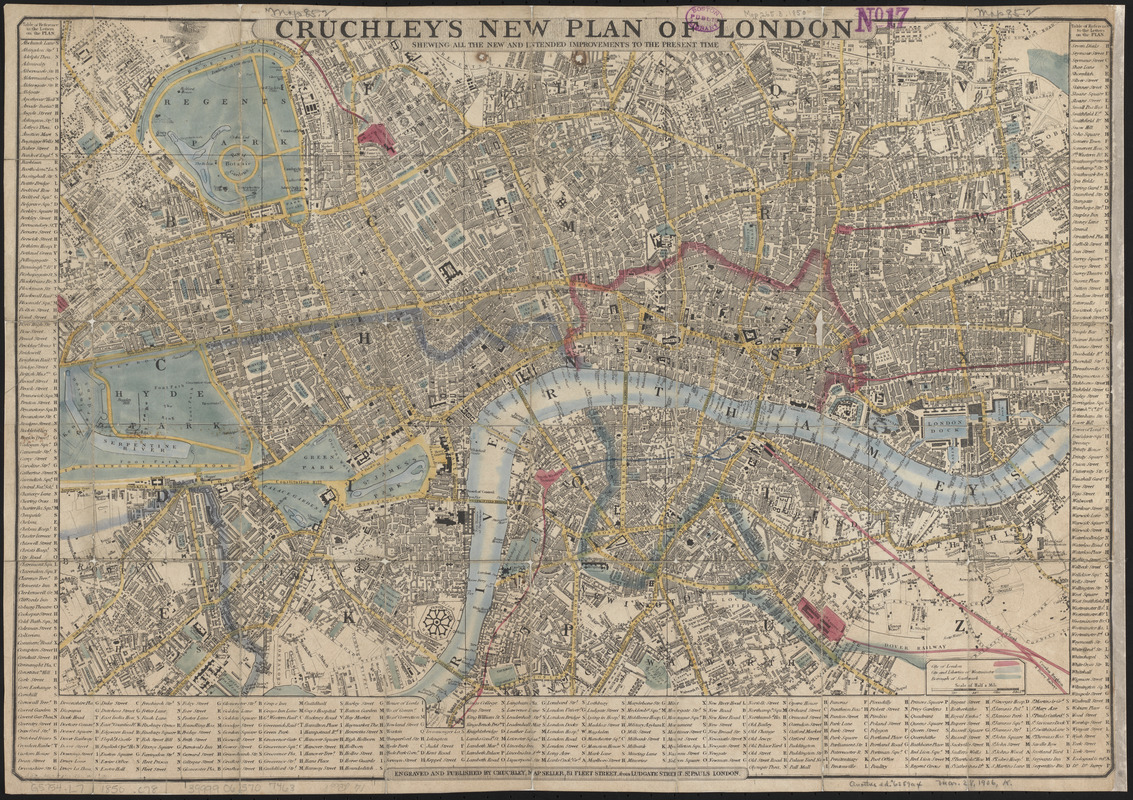
Cruchley's new plan of London shewing all the new and intended improvements to the present time
Cruchleys new plan of London shewing all the new and intended improvements to the present time
×
Item Information
Title:
Cruchley's new plan of London shewing all the new and intended improvements to the present time
Engraver:
Cruchley, G. F.
Publisher:
Cruchley, G. F.
Name on Item:
engraved and published by Cruchley Mapseller, 81 Fleet Street, from Ludgate Street, St. Pauls London
Date:
1850
Format:
Maps/Atlases
Location:
Boston Public Library
Norman B. Leventhal Map Center
Collection (local):
Norman B. Leventhal Map Center Collection
Subjects:
London (England)--Maps
Tourist maps
Places:
England
>
London
Extent:
1 map : hand colored ; 37 x 55 cm
Permalink:
https://ark.digitalcommonwealth.org/ark:/50959/q524n381x
Terms of Use:
No known copyright restrictions.
No known restrictions on use.
Publisher:
London : Cruchley
Scale:
Scale approximately 1:17,000
Language:
English
Notes:
Conservation of this piece was funded by Ryan Jaco in honor of James Connolly.
Includes 'Table of reference to the letters on the plan'.
Identifier:
06_01_014893
Call #:
G5754.L7 1850 .C78
Barcode:
39999065707463
show more...
View MODS XML
More Like This
Acapulco, México
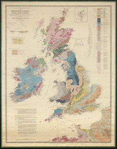
New index geological map of the British Isles, and adjacent coast ...
Overzichtskaart van den Nederlandsch-Indischen archipel
The Builder map of the county of London : shewing the boundaries ...
Find More Like This >>
Tools
Share
Facebook
Pinterest
X
Reddit
Tumblr
Email
Copy link
Add to Folder
Questions/Comments
Cite This Item
IIIF Manifest
Downloads
Primary (full resolution, uncompressed)
(TIF, 151 MB)
Large (full resolution)
(JPEG, 12.7 MB)
Medium
(JPEG, 569 KB)