Skip to search
Skip to main content
Digital Commonwealth
Sign Up / Log In
Search for
Search
Search
Search
Basic
Advanced
Explore
Map
Collections
Institutions
Formats
For Educators
Primary Source Sets
Lesson Plans
Using Primary Sources
Searching Digital Commonwealth
For Institutions
Join Digital Commonwealth
Conferences, Trainings, & Events
How to Contribute Collections
Digitization Services
Board & Committees
Frequently Asked Questions
About
About Digital Commonwealth
News & Announcements
Copyright & Terms of Use
Harmful Content Statement
Partners
API
Contact Us
Boston Public Library
Norman B. Leventhal Map & Education Center Collection
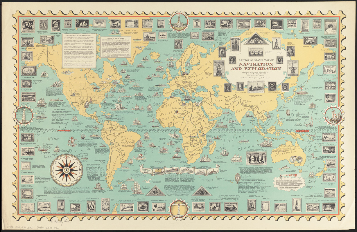
A pictorial stamp map of navigation and exploration
A pictorial stamp map of navigation and exploration
×
Item Information
Title:
A pictorial stamp map of navigation and exploration
Creator:
Chase, Ernest Dudley, 1878-
Artist:
Chase, Ernest Dudley, 1878-
Cartographer:
Chase, Ernest Dudley, 1878-
Contributor:
Lang, Katharine Birdseye
Name on Item:
designed, drawn, and published by Ernest Dudley Chase ; Katharine Birdseye Lang, collaborator
Date:
[1951]
Format:
Maps/Atlases
Location:
Boston Public Library
Norman B. Leventhal Map & Education Center
Collection (local):
Norman B. Leventhal Map & Education Center Collection
Subjects:
Discoveries in geography--Maps
Voyages and travels
Stamp collecting
Pictorial maps
World maps
Places:
World
Extent:
1 map : color ; 49 x 79 cm
Permalink:
https://ark.digitalcommonwealth.org/ark:/50959/q524n369n
Terms of Use:
No known copyright restrictions.
No known restrictions on use.
Publisher:
Winchester, Massachusetts : Ernest Dudley Chase
Scale:
Scale approximately 1:45,000,000
Language:
English
Notes:
Includes illustrations of stamps depicting explorers, ship and discoveries.
Includes illustrations and historical notes.
Notes (date):
This date is inferred.
Identifier:
06_01_014714
Call #:
G3201.S12 1951 .C43
Barcode:
39999065705764
show more...
View MODS XML
More Like This
Mercator map of the world united : a pictorial history of ...
The new map of the world
Racing routes of the Yankee clippers
The story map of flying : being a chronicle of man's conquest of ...
Find More Like This >>
Tools
Share
Facebook
Pinterest
X
Reddit
Tumblr
Email
Copy link
Add to Folder
Questions/Comments
Cite This Item
IIIF Manifest
Downloads
Primary (full resolution, uncompressed)
(TIF, 127 MB)
Large (full resolution)
(JPEG, 10.6 MB)
Medium
(JPEG, 512 KB)