Atlas of the city of Boston : city proper : plate P
Atlas of the city of Boston : city proper
Item Information
Title:
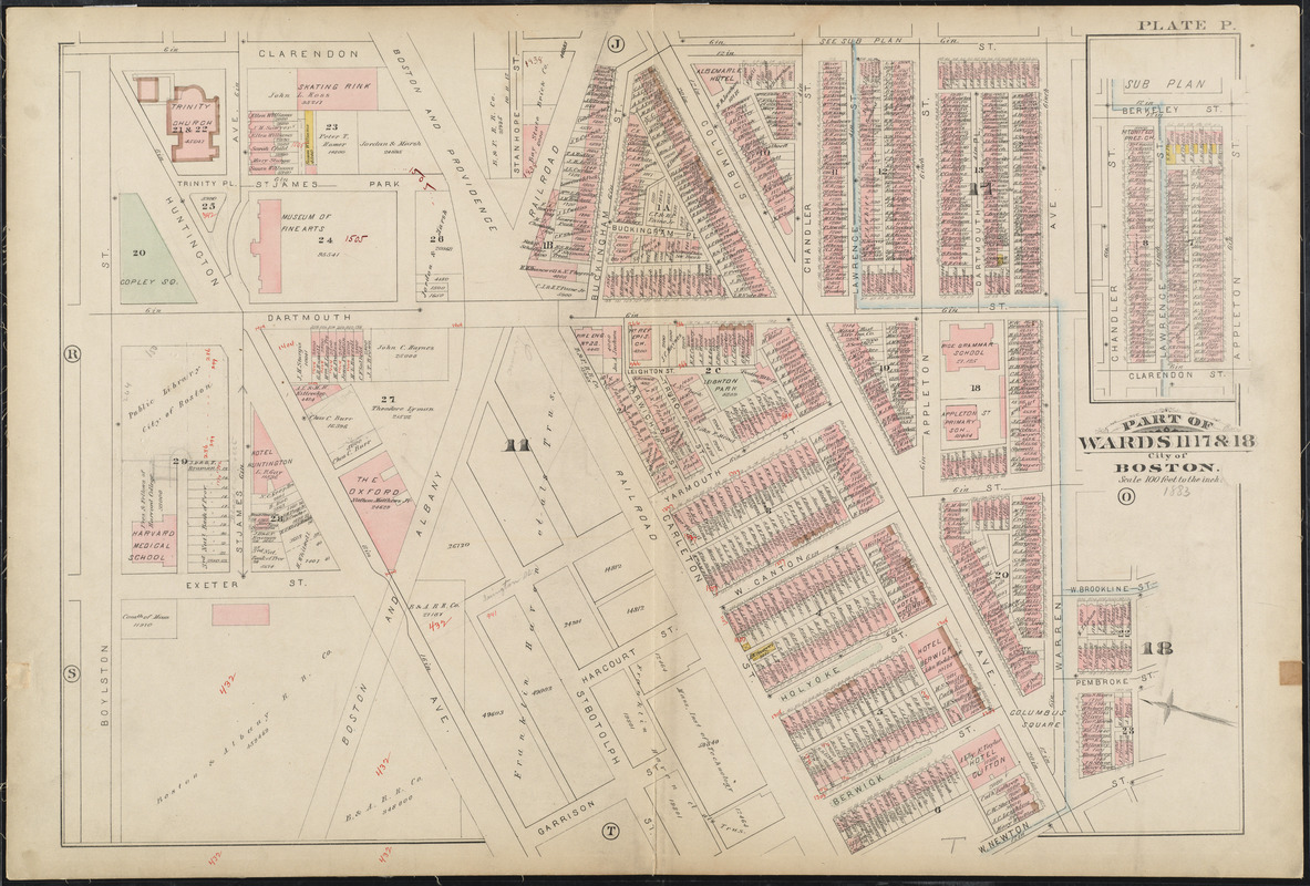
Atlas of the city of Boston : city proper : plate P
Description:
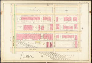
As seen in this 1883 map, Copley Square was once a large triangle. The unique shape of the Square was a result of its location at the junction of the older South End’s and the newer Back Bay’s street grids. Huntington Avenue met Boylston Street at a 45 degree angle, creating a number of triangular spaces in the region. Traffic passed through the square on Huntington Avenue until the late 1960s; however, in the 1980s the area was redesigned to appear as it does today, complete with a large green space for all to enjoy.