Skip to search
Skip to main content
Digital Commonwealth
Sign Up / Log In
Search for
Search
Search
Search
Basic
Advanced
Explore
Map
Collections
Institutions
Formats
For Educators
Primary Source Sets
Lesson Plans
Using Primary Sources
Searching Digital Commonwealth
For Institutions
Join Digital Commonwealth
Conferences, Trainings, & Events
How to Contribute Collections
Digitization Services
Board & Committees
Frequently Asked Questions
About
About Digital Commonwealth
News & Announcements
Copyright & Terms of Use
Harmful Content Statement
Partners
API
Contact Us
Boston Public Library
Norman B. Leventhal Map & Education Center Collection
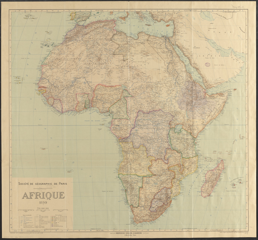
Afrique 1899
Afrique 1899
×
Item Information
Title:
Afrique 1899
Cartographer:
Hansen, Jules, 1849-1931
Publisher:
Maison Andriveau-Goujon (Firm)
Cartographer:
Société de géographie (France)
Publisher:
Barrère, Henry
Name on Item:
dessinée par J. Hansen ; Société de Géographie de Paris
Date:
1899
Format:
Maps/Atlases
Location:
Boston Public Library
Norman B. Leventhal Map & Education Center
Collection (local):
Norman B. Leventhal Map & Education Center Collection
Subjects:
Africa--Maps
Places:
Africa
Africa
Extent:
1 map : color ; 85 x 91 cm
Permalink:
https://ark.digitalcommonwealth.org/ark:/50959/jh344102w
Terms of Use:
No known copyright restrictions.
No known restrictions on use.
Publisher:
Paris : Maison Andriveau-Goujon, H. Barrère
Scale:
Scale 1:10,000,000
Language:
French
Notes:
Relief shown by hachures and spot heights.
Prime meridians: Greenwich and Paris.
"Carte dressée en 1895, mise à jour en 1897 et en 1899."
Identifier:
06_01_015364
Call #:
G8200 1899 .H36
Barcode:
39999085935771
show more...
View MODS XML
More Like This
Africa
Africa
Africa
Africa
Find More Like This >>
Tools
Share
Facebook
Pinterest
X
Reddit
Tumblr
Email
Copy link
Add to Folder
Questions/Comments
Cite This Item
IIIF Manifest
Downloads
Primary (full resolution, uncompressed)
(TIF, 155 MB)
Large (full resolution)
(JPEG, 13 MB)
Medium
(JPEG, 278 KB)