Skip to search
Skip to main content
Digital Commonwealth
Sign Up / Log In
Search for
Search
Search
Search
Basic
Advanced
Explore
Map
Collections
Institutions
Formats
For Educators
Primary Source Sets
Lesson Plans
Using Primary Sources
Searching Digital Commonwealth
For Institutions
Join Digital Commonwealth
Conferences, Trainings, & Events
How to Contribute Collections
Digitization Services
Board & Committees
Frequently Asked Questions
About
About Digital Commonwealth
News & Announcements
Copyright & Terms of Use
Harmful Content Statement
Partners
API
Contact Us
Boston Public Library
Norman B. Leventhal Map & Education Center Collection
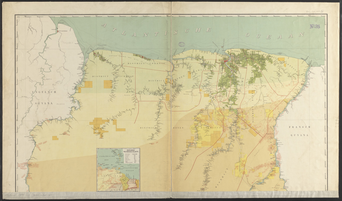
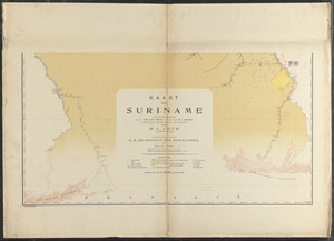
Kaart van Suriname naar de opmetingen van J.F.A. Cateau van Rosevelt en J.F.A.E. van Lansberge, aangevuld tot 1898 met die van
Viewing image 1 of 2
Next >
Kaart van Suriname naar de opmetingen van J.F.A. Cateau van Rosevelt en J.F.A.E. van Lansberge, aangevuld tot 1898 met die van
×
Next
Item Information
Title:
Kaart van Suriname naar de opmetingen van J.F.A. Cateau van Rosevelt en J.F.A.E. van Lansberge, aangevuld tot 1898 met die van
Cartographer:
Loth, W. L.
Publisher:
Bussy, J. H. de
Name on Item:
en geteekend door W.L. Loth
Date:
1899
Format:
Maps/Atlases
Location:
Boston Public Library
Norman B. Leventhal Map & Education Center
Collection (local):
Norman B. Leventhal Map & Education Center Collection
Subjects:
Suriname--Maps
Places:
Suriname
Extent:
1 map on 2 sheets : color ; 106 x 96 cm, on sheets 79 x 111 cm + text (22 pages ; 20 cm)
Permalink:
https://ark.digitalcommonwealth.org/ark:/50959/jh343z75t
Terms of Use:
No known copyright restrictions.
No known restrictions on use.
Publisher:
Amsterdam : Uitgegeven bij J.H. de Bussy
Scale:
Scale 1:500,000
Language:
Dutch
Notes:
Relief shown by hachures.
"Eerbiedig opgedragen aan H.M. de Koningin der Nederlanden."
Inset: Nederlandsch Westindische koloniën.
Accompanied by Handleiding bij de kaart van de Kolonie Suriname / door W.L. Loth (22 pages).
Identifier:
06_01_012002_A
06_01_012002_B
Call #:
G5260 1899 .L68
Barcode:
39999065691147
show more...
View MODS XML
More Like This
Nieuwe gemeten Kaart van de Colonie de Berbice met der zelver ...
Nieuwe special kaart van de colonie Suriname met de tot culture ...
Venezuela with Trinidad and part of West Indies and British Guiana
The 100th anniversary map of Abraham Lincoln's visit to ...
Find More Like This >>
Tools
Share
Facebook
Pinterest
X
Reddit
Tumblr
Email
Copy link
Add to Folder
Questions/Comments
Cite This Item
IIIF Manifest
Downloads
Primary (full resolution, uncompressed)
(TIF, multi-file ZIP, 211 MB)
Large (full resolution)
(JPEG, multi-file ZIP, 1.87 MB)
Medium
(JPEG, multi-file ZIP, 475 KB)