Skip to search
Skip to main content
Digital Commonwealth
Sign Up / Log In
Search for
Search
Search
Search
Basic
Advanced
Explore
Map
Collections
Institutions
Formats
For Educators
Primary Source Sets
Lesson Plans
Using Primary Sources
Searching Digital Commonwealth
For Institutions
Join Digital Commonwealth
Conferences, Trainings, & Events
How to Contribute Collections
Digitization Services
Board & Committees
Frequently Asked Questions
About
About Digital Commonwealth
News & Announcements
Copyright & Terms of Use
Harmful Content Statement
Partners
API
Contact Us
Boston Public Library
Norman B. Leventhal Map Center Collection
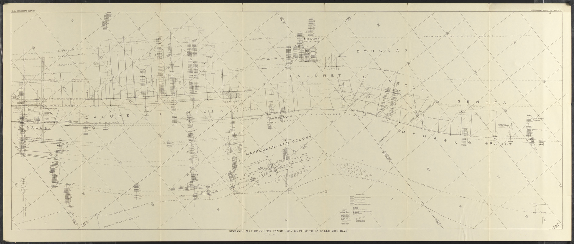
Geologic map of copper range from Gratiot to La Salle, Michigan
Geologic map of copper range from Gratiot to La Salle, Michigan
×
Item Information
Title:
Geologic map of copper range from Gratiot to La Salle, Michigan
Cartographer:
Geological Survey (U.S.)
Contributor:
Butler, B. S. (Bert Sylvenus), 1877-1960
Date:
[1929]
Format:
Maps/Atlases
Location:
Boston Public Library
Norman B. Leventhal Map Center
Collection (local):
Norman B. Leventhal Map Center Collection
Subjects:
Geology--Michigan--Houghton County--Maps
Geology--Michigan--Keweenaw County--Maps
Houghton County (Mich.)--Maps
Keweenaw County (Mich.)--Maps
Places:
Houghton (county)
Keweenaw (county)
Extent:
1 map ; 61 x 154 cm
Permalink:
https://ark.digitalcommonwealth.org/ark:/50959/jh343z44t
Terms of Use:
No known copyright restrictions.
No known restrictions on use.
Publisher:
[Washington, D.C.] : [Government Printing Office]
Scale:
Scale approximately 1:12,000
Language:
English
Notes:
Oriented with north to the upper right.
Covers parts of Keweenaw County and Houghton County.
"Professional paper 144 plate 8."
From The copper deposits of Michigan (Washington, D.C. : G.P.O, 1929).
Notes (date):
This date is inferred.
Identifier:
06_01_014852
Call #:
G4113.H6C5 1929 .G46
Barcode:
39999065707935
show more...
View MODS XML
More Like This
Portion of the copper district, Michigan, Lake Superior
The 100th anniversary map of Abraham Lincoln's visit to ...
1630 shoreline
1879. Progress map of the U.S. Geographical Surveys west of the ...
Find More Like This >>
Tools
Share
Facebook
Pinterest
X
Reddit
Tumblr
Email
Copy link
Add to Folder
Questions/Comments
Cite This Item
IIIF Manifest
Downloads
Primary (full resolution, uncompressed)
(TIF, 180 MB)
Large (full resolution)
(JPEG, 15.1 MB)
Medium
(JPEG, 378 KB)