Skip to search
Skip to main content
Digital Commonwealth
Sign Up / Log In
Search for
Search
Search
Search
Basic
Advanced
Explore
Map
Collections
Institutions
Formats
For Educators
Primary Source Sets
Lesson Plans
Using Primary Sources
Searching Digital Commonwealth
For Institutions
Join Digital Commonwealth
Conferences, Trainings, & Events
How to Contribute Collections
Digitization Services
Board & Committees
Frequently Asked Questions
About
About Digital Commonwealth
News & Announcements
Copyright & Terms of Use
Harmful Content Statement
Partners
API
Contact Us
Boston Public Library
Norman B. Leventhal Map & Education Center Collection
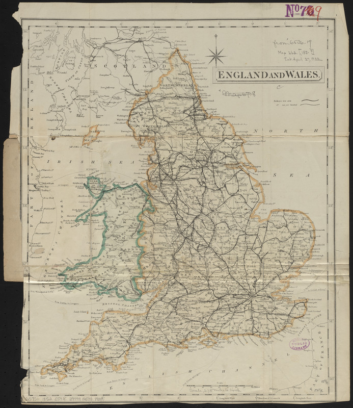
England and Wales
England and Wales
×
Item Information
Title:
England and Wales
Title (alt.):
England with its railways
Publisher:
Collins, Henry George
Date:
[ca. 1852–1854]
Format:
Maps/Atlases
Location:
Boston Public Library
Norman B. Leventhal Map & Education Center
Collection (local):
Norman B. Leventhal Map & Education Center Collection
Subjects:
Railroads--England--Maps
Railroads--Wales--Maps
England--Maps
Wales--Maps
Places:
England
Wales
Extent:
1 map : color ; 40 x 32 cm, folded in cover 16 x 10 cm
Permalink:
https://ark.digitalcommonwealth.org/ark:/50959/ht250460b
Terms of Use:
No known copyright restrictions.
No known restrictions on use.
Publisher:
London : H.G. Collins
Scale:
Scale approximately 1:1,780,000
Language:
English
Notes:
Publisher from cover.
Identifier:
06_01_014888
Call #:
G5750 1852 .E54
Barcode:
39999065707489
show more...
View MODS XML
More Like This
Cruchley's travelling railway map of England & Wales
An accurate map of England and Wales with the principal roads from ...
England
The great landowners of England & Wales
Find More Like This >>
Tools
Share
Facebook
Pinterest
X
Reddit
Tumblr
Email
Copy link
Add to Folder
Questions/Comments
Cite This Item
IIIF Manifest
Downloads
Primary (full resolution, uncompressed)
(TIF, 70.8 MB)
Large (full resolution)
(JPEG, 5.95 MB)
Medium
(JPEG, 244 KB)
We'd love your feedback!
×
Would you be interested in taking a short survey about Digital Commonwealth?