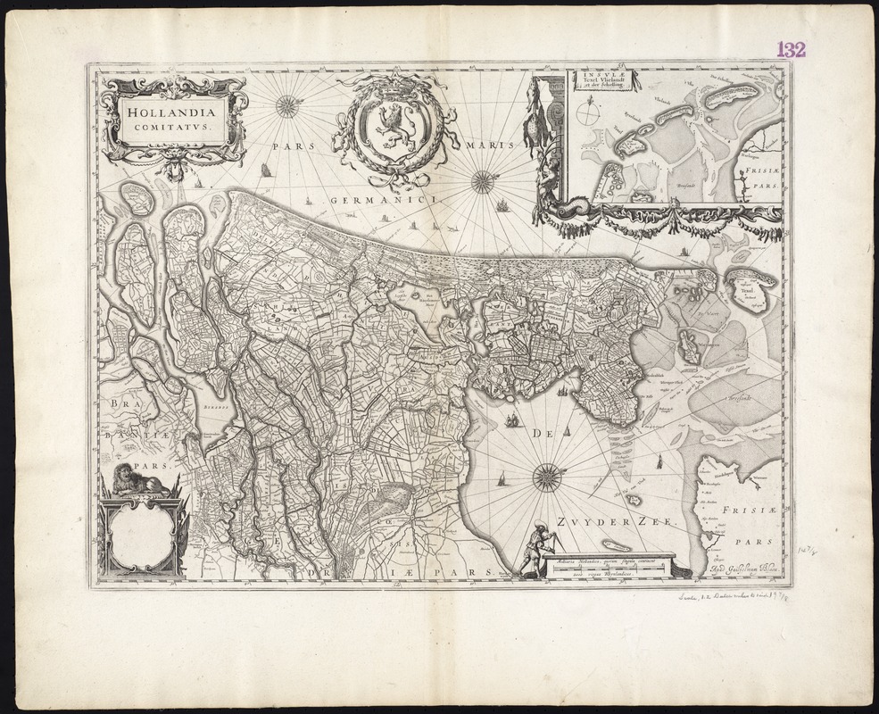
Map of the west coast of the Netherlands.
Oriented with north toward the upper right.
Inset: Insulae texel vlielandt et der Schelling.
Variant "b" according to Koeman-Krogt.
Verso is blank.
Cataloging, conservation, and digitization made possible in part by The National Endowment for the Humanities: Exploring the human endeavor.
Part of composite portfolio atlas with title "Collection of old maps."