Skip to search
Skip to main content
Digital Commonwealth
Folders
Sign Up / Log In
Search for
Search
Search
Search
Basic
Advanced
Explore
Map
Collections
Institutions
Formats
For Educators
Primary Source Sets
Lesson Plans
Using Primary Sources
Searching Digital Commonwealth
For Institutions
Join Digital Commonwealth
Conferences, Trainings, & Events
How to Contribute Collections
Digitization Services
Board & Committees
Frequently Asked Questions
About
About Digital Commonwealth
News & Announcements
Copyright & Terms of Use
Harmful Content Statement
Partners
API
Contact Us
Boston Public Library
Norman B. Leventhal Map & Education Center Collection
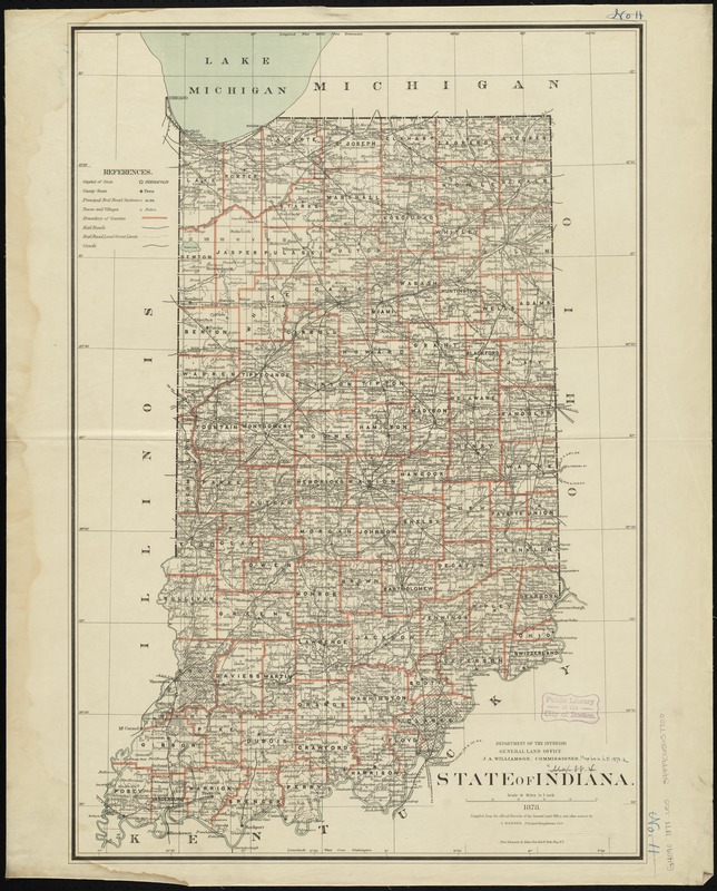
State of Indiana
State of Indiana
×
Item Information
Title:
State of Indiana
Creator:
United States. General Land Office
Name on Item:
compiled from the official records of the General Land Office and other sources by C. Roeser, Principal Draughtsman, G.L.O.
Date:
1878
Format:
Maps/Atlases
Location:
Boston Public Library
Norman B. Leventhal Map & Education Center
Collection (local):
Norman B. Leventhal Map & Education Center Collection
Subjects:
Public lands--Indiana--Maps
Indiana--Maps
Indiana--Surveys
Places:
Indiana
Extent:
1 map : col. ; 80 x 55 cm.
Permalink:
https://ark.digitalcommonwealth.org/ark:/50959/7h14b333t
Terms of Use:
No known copyright restrictions.
No known restrictions on use.
Publisher:
[Washington] : General Land Office
Scale:
Scale [1:633,600]. 10 miles to 1 in.
Language:
English
Notes:
Shows drainage, county boundaries, railroads, townships, etc.
Prime meridans: Greenwich and Washington.
"J.S. Williamson, Commissioner."
Identifier:
06_01_008822
Call #:
G4090 1878 .U55
Barcode:
39999065657700
show more...
View MODS XML
More Like This
Colton's map of the state of Indiana : compiled from the United ...
Geological map of Indiana, showing location of stone quarries and ...
Manuscript maps of U.S. states
Map of De Kalb Co., Indiana
Find More Like This >>
Tools
Share
Facebook
Pinterest
X
Reddit
Tumblr
Email
Copy link
Add to Folder
Questions/Comments
Cite This Item
IIIF Manifest
Downloads
Primary (full resolution, uncompressed)
(TIF, 216 MB)
Large (full resolution)
(JPEG, 18.1 MB)
Medium
(JPEG, 210 KB)
GeoTIFF (georeferenced)
(TIF, 281 MB)