Skip to search
Skip to main content
Digital Commonwealth
Sign Up / Log In
Search for
Search
Search
Search
Basic
Advanced
Explore
Map
Collections
Institutions
Formats
For Educators
Primary Source Sets
Lesson Plans
Using Primary Sources
Searching Digital Commonwealth
For Institutions
Join Digital Commonwealth
Conferences, Trainings, & Events
How to Contribute Collections
Digitization Services
Board & Committees
Frequently Asked Questions
About
About Digital Commonwealth
News & Announcements
Copyright & Terms of Use
Harmful Content Statement
Partners
API
Contact Us
Boston Public Library
Norman B. Leventhal Map & Education Center Collection
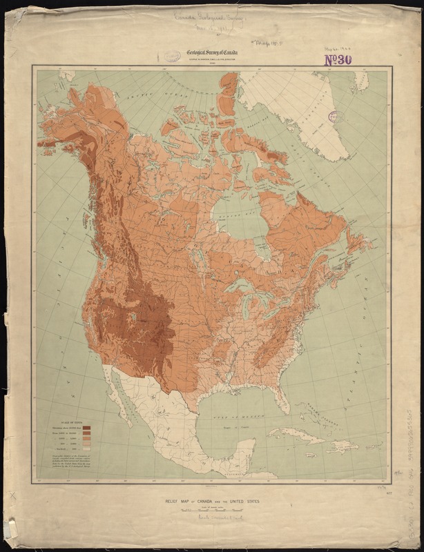
Relief map of Canada and the United States
Relief map of Canada and the United States
×
Item Information
Title:
Relief map of Canada and the United States
Creator:
Geological Survey of Canada
Date:
1900
Format:
Maps/Atlases
Location:
Boston Public Library
Norman B. Leventhal Map & Education Center
Collection (local):
Norman B. Leventhal Map & Education Center Collection
Subjects:
United States--Maps
Canada--Maps
Places:
United States
Canada
Extent:
1 map : col. ; 50 x 43 cm.
Permalink:
https://ark.digitalcommonwealth.org/ark:/50959/7h149x70r
Terms of Use:
No known copyright restrictions.
No known restrictions on use.
Publisher:
[Ottawa] : Geological Survey of Canada
Scale:
Scale [ca. 1:15,400,000]
Language:
English
Notes:
Relief shown by gradient tints.
Identifier:
06_01_008587
Call #:
G3301.C2 1900 .G46
Barcode:
39999065655365
show more...
View MODS XML
More Like This
Aboriginal map of North America, denoting the boundaries and the ...
Dinsmore's complete map of the railroads & canals in the United ...
Dinsmore's new railroad map of the United States and the Canadas, ...
The Dominion of Canada from the latest surveys and data
Find More Like This >>
Tools
Share
Facebook
Pinterest
X
Reddit
Tumblr
Email
Copy link
Add to Folder
Questions/Comments
Cite This Item
IIIF Manifest
Downloads
Primary (full resolution, uncompressed)
(TIF, 81.5 MB)
Large (full resolution)
(JPEG, 6.85 MB)
Medium
(JPEG, 165 KB)