Skip to search
Skip to main content
Digital Commonwealth
Sign Up / Log In
Search for
Search
Search
Search
Basic
Advanced
Explore
Map
Collections
Institutions
Formats
For Educators
Primary Source Sets
Lesson Plans
Using Primary Sources
Searching Digital Commonwealth
For Institutions
Join Digital Commonwealth
Conferences, Trainings, & Events
How to Contribute Collections
Digitization Services
Board & Committees
Frequently Asked Questions
About
About Digital Commonwealth
News & Announcements
Copyright & Terms of Use
Harmful Content Statement
Partners
API
Contact Us
Boston Public Library
Norman B. Leventhal Map & Education Center Collection
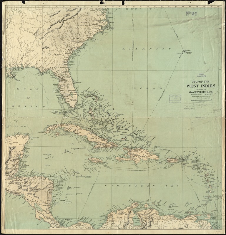
Map of the West Indies
Map of the West Indies
×
Item Information
Title:
Map of the West Indies
Creator:
Geo. H. Walker & Co
Date:
1898
Format:
Maps/Atlases
Location:
Boston Public Library
Norman B. Leventhal Map & Education Center
Collection (local):
Norman B. Leventhal Map & Education Center Collection
Subjects:
Cables, Submarine--West Indies--Maps
Cables, Submarine--Caribbean Area--Maps
West Indies--Maps
Caribbean Area--Maps
Places:
West Indies
Caribbean Sea
Extent:
1 map : color ; 72 x 70 cm
Permalink:
https://ark.digitalcommonwealth.org/ark:/50959/4m90fk49h
Terms of Use:
No known copyright restrictions.
No known restrictions on use.
Publisher:
Boston : Geo. H. Walker & Co.,
Scale:
Scale approximately 1:4,900,000
Language:
English
Notes:
Relief shown by hachures and spot heights. Depths shown by soundings.
Also shows cables.
Identifier:
06_01_011889
Call #:
G4390 1898 .G46
Barcode:
39999065690065
show more...
View MODS XML
More Like This
The countries of the Caribbean : including Mexico, Central ...
The Evening Post map of the West Indies
Gulf of Mexico, West Indies and Caribbean Sea : from the most ...
Map of Central America, Cuba, Porto Rico, and the islands of the ...
Find More Like This >>
Tools
Share
Facebook
Pinterest
X
Reddit
Tumblr
Email
Copy link
Add to Folder
Questions/Comments
Cite This Item
IIIF Manifest
Downloads
Primary (full resolution, uncompressed)
(TIF, 132 MB)
Large (full resolution)
(JPEG, 11.1 MB)
Medium
(JPEG, 232 KB)
GeoTIFF (georeferenced)
(TIF, 169 MB)