Skip to search
Skip to main content
Digital Commonwealth
Sign Up / Log In
Search for
Search
Search
Search
Basic
Advanced
Explore
Map
Collections
Institutions
Formats
For Educators
Primary Source Sets
Lesson Plans
Using Primary Sources
Searching Digital Commonwealth
For Institutions
Join Digital Commonwealth
Conferences, Trainings, & Events
How to Contribute Collections
Digitization Services
Board & Committees
Frequently Asked Questions
About
About Digital Commonwealth
News & Announcements
Copyright & Terms of Use
Harmful Content Statement
Partners
API
Contact Us
Boston Public Library
Norman B. Leventhal Map & Education Center Collection
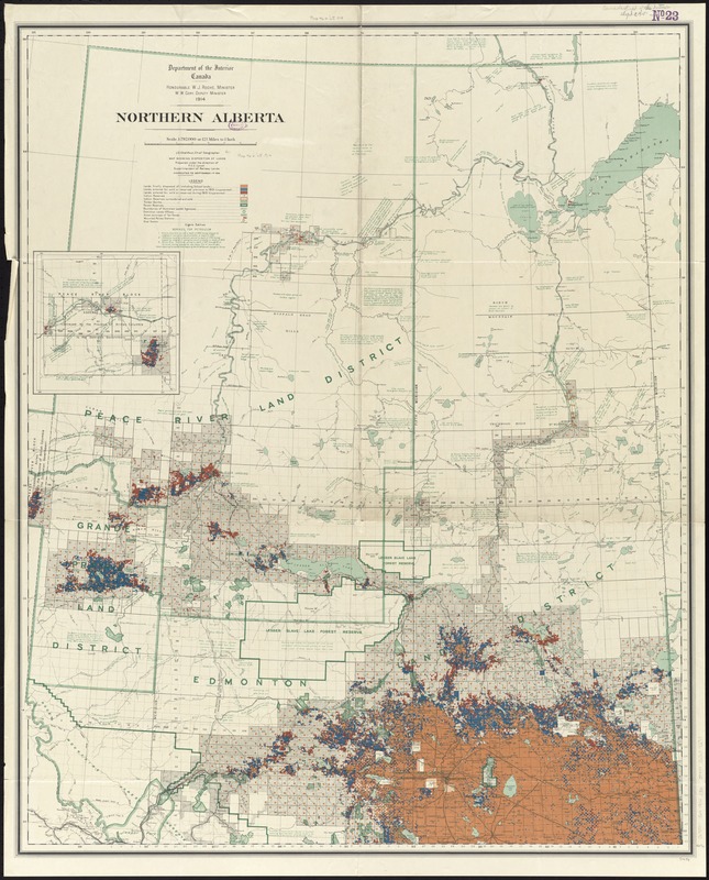
Northern Alberta : map showing disposition of lands
Northern Alberta
×
Item Information
Title:
Northern Alberta : map showing disposition of lands
Creator:
Canada. Railway Lands Branch
Name on Item:
J.E. Chalifour, Chief Geographer ; map prepared under the direction of F.C.C. Lynch, Superintendent of Railway Lands.
Date:
1914
Format:
Maps/Atlases
Location:
Boston Public Library
Norman B. Leventhal Map & Education Center
Collection (local):
Norman B. Leventhal Map & Education Center Collection
Subjects:
Land use--Alberta--Maps
Petroleum--Alberta--Maps
Natural gas--Alberta--Maps
Real property--Alberta--Maps
Alberta--Maps
Places:
Canada
>
Province of Alberta
(province)
Extent:
1 map : color ; 104 x 84 cm
Permalink:
https://ark.digitalcommonwealth.org/ark:/50959/4m90fg78b
Terms of Use:
No known copyright restrictions.
No known restrictions on use.
Publisher:
Ottawa : Department of the Interior
Edition:
8th edition.
Scale:
Scale 1:792,000. 12.5 miles to 1 inch
Language:
English
Notes:
Relief shown by spot heights.
Inset: [western continuation].
Includes notes on soil, land, vegetation, and petroleum borings.
"Corrected to September 1st 1914."
Identifier:
06_01_011678
Call #:
G3501.G4 1914 .C36
Barcode:
39999065687293
show more...
View MODS XML
More Like This
Northern Alberta : map showing disposition of lands
Alberta, southern : map showing disposition of lands
Alberta, southern : map showing disposition of lands
Southern Alberta : map showing disposition of lands
Find More Like This >>
Tools
Share
Facebook
Pinterest
X
Reddit
Tumblr
Email
Copy link
Add to Folder
Questions/Comments
Cite This Item
IIIF Manifest
Downloads
Primary (full resolution, uncompressed)
(TIF, 247 MB)
Large (full resolution)
(JPEG, 20.8 MB)
Medium
(JPEG, 215 KB)