Skip to search
Skip to main content
Digital Commonwealth
Sign Up / Log In
Search for
Search
Search
Search
Basic
Advanced
Explore
Map
Collections
Institutions
Formats
For Educators
Primary Source Sets
Lesson Plans
Using Primary Sources
Searching Digital Commonwealth
For Institutions
Join Digital Commonwealth
Conferences, Trainings, & Events
How to Contribute Collections
Digitization Services
Board & Committees
Frequently Asked Questions
About
About Digital Commonwealth
News & Announcements
Copyright & Terms of Use
Harmful Content Statement
Partners
API
Contact Us
Boston Public Library
Norman B. Leventhal Map & Education Center Collection
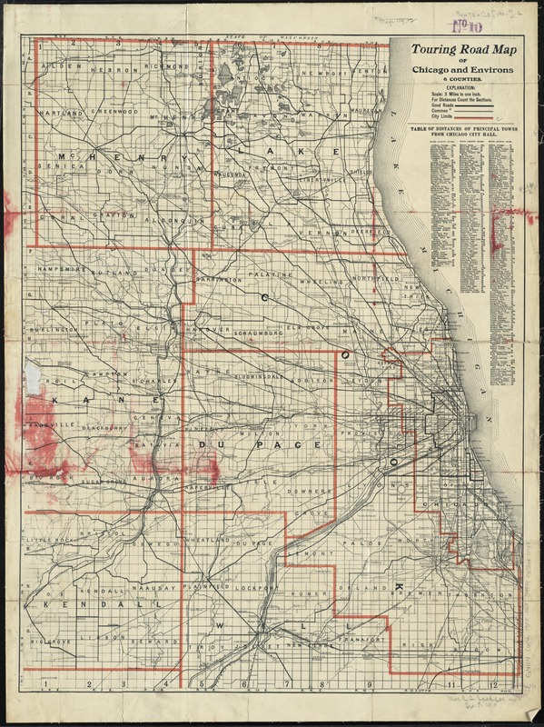
Touring road map of Chicago and environs : 6 counties
Touring road map of Chicago and environs
×
Item Information
Title:
Touring road map of Chicago and environs : 6 counties
Creator:
Blanchard, Rufus, 1821-1904
Date:
[1900?–1909?]
Format:
Maps/Atlases
Location:
Boston Public Library
Norman B. Leventhal Map & Education Center
Collection (local):
Norman B. Leventhal Map & Education Center Collection
Subjects:
Chicago (Ill.)--Maps
Places:
Illinois
>
Cook (county)
>
Chicago
Extent:
1 map : col. ; 68 x 52 cm.
Permalink:
https://ark.digitalcommonwealth.org/ark:/50959/4m90f7620
Terms of Use:
No known copyright restrictions.
No known restrictions on use.
Publisher:
Chicago : Rufus Blanchard
Scale:
Scale [1:190,080]. 3 miles to one inch
Language:
English
Notes:
Includes table of distances of towns from Chicago City Hall.
Identifier:
06_01_011143
Call #:
G4104.C6P2 1900 .B53
Barcode:
39999065681148
show more...
View MODS XML
More Like This
Chicago
Chicago
Chicago motor coach pictorial map of Chicago
Chicago Terminal Transfer Railroad Co. map showing property of ...
Find More Like This >>
Tools
Share
Facebook
Pinterest
X
Reddit
Tumblr
Email
Copy link
Add to Folder
Questions/Comments
Cite This Item
IIIF Manifest
Downloads
Primary (full resolution, uncompressed)
(TIF, 187 MB)
Large (full resolution)
(JPEG, 15.7 MB)
Medium
(JPEG, 261 KB)