Skip to search
Skip to main content
Digital Commonwealth
Sign Up / Log In
Search for
Search
Search
Search
Basic
Advanced
Explore
Map
Collections
Institutions
Formats
For Educators
Primary Source Sets
Lesson Plans
Using Primary Sources
Searching Digital Commonwealth
For Institutions
Join Digital Commonwealth
Conferences, Trainings, & Events
How to Contribute Collections
Digitization Services
Board & Committees
Frequently Asked Questions
About
About Digital Commonwealth
News & Announcements
Copyright & Terms of Use
Harmful Content Statement
Partners
API
Contact Us
Boston Public Library
Norman B. Leventhal Map & Education Center Collection
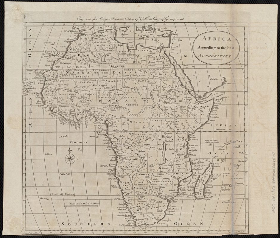
Africa according to the best authorities
Africa according to the best authorities
×
Item Information
Title:
Africa according to the best authorities
Publisher:
Carey, Mathew, 1760-1839
Date:
[1800]
Format:
Maps/Atlases
Location:
Boston Public Library
Norman B. Leventhal Map & Education Center
Collection (local):
Norman B. Leventhal Map & Education Center Collection
Subjects:
Africa--Maps
Places:
Africa
Africa
Extent:
1 map ; 33 x 36 cm
Permalink:
https://ark.digitalcommonwealth.org/ark:/50959/3f462z75f
Terms of Use:
No known copyright restrictions.
No known restrictions on use.
Publisher:
[Philadelphia] : [Mathew Carey]
Scale:
Scale approximately 1:26,500,000
Language:
English
Notes:
Relief shown pictorially.
"Engraved for Carey's American edition of Guthrie's Geography improved."
In upper left margin: 22.
Map 22 in his Carey's general atlas. Philadelphia : Mathew Carey, 1800.
Notes (date):
This date is inferred.
Identifier:
06_01_004541
Call #:
G1015 .C3 1800x
Barcode:
30000005056359
show more...
View MODS XML
More Like This
Africa
Africa
Africa
Africa
Find More Like This >>
Tools
Share
Facebook
Pinterest
X
Reddit
Tumblr
Email
Copy link
Add to Folder
Questions/Comments
Cite This Item
IIIF Manifest
Downloads
Primary (full resolution, uncompressed)
(TIF, 36.2 MB)
Large (full resolution)
(JPEG, 3.04 MB)
Medium
(JPEG, 323 KB)