An accurate map of North America : describing and distinguishing the British and Spanish dominions on this great continent : according to the definitive treaty concluded at Paris 10th Feby. 1763 : also all the West India Islands belonging to, and possessed by the several European princes and states
Item Information
- Title:
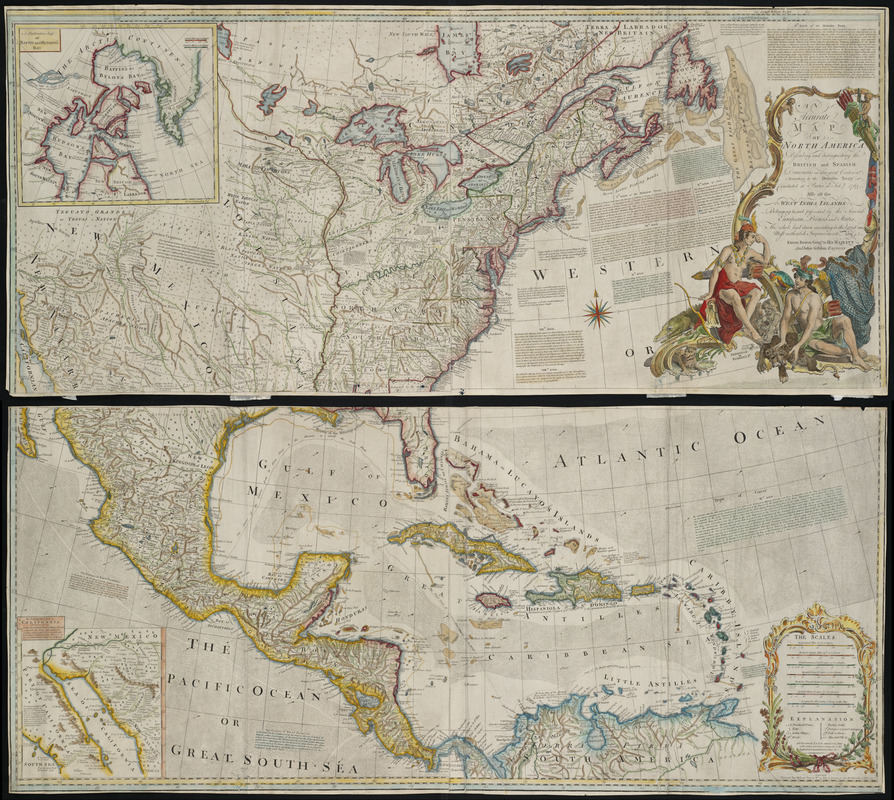
- An accurate map of North America : describing and distinguishing the British and Spanish dominions on this great continent : according to the definitive treaty concluded at Paris 10th Feby. 1763 : also all the West India Islands belonging to, and possessed by the several European princes and states
- Creator:
- Bowen, Emanuel, d. 1767
- Contributor:
- Gibson, John
- Contributor:
- Sayer, Robert, 1725-1794
- Name on Item:
-
the whole laid down according to the latest and most authentick improvements, by Eman. Bowen, geogr. to His Majesty, and John Gibson, engraver
- Date:
-
1772
- Format:
-
Maps/Atlases
- Location:
- Private Collection
- Collection (local):
-
Mapping Boston Collection
- Subjects:
-
North America--Maps--Early works to 1800
- Places:
-
North America (area)
- Extent:
- 1 map : col. ; 116 x 53 cm.
- Permalink:
- https://ark.digitalcommonwealth.org/ark:/50959/3f462v674
- Terms of Use:
-
No known copyright restrictions.
This work is licensed for use under a Creative Commons Attribution Non-Commercial Share Alike License (CC BY-NC-SA).


