Nouvelle Hollande (à présent Nouvelle-York), Nouvelle-Angleterre, et une partie de la Virginie
Item Information
- Title:
- Nouvelle Hollande (à présent Nouvelle-York), Nouvelle-Angleterre, et une partie de la Virginie
- Description:
-
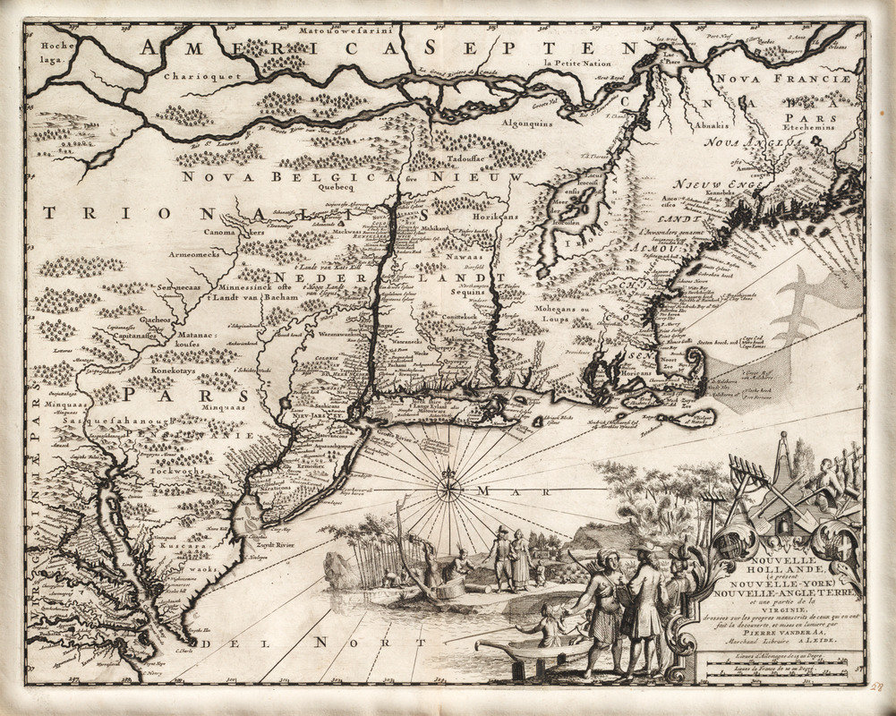
Van der Aa, a publisher of several early 18th-century atlases, based his 1729 map of New York and New England on a 1671 map by Arnoldus Montanus. The title cartouche was removed along with the scale of miles and decorative animals, and then a new title was added with a colonial scene depicting Native Americans assisting the Europeans in clearing the land and exploiting its natural resources. As part of the cartographic progression of maps of the Northeast initiated by Jan Jansson and Nicolas Visscher in the 1650s, this map is the only one of the thirty-map series to show Providence and to name Canada. There are new and important place names in Canada, along the Connecticut and Delaware Rivers, and around the Chesapeake Bay.
- Creator:
- Aa, Pieter van der, 1659-1733
- Name on Item:
-
dressées sur les propres manuscrits de ceux qui en ont fait la decouverte, et mises en lumiere par Pierre vander Aa, marchand libraire a Leide
- Date:
-
[1729?]
- Format:
-
Maps/Atlases
- Location:
- Private Collection
- Collection (local):
-
Mapping Boston Collection
- Subjects:
-
Middle Atlantic States--Maps--Early works to 1800
New England--Maps--Early works to 1800
- Places:
-
New England (area)
Middle Atlantic (area)
- Extent:
- 1 map ; 30 x 37 cm.
- Permalink:
- https://ark.digitalcommonwealth.org/ark:/50959/3f462t376
- Terms of Use:
-
No known copyright restrictions.
This work is licensed for use under a Creative Commons Attribution Non-Commercial Share Alike License (CC BY-NC-SA).


