Skip to search
Skip to main content
Digital Commonwealth
Sign Up / Log In
Search for
Search
Search
Search
Basic
Advanced
Explore
Map
Collections
Institutions
Formats
For Educators
Primary Source Sets
Lesson Plans
Using Primary Sources
Searching Digital Commonwealth
For Institutions
Join Digital Commonwealth
Conferences, Trainings, & Events
How to Contribute Collections
Digitization Services
Board & Committees
Frequently Asked Questions
About
About Digital Commonwealth
News & Announcements
Copyright & Terms of Use
Harmful Content Statement
Partners
API
Contact Us
Boston Public Library
Norman B. Leventhal Map & Education Center Collection
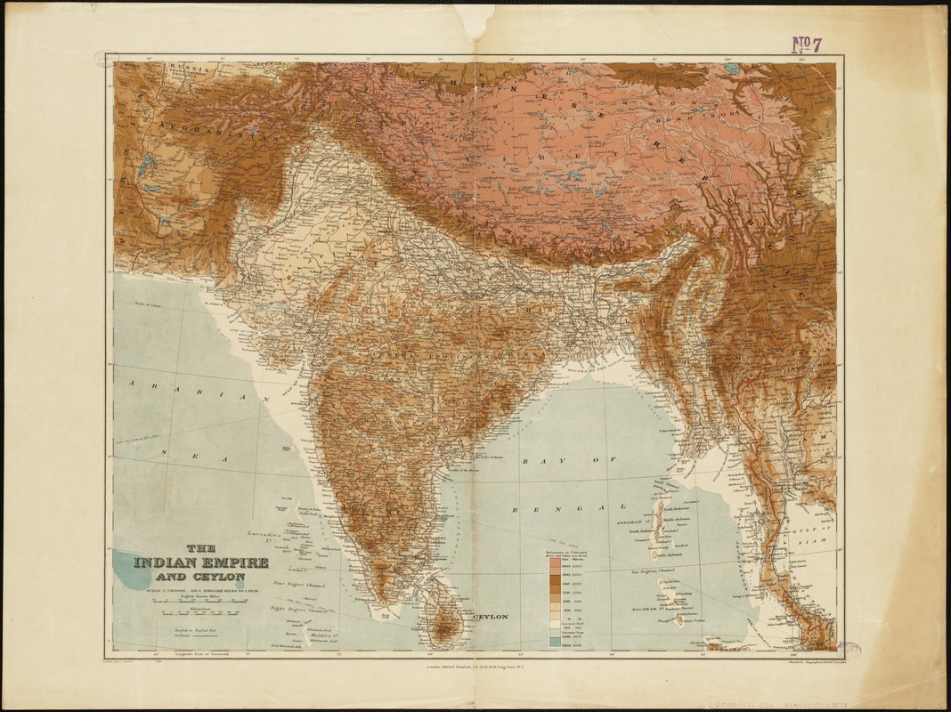
The Indian Empire and Ceylon
The Indian Empire and Ceylon
×
Item Information
Title:
The Indian Empire and Ceylon
Creator:
Edward Stanford Ltd
Date:
[1920]
Format:
Maps/Atlases
Location:
Boston Public Library
Norman B. Leventhal Map & Education Center
Collection (local):
Norman B. Leventhal Map & Education Center Collection
Subjects:
South Asia--Maps
India--Maps
Sri Lanka--Maps
1920
Places:
Southern Asia
(area)
India
Sri Lanka
Extent:
1 map : col. ; 48 x 59 cm.
Permalink:
https://ark.digitalcommonwealth.org/ark:/50959/1257bb04j
Terms of Use:
No known copyright restrictions.
No known restrictions on use.
Publisher:
[London] : Edward Stanford Ltd.
Scale:
Scale 1:7,500,000 ;
Language:
English
Notes:
Relief shown as gradient tints.
London Atlas Series.
Shows international and administrative boundaries, railways.
Notes (date):
This date is inferred.
Identifier:
06_01_004927
Call #:
G7750 1920 .E3x
Barcode:
39999059008878
show more...
View MODS XML
More Like This
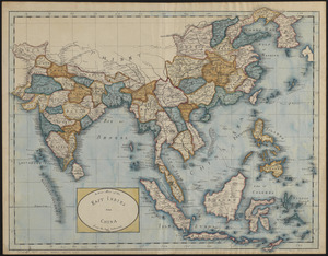
An accurate map of Hindostan or India, from the best authorities
Hindoostan
A new map of the East Indies and China from the best authorities
Joshua Plaut
Find More Like This >>
Tools
Share
Facebook
Pinterest
X
Reddit
Tumblr
Email
Copy link
Add to Folder
Questions/Comments
Cite This Item
IIIF Manifest
Downloads
Primary (full resolution, uncompressed)
(TIF, 158 MB)
Large (full resolution)
(JPEG, 13.3 MB)
Medium
(JPEG, 316 KB)