Skip to search
Skip to main content
Digital Commonwealth
Sign Up / Log In
Search for
Search
Search
Search
Basic
Advanced
Explore
Map
Collections
Institutions
Formats
For Educators
Primary Source Sets
Lesson Plans
Using Primary Sources
Searching Digital Commonwealth
For Institutions
Join Digital Commonwealth
Conferences, Trainings, & Events
How to Contribute Collections
Digitization Services
Board & Committees
Frequently Asked Questions
About
About Digital Commonwealth
News & Announcements
Copyright & Terms of Use
Harmful Content Statement
Partners
API
Contact Us
Boston Public Library
Norman B. Leventhal Map & Education Center Collection
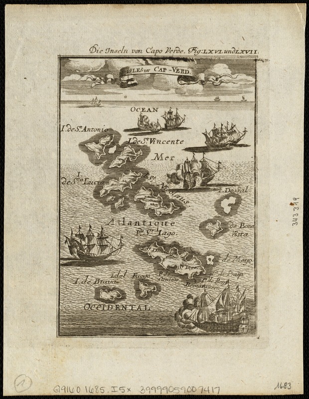
Isles Du Cap-Verd = Die Inseln von Capo Verde
Isles Du Cap-Verd
×
Item Information
Title:
Isles Du Cap-Verd = Die Inseln von Capo Verde
Date:
[1685]
Format:
Maps/Atlases
Location:
Boston Public Library
Norman B. Leventhal Map & Education Center
Collection (local):
Norman B. Leventhal Map & Education Center Collection
Subjects:
Cape Verde--Maps--Early works to 1800
Places:
Cape Verde
Extent:
1 map ; 15 x 10 cm.
Permalink:
https://ark.digitalcommonwealth.org/ark:/50959/1257b939f
Terms of Use:
No known copyright restrictions.
No known restrictions on use.
Publisher:
Frankfurt au Main : Johann David Zunner
Scale:
Scale [ca. 1:350,000].
Language:
French
German
Notes:
From: Description De L'Univers by Allain Manesson-Mallet, 3rd ed., [1685], sheet LXVI u. LXVII.
Notes (date):
This date is inferred.
Identifier:
06_01_004756
Call #:
G9160 1685 .I5x
Barcode:
39999059007417
show more...
View MODS XML
More Like This
Archipelagus Atlanticus cum suis insulis Canariis, Hesperidibus et ...
Barbariae et Guineae maritimi à freto Gibraltar ad fluvium ...
Bocche del Fiume Negro et Isole di Cape Verde : possedute dà ...
The Cape Verd Islands : laid down from the remarks and ...
Find More Like This >>
Tools
Share
Facebook
Pinterest
X
Reddit
Tumblr
Email
Copy link
Add to Folder
Questions/Comments
Cite This Item
IIIF Manifest
Downloads
Primary (full resolution, uncompressed)
(TIF, 16 MB)
Large (full resolution)
(JPEG, 1.35 MB)
Medium
(JPEG, 225 KB)
We'd love your feedback!
×
Would you be interested in taking a short survey about Digital Commonwealth?