Skip to search
Skip to main content
Digital Commonwealth
Sign Up / Log In
Search for
Search
Search
Search
Basic
Advanced
Explore
Map
Collections
Institutions
Formats
For Educators
Primary Source Sets
Lesson Plans
Using Primary Sources
Searching Digital Commonwealth
For Institutions
Join Digital Commonwealth
Conferences, Trainings, & Events
How to Contribute Collections
Digitization Services
Board & Committees
Frequently Asked Questions
About
About Digital Commonwealth
News & Announcements
Copyright & Terms of Use
Harmful Content Statement
Partners
API
Contact Us
Boston Public Library
Norman B. Leventhal Map Center Collection
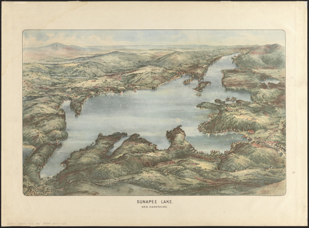
Sunapee Lake, New Hampshire
Sunapee Lake, New Hampshire
×
Item Information
Title:
Sunapee Lake, New Hampshire
Publisher:
Geo. H. Walker & Co.
Date:
1905
Format:
Maps/Atlases
Location:
Boston Public Library
Norman B. Leventhal Map Center
Collection (local):
Norman B. Leventhal Map Center Collection
Subjects:
Sunapee Lake (N.H.)--Aerial views
Places:
Sunapee Lake
Extent:
1 view : color ; 42 x 66 cm
Permalink:
https://ark.digitalcommonwealth.org/ark:/50959/0r96fq06h
Terms of Use:
No known copyright restrictions.
No known restrictions on use.
Publisher:
Boston : Geo. H. Walker & Co.
Scale:
Not drawn to scale
Language:
English
Notes:
Bird's-eye view from the north.
Some locations numbered but view does not include key.
Identifier:
06_01_016146
Call #:
G3742.S93A3 1905 .G46
Barcode:
39999085944385
show more...
View MODS XML
More Like This
The 100th anniversary map of Abraham Lincoln's visit to ...
1630 shoreline
1879. Progress map of the U.S. Geographical Surveys west of the ...
1903 Map of Salem and surrounding places
Find More Like This >>
Tools
Share
Facebook
Pinterest
X
Reddit
Tumblr
Email
Copy link
Add to Folder
Questions/Comments
Cite This Item
IIIF Manifest
Downloads
Primary (full resolution, uncompressed)
(TIF, 102 MB)
Large (full resolution)
(JPEG, 8.57 MB)
Medium
(JPEG, 302 KB)