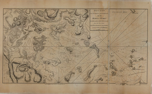
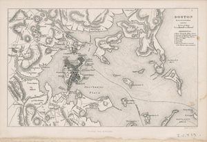
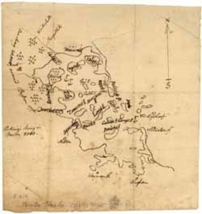
Boston, its environs and harbour, with the rebels works raised against that town in 1775 / from the observations of Lieut. Page of His Majesty’s Corps of Engineers, and from the plans of Capt. Montresor
Boston, its environs and harbour, with the rebels works raised against that town in 1775 / from the observations of Lieut. Page of His Majesty’s Corps of Engineers, and from the plans of Capt. Montresor
Description:
Sir Thomas Hyde Page was a British military engineer and cartographer. This map shows Boston during the seige in 1775 and depicts the works put in place by the "rebels". [London] : Engraved Publishd by Wm. Faden, 1778 Maps M-1-3
Item from the collections of the Massachusetts Historical Society. Image use and licensing information: www.masshist.org/library/permissions
Contact host institution for more information.