Skip to search
Skip to main content
Skip to first result
Digital Commonwealth
Folders
Sign Up / Log In
Search for
Search
Search
Search
Basic
Advanced
Explore
Map
Collections
Institutions
Formats
For Educators
Primary Source Sets
Lesson Plans
Using Primary Sources
Searching Digital Commonwealth
For Institutions
Join Digital Commonwealth
Conferences, Trainings, & Events
How to Contribute Collections
Digitization Services
Board & Committees
Frequently Asked Questions
About
About Digital Commonwealth
News & Announcements
Copyright & Terms of Use
Harmful Content Statement
Partners
API
Contact Us
Search
Search Constraints
Start Over
Save Search
Your search:
More Like
commonwealth-oai:xp68mj42z
✖
Remove constraint More Like: commonwealth-oai:xp68mj42z
« Prev. |
1
-
20
of
2,053
|
Next »
Sort
by date (asc)
relevance
title
date (asc)
date (desc)
Number of results to display per page
20
per page
per page
10
per page
20
per page
50
per page
100
per page
View results as:
List
list view
Maps
map view
Gallery
grid view
Search Results
1.
Plan of lots on Mount-Bowdoin in Dorchester
2.
Map of Dorchester Mass
3.
Woodland Cemetery in Dorchester and Roxbury main entrance on Walk-Hill Street : five miles from Boylston market, direct route...
4.
Plan of Neponset River and part of Dorchester Bay showing the harbor lines proposed by the Commissioners 1854
5.
Plan of land in Roxbury belonging to the heirs of Alfred Evans
6.
[Plan of house lots for sale on Savin Hill Avenue, Dorchester, Mass.]
7.
Plan of house lots in ward 16 : owned by Saml. B. Pierce & Geo. C. Ludington, Boston, near the Dorchester Station, Norfolk...
8.
Plan of real estate belonging to T.W. & J.H. Cox : situated in ward 16, Boston
9.
Plat of lots in Boston (Dorchester Dist.) belonging to B.P. Cunningham
10.
Plan no II of land of George D. Welles situated in ward 16 Boston
11.
Plan of house lots in Boston belonging to Otis H. Weed
12.
Plan of land belonging to J.M. & G.H. Pike : ward 16 - Boston
13.
[Plan of the cove between Savin Hill and Commercial Point, Dorchester]
14.
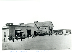
Fields Corner, Dorchester Avenue
15.
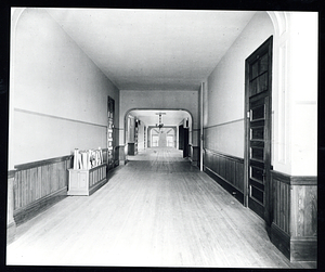
Roxbury High School second floor corridor
16.
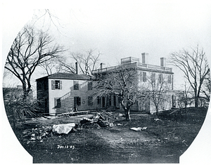
Rear view of the Corcoran House, Preston Street, Dorchester
17.
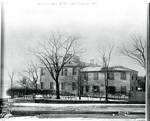
Easterly side of the Corcoran House, Preston Street at Neponset Street, Dorchester
18.
Boston Gas Company, Commercial Point
19.
Boston Gas Company, Commercial Point
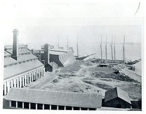
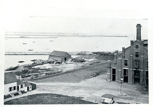
20.
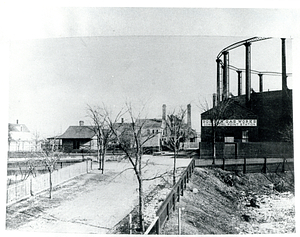
Boston Gas Company, Neponset Street at Washington Street, Commercial Point
« Previous
Next »
1
2
3
4
5
…
102
103
Limit your search
Subject
Dorchester (Boston, Mass.)
769
Housing development--Massachusetts--Boston
573
Community development
539
Urban renewal--Massachusetts--Boston
491
Building sites--Planning
448
Urban--Massachusetts--Boston
443
Nonprofit organizations--Finance
441
Housing--Massachusetts--Boston
436
more
Subject
»
Place
North and Central America
2,018
United States
2,018
Suffolk (county)
2,012
Boston
2,011
Massachusetts
2,001
Dorchester
647
Roxbury
386
Mattapan
34
more
Place
»
Format
Photographs
1,147
Documents
614
Letters/Correspondence
211
Newspapers
40
Audio recordings (nonmusical)
32
Maps/Atlases
17
Film/Video
17
Books
2
more
Format
»
Available to use
No known restrictions
13
Creative Commons license
1
Date
View distribution
Current results range from
1836
to
2019
Date range begin
Date range end
View larger »
Unknown
17
Collection
Inquilinos Boricuas en Acción Records
610
Dorchester Rapid Transit System Photographs
392
School Buildings Photographs
137
La Alianza Hispana Records
124
Public Works Department Photographs
122
Boston Elevated Photographs: Dudley
94
Mayor Kevin White Records
86
Chinese Progressive Association Records
84
more
Collection
»
Institution
Boston City Archives
1,068
Northeastern University Library
913
University of Massachusetts Boston, Joseph P. Healey Library
53
Boston Public Library
14
WGBH
5


![[Plan of house lots for sale on Savin Hill Avenue, Dorchester, Mass.]](https://bpldcassets.blob.core.windows.net/derivatives/images/commonwealth:9s161f68b/image_thumbnail_300.jpg)


![[Plan of the cove between Savin Hill and Commercial Point, Dorchester]](https://bpldcassets.blob.core.windows.net/derivatives/images/commonwealth:js956k66d/image_thumbnail_300.jpg)