Skip to search
Skip to main content
Skip to first result
Digital Commonwealth
Folders
Sign Up / Log In
Search for
Search
Search
Search
Basic
Advanced
Explore
Map
Collections
Institutions
Formats
For Educators
Primary Source Sets
Lesson Plans
Using Primary Sources
Searching Digital Commonwealth
For Institutions
Join Digital Commonwealth
Conferences, Trainings, & Events
How to Contribute Collections
Digitization Services
Board & Committees
Frequently Asked Questions
About
About Digital Commonwealth
News & Announcements
Copyright & Terms of Use
Harmful Content Statement
Partners
API
Contact Us
Search
Search Constraints
Start Over
Save Search
Your search:
More Like
commonwealth-oai:ww72bm870
✖
Remove constraint More Like: commonwealth-oai:ww72bm870
« Prev.
|
41
-
60
of
145
|
Next »
Sort
by relevance
relevance
title
date (asc)
date (desc)
Number of results to display per page
20
per page
per page
10
per page
20
per page
50
per page
100
per page
View results as:
List
list view
Maps
map view
Gallery
grid view
Search Results
41.
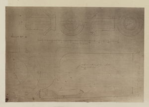
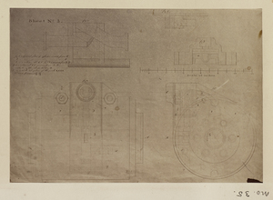
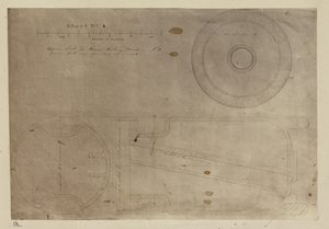
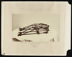
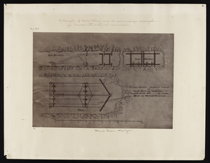
Plans numbered from 1 to 4 are details of Harsen's rock drill : with which the first experiments were made in the attempt to...
42.
Plans numbered from 1 to 4 are details of Harsen's rock drill : with which the first experiments were made in the attempt to...
43.
Plans numbered from 1 to 4 are details of Harsen's rock drill : with which the first experiments were made in the attempt to...
44.
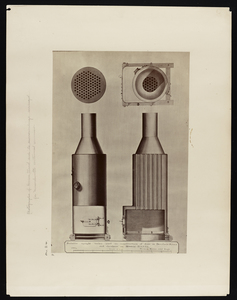
Portable horizontal boiler used in construction of Hoosac Tunnel 1864
45.
Portable upright boiler used in construction of dam in Deerfield River and elsewhere on Hoosac Tunnel 1864
46.
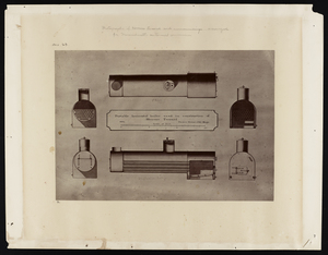
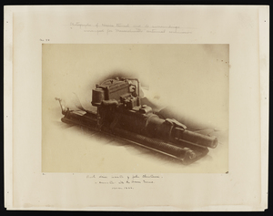
Rock drill invention by John Christiansen in connection with the Hoosac Tunnel
47.
Safety cages for west shaft of Hoosac Tunnel
48.
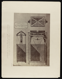
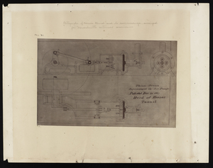
Thomas Doane's improved carriage for rock drilling machines
49.
Thomas Doane's improved carriage for rock drilling machines used at Hoosac Tunnel
50.
Thomas Doane's improvement in air pumps, patented December 31, 1867, used at Hoosac Tunnel
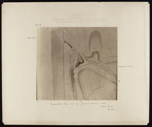
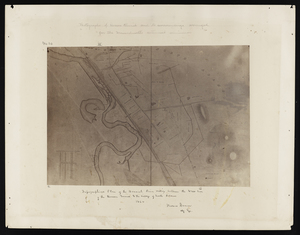
51.
Topographical plan east end of Hoosac Tunnel 1864
52.
Topographical plan east end of Hoosac Tunnel 1864
53.
Topographical plan east end of Hoosac Tunnel 1864
54.
Topographical plan east end of Hoosac Tunnel 1864
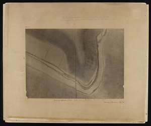
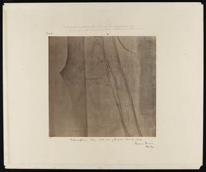
55.
Topographical plan from west shaft to west end of Hoosac Tunnel 1864
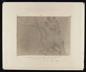
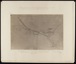
56.
Topographical plan of the Hoosick River valley between the west end of the Hoosac Tunnel and the village of North Adams 1864
57.
Topographical plan of the Hoosick River valley between the west end of the Hoosac Tunnel and the village of North Adams 1864
58.
Topographical plan of the Hoosick River valley between the west end of the Hoosac Tunnel and the village of North Adams 1864
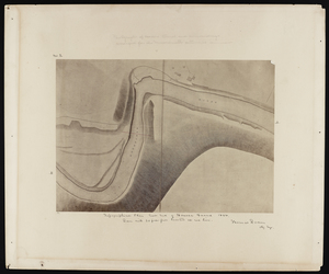
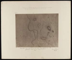
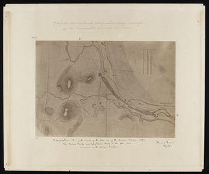
59.
Topographical plan of the vicinity of the west end of the Hoosac Tunnel 1864
60.
Topographical plan of the vicinity of the west end of the Hoosac Tunnel 1864
« Previous
Next »
1
2
3
4
5
6
7
8
Limit your search
Subject
Hoosac Tunnel (Mass.)--Photographs
111
Tunnels--Massachusetts--Photographs
66
Tunnels--Massachusetts--History
45
North Adams (Mass.)--Photographs
30
Maps, Pictorial
25
Massachusetts--Maps
2
Plymouth (Mass.)--Aerial views
2
Plymouth (Mass.)--Maps, Pictorial
2
more
Subject
»
Place
North and Central America
145
United States
145
Massachusetts
143
Berkshire (county)
32
Adams
30
Worcester (county)
13
Hampden (county)
3
Middlesex (county)
3
more
Place
»
Format
Photographs
111
Maps/Atlases
34
Date
View distribution
Current results range from
1800
to
1915
Date range begin
Date range end
View larger »
Unknown
1
Collection
Other
145
Institution
State Library of Massachusetts
145