Skip to search
Skip to main content
Skip to first result
Digital Commonwealth
Folders
Sign Up / Log In
Search for
Search
Search
Search
Basic
Advanced
Explore
Map
Collections
Institutions
Formats
For Educators
Primary Source Sets
Lesson Plans
Using Primary Sources
Searching Digital Commonwealth
For Institutions
Join Digital Commonwealth
Conferences, Trainings, & Events
How to Contribute Collections
Digitization Services
Board & Committees
Frequently Asked Questions
About
About Digital Commonwealth
News & Announcements
Copyright & Terms of Use
Harmful Content Statement
Partners
API
Contact Us
Search
Search Constraints
Start Over
Save Search
Your search:
More Like
commonwealth-oai:ww72bj206
✖
Remove constraint More Like: commonwealth-oai:ww72bj206
« Prev.
|
121
-
140
of
368
|
Next »
Sort
by relevance
relevance
title
date (asc)
date (desc)
Number of results to display per page
20
per page
per page
10
per page
20
per page
50
per page
100
per page
View results as:
List
list view
Maps
map view
Gallery
grid view
Search Results
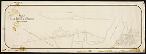
121.
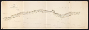
Map of the route of the Fall River & Warren Railroad.
122.
Map of the route of the proposed New Haven & Pittsfield railroad from Pittsfield to the Summit in W. Becket / Frederick...
123.
Map of the route of the proposed New Haven & Pittsfield railroad from summit in W. Becket to state line in Tolland / Frederick...
124.
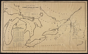
Map of the Vermont central railroad and its connections from Smith's map of the United States.
125.
Map of the vicinity of Boston / compiled from plans made by A. Andrews and J.H. Shearer.
126.
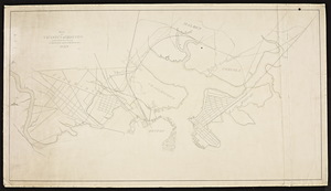
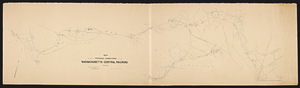
Map showing proposed connections of the Massachusetts Central Railroad / Edward Frost, chief engineer.
127.
Map showing proposed location of the Broadway horse railroad, Cambridge / W.A. Mason and W.S. Barbour, engineers.
128.
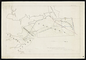
Map showing proposed rail road routes from Bristol to India Point, Providence and to the Providence & Boston Road above Pawtucket
129.
Map showing the lines of preliminary survey and office location line of the Plymouth and Middleboro Railroad / James M. Hodge,...
130.
Map showing the proposed connections between the Dorchester and Milton branch and the New York Central and Boston and...
131.
Map showing the proposed location of the Charles River Railroad / W.S. Barbour, engineer.
132.
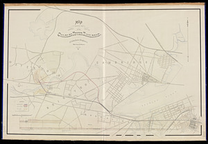
Map showing the proposed location of the Charles River Railroad / W.S. Barbour, engineer copied [by] G. Tyler.
133.
Nineteenth annual report of the Board of Railroad Commissioners (1887)
134.
Ninth annual report of the Board of Railroad Commissioners (1877)
135.
Papers pertaining to a proposed branch railroad diverging from the Boston and Providence Railroad and terminating at Taunton, 1835
136.
Papers, petitions, and estimates relative to the construction of a railroad from Plympton to Wareham. 1854
137.
Papers related to the Grand Hotel Branch Railroad Company of Dorchester, Massachusetts, 1867
138.
Plan & profile of a contemplated connection between New Bedford and Fall River Rail Roads
139.
Plan & profile of the Boston, Barre & Gardner extension
140.
Plan & profile of the Easton branch of Old Colony Railroad / Charles F. Choate, president George S. Morrill, Chief Engr.
« Previous
Next »
1
2
3
4
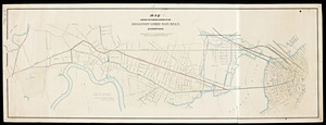
5
6
7
8
9
10
11
…
18
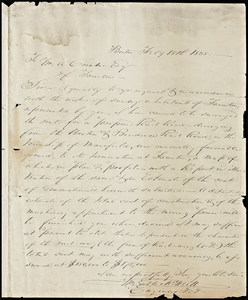
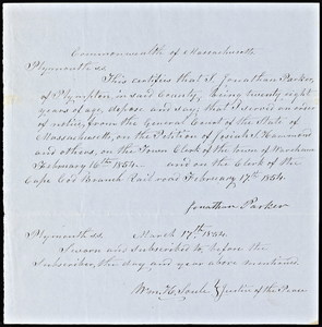
19
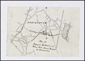
Limit your search
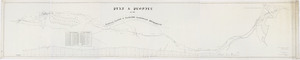
Subject
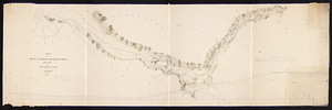
Railroads--Massachusetts
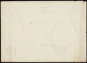
59
Railroads--Massachusetts--Maps
13
Massachusetts--Maps
9
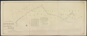
Old Colony Railroad
8
Boston and Maine Railroad--Maps
7
Massachusetts. Board of Railroad Commissioners
7
Massachusetts. Public Service Commission
7
Public utilities--Massachusetts
7
more
Subject
»
Place
North and Central America
368
United States
368
Massachusetts
356
Middlesex (county)
91
Suffolk (county)
72
Boston
71
Norfolk (county)
46
Essex (county)
43
more
Place
»
Format
Maps/Atlases
269
Documents
99
Date
View distribution
Current results range from
1827
to
1919
Date range begin
Date range end
View larger »
Unknown
56
Collection
Massachusetts Board of Railroad Commissioners
368
Institution
State Library of Massachusetts
368
![Map showing the proposed location of the Charles River Railroad / W.S. Barbour, engineer copied [by] G. Tyler.](https://bpldcassets.blob.core.windows.net/derivatives/metadata/commonwealth-oai:6q1832208/image_thumbnail_300.jpg)