Skip to search
Skip to main content
Skip to first result
Digital Commonwealth
Folders
Sign Up / Log In
Search for
Search
Search
Search
Basic
Advanced
Explore
Map
Collections
Institutions
Formats
For Educators
Primary Source Sets
Lesson Plans
Using Primary Sources
Searching Digital Commonwealth
For Institutions
Join Digital Commonwealth
Conferences, Trainings, & Events
How to Contribute Collections
Digitization Services
Board & Committees
Frequently Asked Questions
About
About Digital Commonwealth
News & Announcements
Copyright & Terms of Use
Harmful Content Statement
Partners
API
Contact Us
Search
Search Constraints
Start Over
Save Search
Your search:
More Like
commonwealth-oai:ww72bg05p
✖
Remove constraint More Like: commonwealth-oai:ww72bg05p
« Prev. |
1
-
20
of
147
|
Next »
Sort
by relevance
relevance
title
date (asc)
date (desc)
Number of results to display per page
20
per page
per page
10
per page
20
per page
50
per page
100
per page
View results as:
List
list view
Maps
map view
Gallery
grid view
Search Results
1.
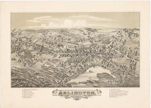
Arlington, Massachusetts, 1884
2.
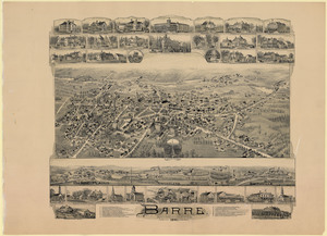
Barre, Massachusetts, 1891
3.
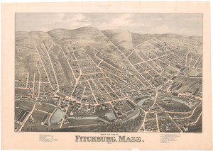
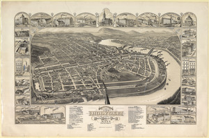
Bird's eye view of Fitchburg, Mass., 1875
4.
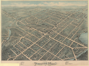
Bird's eye view of Pittsfield, Mass., 1876
5.
Bird's eye view of the city of Holyoke: and village of South Hadley Falls, Mass., looking north
6.
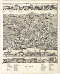
Gardner, Mass., 1880
7.
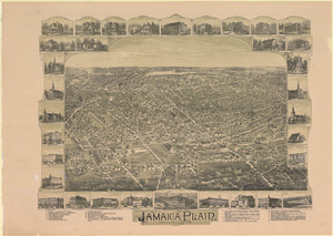
Jamaica Plain, Massachusetts: Ward 2, city of Boston
8.
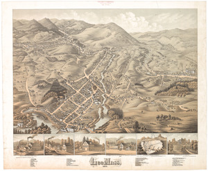
Lee, Mass., 1878
9.
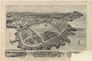
Magnolia, Gloucester, Mass., 1887
10.
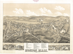
Monson, Mass. 1879
11.
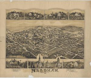
Needham, Massachusetts, 1887
12.
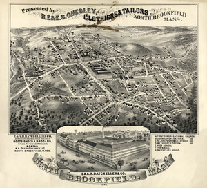
North Brookfield, Mass., 1878
13.
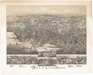
Plymouth, Mass. 1882
14.
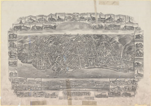
Plymouth, Massachusetts, 1897
15.
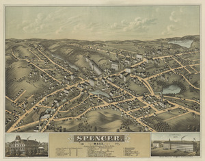
Spencer, Mass., 1877
16.
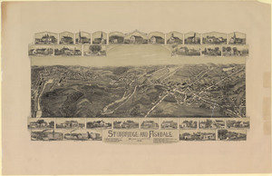
Sturbridge and Fiskdale, Massachusetts, 1892
17.
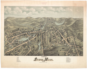
View of Athol, Mass., 1878
18.
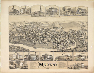
View of Medway, Massachusetts, 1887
19.
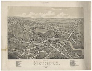
View of Methuen, Massachusetts, 1882
20.
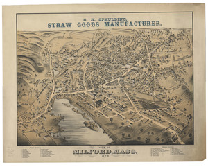
View of Milford, Mass., 1876
« Previous
Next »
1
2
3
4
5
…
7
8
Limit your search
Subject
Hoosac Tunnel (Mass.)--Photographs
112
Tunnels--Massachusetts--Photographs
67
Tunnels--Massachusetts--History
45
North Adams (Mass.)--Photographs
30
Maps, Pictorial
24
Leominster (Mass.)--Aerial views
2
Massachusetts--Maps
2
Plymouth (Mass.)--Aerial views
2
more
Subject
»
Place
North and Central America
147
United States
147
Massachusetts
145
Berkshire (county)
32
Adams
30
Worcester (county)
14
Hampden (county)
3
Middlesex (county)
3
more
Place
»
Format
Photographs
112
Maps/Atlases
35
Available to use
No known restrictions
2
Date
View distribution
Current results range from
1800
to
1915
Date range begin
Date range end
View larger »
Unknown
1
Collection
Other
145
Boston and New England Maps (Collection of Distinction)
2
Norman B. Leventhal Map & Education Center Collection
2
Urban Maps (Collection of Distinction)
2
Institution
State Library of Massachusetts
145
Boston Public Library
2