61. Atlas of the boundaries of the town of Winchester, Middlesex County Creator: Massachusetts. Topographical Survey Commission Format: Books Collection: Massachusetts Board of Harbor and Land Commissioners Date: 1899 Institution: State Library of Massachusetts
62. Atlas of the boundaries of the town of Winthrop, Suffolk County Creator: Massachusetts. Topographical Survey Commission Format: Books Collection: Massachusetts Board of Harbor and Land Commissioners Date: 1898 Institution: State Library of Massachusetts
63. Atlas of the boundaries of the towns of Acton, Bedford, Concord, Lincoln, Maynard, Sudbury, Wayland, Weston, Middlesex County Creator: Board of Harbor and Land Commissioners of Massachusetts Format: Maps/Atlases Collection: Massachusetts Board of Harbor and Land Commissioners Date: 1904 Institution: State Library of Massachusetts
64. Atlas of the boundaries of the towns of Amherst, Enfield, Greenwich, Hadley, Pelham, Prescott, Hampshire County : Leverett, Shutesbury, Sunderland, New Salem, Franklin... Creator: Board of Harbor and Land Commissioners of Massachusetts Format: Maps/Atlases Collection: Massachusetts Board of Harbor and Land Commissioners Date: 1912 Institution: State Library of Massachusetts
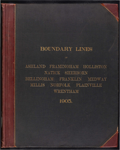
65. Atlas of the boundaries of the towns of Ashland, Framingham, Holliston, Natick, Sherborn, Middlesex County Bellingham, Franklin, Medway, Millis, Norfolk, Plainville,... Creator: Board of Harbor and Land Commissioners of Massachusetts Format: Maps/Atlases Collection: Massachusetts Board of Harbor and Land Commissioners Date: 1905 Institution: State Library of Massachusetts
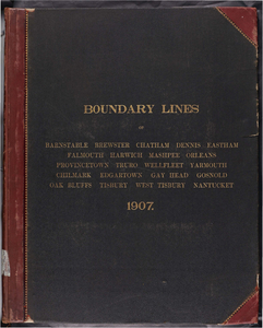
66. Atlas of the boundaries of the towns of Barnstable, Brewster, Chatham, Dennis, Eastham, Falmouth, Harwich, Mashpee, Orleans, Provincetown, Truro, Wellfleet, Yarmouth,... Creator: Board of Harbor and Land Commissioners of Massachusetts Format: Maps/Atlases Collection: Massachusetts Board of Harbor and Land Commissioners Date: 1907 Institution: State Library of Massachusetts
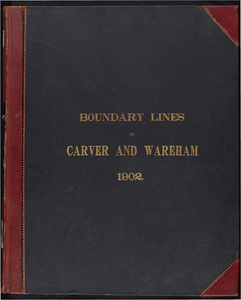
67. Atlas of the boundaries of the towns of Carver and Wareham, Plymouth County Creator: Board of Harbor and Land Commissioners of Massachusetts Format: Maps/Atlases Collection: Massachusetts Board of Harbor and Land Commissioners Date: 1902 Institution: State Library of Massachusetts
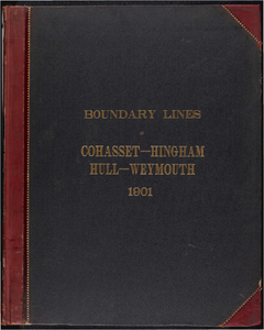
68. Atlas of the boundaries of the towns of Cohasset - Weymouth, Norfolk County Hingham - Hull, Plymouth County Creator: Board of Harbor and Land Commissioners of Massachusetts Format: Maps/Atlases Collection: Massachusetts Board of Harbor and Land Commissioners Date: 1901 Institution: State Library of Massachusetts
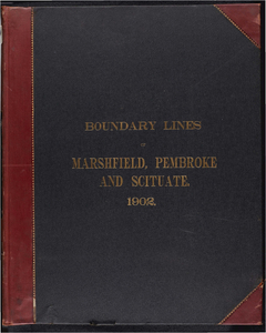
69. Atlas of the boundaries of the towns of Marshfield, Pembroke and Scituate, Plymouth County Creator: Board of Harbor and Land Commissioners of Massachusetts Format: Maps/Atlases Collection: Massachusetts Board of Harbor and Land Commissioners Date: 1902 Institution: State Library of Massachusetts
70. Boston harbor improvements at and below the narrows: and special sketch of Barrel & Kelly's Rocks Creator: Foster, John G. (John Gray), 1823-1874.; Massachusetts. Board of Harbor Commissioners Format: Maps/Atlases Collection: Massachusetts Board of Harbor and Land Commissioners Date: 1869 Institution: State Library of Massachusetts
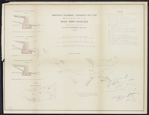
71. Boston harbor improvements: Sketch showing works in the main ship channel carried on under the direction of Lt. Col. J.G. Foster, Corps of Engrs. in 1870 Creator: Foster, John G. (John Gray), 1823-1874.; Massachusetts. Board of Harbor Commissioners Format: Maps/Atlases Collection: Massachusetts Board of Harbor and Land Commissioners Date: 1870 Institution: State Library of Massachusetts
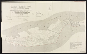
72. Boston Harbor, Mass. Map of Charles River: From Brookline Street Bridge to Charles River Bridge Creator: Board of Harbor and Land Commissioners of Massachusetts Format: Maps/Atlases Collection: Massachusetts Board of Harbor and Land Commissioners Date: 1889 Institution: State Library of Massachusetts
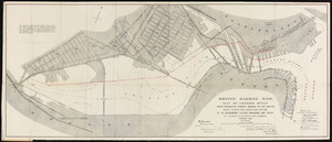
73. Boston Harbor, Mass., map of Charles River: from Brookline Street Bridge to its mouth Creator: Board of Harbor and Land Commissioners of Massachusetts Format: Maps/Atlases Collection: Massachusetts Board of Harbor and Land Commissioners Date: 1890 Institution: State Library of Massachusetts
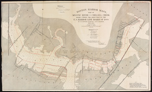
74. Boston Harbor, Mass.: map of Mystic River and Chelsea Creek Creator: Board of Harbor and Land Commissioners of Massachusetts Format: Maps/Atlases Collection: Massachusetts Board of Harbor and Land Commissioners Date: 1890 Institution: State Library of Massachusetts
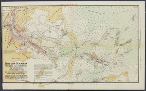
75. Boston Harbor: showing all dredging of channels to December, 1902 Creator: Board of Harbor and Land Commissioners of Massachusetts Format: Maps/Atlases Collection: Massachusetts Board of Harbor and Land Commissioners Date: 1902 Institution: State Library of Massachusetts
76. Boston Inner Harbor, Massachusetts: from bridges to upper middle channel Creator: Board of Harbor and Land Commissioners of Massachusetts Format: Maps/Atlases Collection: Massachusetts Board of Harbor and Land Commissioners Date: 1888 Institution: State Library of Massachusetts
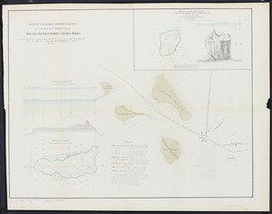
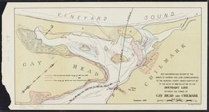
77. Boundary line between the towns of Gay Head and Chilmark Creator: Board of Harbor and Land Commissioners of Massachusetts Format: Maps/Atlases Collection: Massachusetts Board of Harbor and Land Commissioners Date: 1896 Institution: State Library of Massachusetts
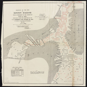
78. Changes in the bed of Boston Harbor: from a comparison of the surveys of 1835 and 1861 Creator: Board of Harbor and Land Commissioners of Massachusetts Format: Maps/Atlases Collection: Massachusetts Board of Harbor and Land Commissioners Date: 1889 Institution: State Library of Massachusetts
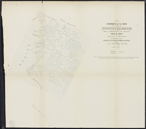
79. Changes in the bed of Boston harbor from a comparison of the surveys of 1835-61. Sheet 1. Survey of 1835 and 1847 Creator: Massachusetts. Board of Harbor Commissioners Format: Maps/Atlases Collection: Massachusetts Board of Harbor and Land Commissioners Date: 1868 Institution: State Library of Massachusetts
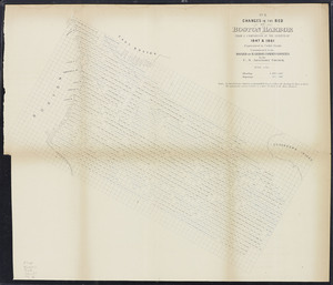
80. Changes in the bed of Boston harbor from a comparison of the surveys of 1835-61. Sheet 2. 1847 and 1861 Creator: Massachusetts. Board of Harbor Commissioners Format: Maps/Atlases Collection: Massachusetts Board of Harbor and Land Commissioners Date: 1868 Institution: State Library of Massachusetts