Search

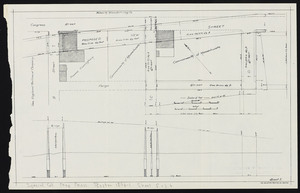
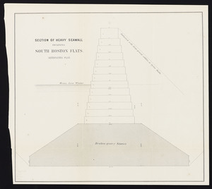
![[Plans of the South Bay]. Map A. Plan for the occupation of the South Boston flats](https://bpldcassets.blob.core.windows.net/derivatives/metadata/commonwealth-oai:m039km391/image_thumbnail_300.jpg)
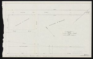
![[Plans of the South Bay]. Map B. Plan of the first section for the occupation of the South Boston flats](https://bpldcassets.blob.core.windows.net/derivatives/metadata/commonwealth-oai:f1882318v/image_thumbnail_300.jpg)
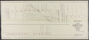
![[Plans of the South Bay]. Map C. Plan of South Bay showing changes in the Harbor Commissioners Lines](https://bpldcassets.blob.core.windows.net/derivatives/metadata/commonwealth-oai:kw52jr44j/image_thumbnail_300.jpg)
Limit your search
- Massachusetts Board of Harbor and Land Commissioners202
- Boston and New England Maps (Collection of Distinction)20
- Norman B. Leventhal Map Center Collection20
- Historic Maps5
- Urban Maps (Collection of Distinction)4
- Boston Redevelopment Authority Collection2
- Mapping Boston Collection1
- Maritime Charts and Atlases (Collection of Distinction)1