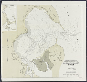
261. Scituate Harbor Creator: Board of Harbor and Land Commissioners of Massachusetts Format: Maps/Atlases Collection: Massachusetts Board of Harbor and Land Commissioners Date: 1915 Institution: State Library of Massachusetts
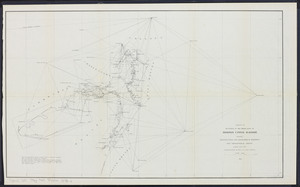
262. Sketch of re-survey of the wharf lines of Boston upper harbor: showing triangulation and geographical positions, and topographical sheets Creator: Massachusetts. Board of Harbor Commissioners Format: Maps/Atlases Collection: Massachusetts Board of Harbor and Land Commissioners Date: 1878 Institution: State Library of Massachusetts
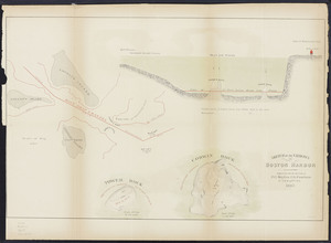
263. Sketch of the narrows in Boston harbor Creator: Foster, John G. (John Gray), 1823-1874.; Massachusetts. Board of Harbor Commissioners Format: Maps/Atlases Collection: Massachusetts Board of Harbor and Land Commissioners Date: 1868 Institution: State Library of Massachusetts
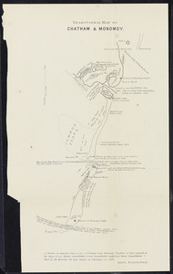
264. Traditional map of Chatham & Monomoy Creator: Massachusetts. Board of Harbor Commissioners; Eldridge, George Format: Maps/Atlases Collection: Massachusetts Board of Harbor and Land Commissioners Date: 1874 Institution: State Library of Massachusetts