Skip to search
Skip to main content
Skip to first result
Digital Commonwealth
Folders
Sign Up / Log In
Search for
Search
Search
Search
Basic
Advanced
Explore
Map
Collections
Institutions
Formats
For Educators
Primary Source Sets
Lesson Plans
Using Primary Sources
Searching Digital Commonwealth
For Institutions
Join Digital Commonwealth
Conferences, Trainings, & Events
How to Contribute Collections
Digitization Services
Board & Committees
Frequently Asked Questions
About
About Digital Commonwealth
News & Announcements
Copyright & Terms of Use
Harmful Content Statement
Partners
API
Contact Us
Search
Search Constraints
Start Over
Save Search
Your search:
More Like
commonwealth-oai:pc289q94x
✖
Remove constraint More Like: commonwealth-oai:pc289q94x
« Prev.
|
61
-
80
of
207
|
Next »
Sort
by relevance
relevance
title
date (asc)
date (desc)
Number of results to display per page
20
per page
per page
10
per page
20
per page
50
per page
100
per page
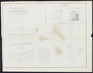
View results as:
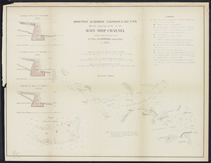
List
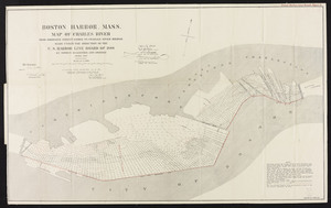
list view
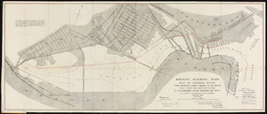
Maps
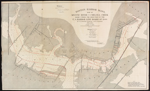
map view
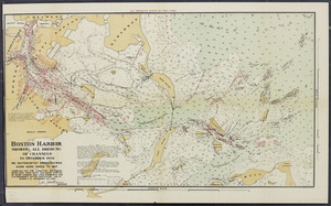
Gallery
grid view
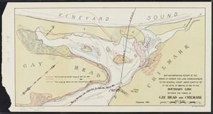
Search Results
61.
Atlas of the boundaries of the town of Seekonk, Bristol County
62.
Atlas of the boundaries of the town of Stoneham, Middlesex County
63.
Atlas of the boundaries of the town of West Bridgewater, Plymouth County
64.
Atlas of the boundaries of the town of Whitman, Plymouth County
65.
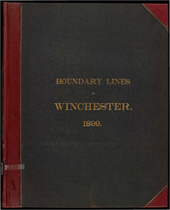
Atlas of the boundaries of the town of Winchester, Middlesex County
66.
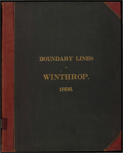
Atlas of the boundaries of the town of Winthrop, Suffolk County
67.
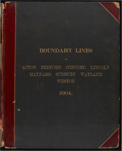
Atlas of the boundaries of the towns of Acton, Bedford, Concord, Lincoln, Maynard, Sudbury, Wayland, Weston, Middlesex County
68.
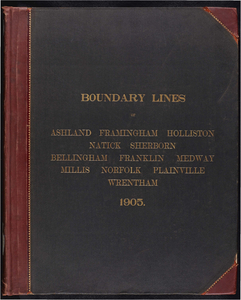
Atlas of the boundaries of the towns of Ashland, Framingham, Holliston, Natick, Sherborn, Middlesex County Bellingham,...
69.
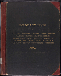
Atlas of the boundaries of the towns of Barnstable, Brewster, Chatham, Dennis, Eastham, Falmouth, Harwich, Mashpee, Orleans,...
70.
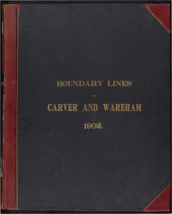
Atlas of the boundaries of the towns of Carver and Wareham, Plymouth County
71.
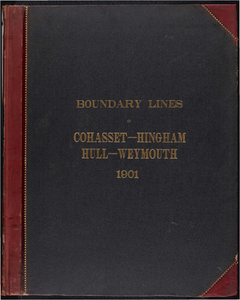
Atlas of the boundaries of the towns of Cohasset - Weymouth, Norfolk County Hingham - Hull, Plymouth County
72.
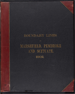
Atlas of the boundaries of the towns of Marshfield, Pembroke and Scituate, Plymouth County
73.
Boston harbor improvements at and below the narrows: and special sketch of Barrel & Kelly's Rocks
74.
Boston harbor improvements: Sketch showing works in the main ship channel carried on under the direction of Lt. Col. J.G....
75.
Boston Harbor, Mass. Map of Charles River: From Brookline Street Bridge to Charles River Bridge
76.
Boston Harbor, Mass., map of Charles River: from Brookline Street Bridge to its mouth
77.
Boston Harbor, Mass.: map of Mystic River and Chelsea Creek
78.
Boston Harbor: showing all dredging of channels to December, 1902
79.
Boston Inner Harbor, Massachusetts: from bridges to upper middle channel
80.
Boundary line between the towns of Gay Head and Chilmark
« Previous
Next »
1
2
3
4
5
6
7
8
…
10
11
Limit your search
Subject
Harbors--Massachusetts--Boston--Maps
58
Boston (Mass.)--Maps
10
Massachusetts--Maps
10
Boston Harbor (Mass.)--Maps
8
Charles River (Mass.)--Maps
7
Connecticut River--Maps
7
Connecticut--Maps
7
New England Railroad--Maps
6
more
Subject
»
Place
North and Central America
207
United States
207
Massachusetts
202
Suffolk (county)
82
Boston
78
Plymouth (county)
31
Middlesex (county)
24
Barnstable (county)
23
more
Place
»
Format
Maps/Atlases
163
Books
42
Photographs
2
Available to use
No known restrictions
3
Date
View distribution
Current results range from
1833
to
1916
Date range begin
Date range end
View larger »
Unknown
2
Collection
Massachusetts Board of Harbor and Land Commissioners
202
Boston and New England Maps (Collection of Distinction)
3
Norman B. Leventhal Map Center Collection
3
Urban Maps (Collection of Distinction)
3
Digital Amherst Collection
1
Massachusetts Board of Railroad Commissioners
1
Institution
State Library of Massachusetts
203
Boston Public Library
3
Jones Library, Amherst
1