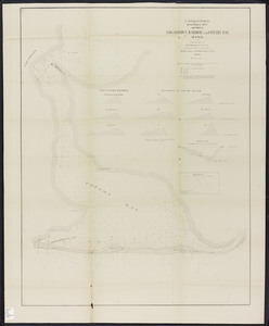
Skip to search
Skip to main content
Skip to first result
Digital Commonwealth
Folders
Sign Up / Log In
Search for
Search
Search
Search
Basic
Advanced
Explore
Map
Collections
Institutions
Formats
For Educators
Primary Source Sets
Lesson Plans
Using Primary Sources
Searching Digital Commonwealth
For Institutions
Join Digital Commonwealth
Conferences, Trainings, & Events
How to Contribute Collections
Digitization Services
Board & Committees
Frequently Asked Questions
About
About Digital Commonwealth
News & Announcements
Copyright & Terms of Use
Harmful Content Statement
Partners
API
Contact Us
Search
Search Constraints
Start Over
Save Search
Your search:
More Like
commonwealth-oai:pc289q892
✖
Remove constraint More Like: commonwealth-oai:pc289q892
« Prev.
|
41
-
60
of
235
|
Next »
Sort
by date (asc)
relevance
title
date (asc)
date (desc)
Number of results to display per page
20
per page
per page
10
per page
20
per page
50
per page
100
per page
View results as:
List
list view
Maps
map view
Gallery
grid view
Search Results
41.
Boston harbor improvements: Sketch showing works in the main ship channel carried on under the direction of Lt. Col. J.G....
42.
Map of Milford : town of Milford Worcester Co. Mass : from actual surveys and records
43.
Plan for the occupation of flats owned by the Commonwealth in Boston harbor
44.
Plan of the towns of Webster and Dudley : from actual surveys and records
45.
Edgartown harbor and Cotamy Bay, Mass.
46.
Map of Wareham River showing a scheme of harbor lines and improvement
47.
Plan for the occupation of flats owned by the Commonwealth in Boston harbor
48.
Reclamation of the Green Harbor River and North River marshes
49.
Map of a portion of the cities of Cambridge, Somerville and Charlestown, showing the drainage area of Millers River and Basins
50.
Plan for the occupation of flats owned by the Commonwealth in Boston harbor
51.
Plan for the occupation of flats owned by the Commonwealth in Boston harbor
52.
Plan showing the harbor line in Charles River
53.
Plan showing the harbor line in Fort Point Channel
54.
Plan showing the harbor line in Mystic River
55.
Plan showing the harbor line in Mystic River [South Channel]
56.
Hydrographic plan of Man of War Shoal, Boston upper harbor
57.
Map of the city of Worcester
58.
Milford, Massachusetts, Sanborn's survey, April 1874
59.
Plan for the occupation of flats owned by the Commonwealth in Boston harbor
60.
Plan of Worcester and Shrewsbury R.R.
« Previous
Next »
1
2
3
4
5
6
7
…
11
12
Limit your search
Subject
Harbors--Massachusetts--Boston--Maps
58
Worcester (Mass.)--Maps
19
Boston (Mass.)--Maps
14
Massachusetts--Maps
14
Boston Harbor (Mass.)--Maps
8
Charles River (Mass.)--Maps
7
Connecticut River--Maps
7
Connecticut--Maps
7
more
Subject
»
Place
North and Central America
235
United States
233
Massachusetts
226
Suffolk (county)
84
Boston
80
Worcester (county)
35
Plymouth (county)
31
Barnstable (county)
23
more
Place
»
Format
Maps/Atlases
190
Books
42
Manuscripts
5
Photographs
2
Prints
1
Available to use
No known restrictions
21
Date
View distribution
Current results range from
1784
to
2005
Date range begin
Date range end
View larger »
Unknown
1
Collection
Massachusetts Board of Harbor and Land Commissioners
202
Norman B. Leventhal Map & Education Center Collection
21
Boston and New England Maps (Collection of Distinction)
18
Urban Maps (Collection of Distinction)
13
Massachusetts Real Estate Atlases
7
American Antiquarian Society Collection
2
American Revolutionary War-Era Maps (Collection of Distinction)
2
Bancroft Memorial Library Local History Collection
1
more
Collection
»
Institution
State Library of Massachusetts
211
Boston Public Library
21
American Antiquarian Society
2
Bancroft Memorial Library
1