Skip to search
Skip to main content
Skip to first result
Digital Commonwealth
Folders
Sign Up / Log In
Search for
Search
Search
Search
Basic
Advanced
Explore
Map
Collections
Institutions
Formats
For Educators
Primary Source Sets
Lesson Plans
Using Primary Sources
Searching Digital Commonwealth
For Institutions
Join Digital Commonwealth
Conferences, Trainings, & Events
How to Contribute Collections
Digitization Services
Board & Committees
Frequently Asked Questions
About
About Digital Commonwealth
News & Announcements
Copyright & Terms of Use
Harmful Content Statement
Partners
API
Contact Us
Search
Search Constraints
Start Over
Save Search
Your search:
More Like
commonwealth:z316s1963
✖
Remove constraint More Like: commonwealth:z316s1963
« Prev.
|
41
-
60
of
3,661
|
Next »
Sort
by relevance
relevance
title
date (asc)
date (desc)
Number of results to display per page
20
per page
per page
10
per page
20
per page
50
per page
100
per page
View results as:
List
list view
Maps
map view
Gallery
grid view
Search Results
41.
Indentures, 1804-1820
42.
Indentures, 1821-1829
43.
Land Petitions, Plot Plans, and Land Leases, 1762-1874
44.
Layout of First Telephone Lines, 1880
45.
Letters of Recommendation from Other Churches, 1786-1791
46.
List of Deaths, 1799-1823
47.
Lists of Persons Liable for Enrollment in the Militia, 1840, 1843-1846
48.
Lists of Persons Liable for Enrollment in the Militia, 1841, 1842
49.
Lists of Persons Liable for Enrollment in the Militia, 1856-1859
50.
Militia Pay Rolls, 1794-1868
51.
Note from “Documents, 1709-1831” Wood Box re: “Town Documents – Vol. 1 and Vol. 2”
52.
Notices to Appear in Court, 1788-1824
53.
Notifications of New Residents, 1735-1753
54.
Notifications of New Residents, 1762-1763
55.
Notifications of New Residents, 1764-1769
56.
Notifications of New Residents, 1770-1792
57.
Perambulations of Town Boundary, 1730-1793
58.
Perambulations of Town Boundary, 1810-1822
59.
Perambulations of Town Boundary, 1826-1838
60.
Perambulations of Town Boundary, 1841-1856
« Previous
Next »
1
2
3
4
5
6
7
…
183
184
Limit your search
Subject
Roads
3,537
Cities and towns
1,680
Land use mapping
1,680
Soil mapping
1,680
United States. Work Projects Administration
1,680
United States. Works Progress Administration
1,680
Trees
324
Houses
154
more
Subject
»
Place
North and Central America
3,130
United States
3,096
Massachusetts
2,647
Worcester (county)
450
Essex (county)
448
Middlesex (county)
387
Berkshire (county)
287
Norfolk (county)
184
more
Place
»
Format
Maps/Atlases
1,693
Photographs
991
Postcards/Cards
711
Manuscripts
145
Prints
110
Film/Video
29
Albums/Scrapbooks
18
Documents
18
more
Format
»
Available to use
No known restrictions
2,749
Creative Commons license
249
Date
View distribution
Current results range from
1683
to
2011
Date range begin
Date range end
View larger »
Unknown
68
Collection
Land study maps, 1936-1937
1,680
Tichnor Brothers Postcard Collection
576
Bill Lane Photograph Collection
217
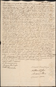
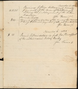
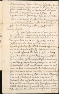
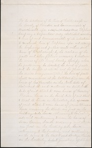
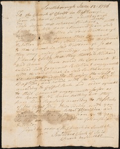
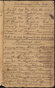
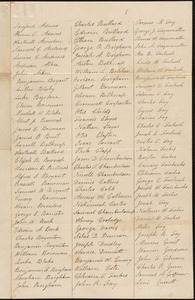
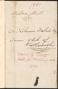
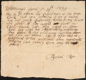
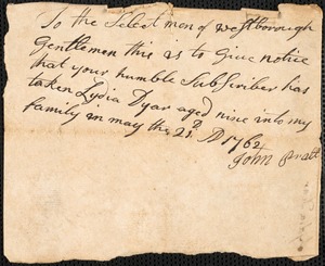
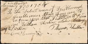
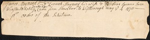
Historical Records of the Town of Westborough: Administrative Documents, 1724-1929
133
Arlington Historical Society Collection
78
Leon Abdalian Collection
70
Alexander Davidson Photography
48
Edmund L. Mitchell Collection
42
more
Collection
»
Institution
Massachusetts Archives
1,680
Boston Public Library
993
Newburyport Public Library
217
Westborough Public Library
133
Arlington Historical Society
102
Williams College
48
Hamilton Historical Society
41
Lenox Library Association
35
more
Institution
»