Skip to search
Skip to main content
Skip to first result
Digital Commonwealth
Folders
Sign Up / Log In
Search for
Search
Search
Search
Basic
Advanced
Explore
Map
Collections
Institutions
Formats
For Educators
Primary Source Sets
Lesson Plans
Using Primary Sources
Searching Digital Commonwealth
For Institutions
Join Digital Commonwealth
Conferences, Trainings, & Events
How to Contribute Collections
Digitization Services
Board & Committees
Frequently Asked Questions
About
About Digital Commonwealth
News & Announcements
Copyright & Terms of Use
Harmful Content Statement
Partners
API
Contact Us
Search
Search Constraints
Start Over
Save Search
Your search:
More Like
commonwealth:tm70nj923
✖
Remove constraint More Like: commonwealth:tm70nj923
« Prev.
|
61
-
80
of
5,551
|
Next »
Sort
by relevance
relevance
title
date (asc)
date (desc)
Number of results to display per page
20
per page
per page
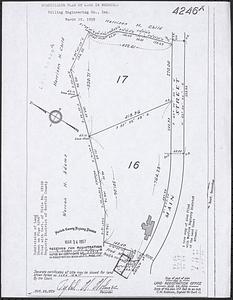
10
per page
20
per page
50
per page
100
per page
View results as:
List
list view
Maps
map view
Gallery
grid view
Search Results
61.
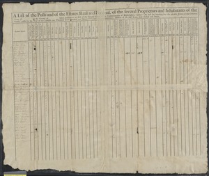
A list of the polls and of the estates, real and personal, of the several proprietors and inhabitants of the town of in the...
62.
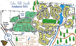
Map of Echo Hill South in Amherst
63.
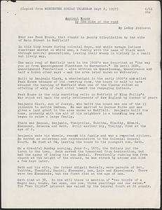
Notes on Peak House - by various individuals
64.
Ownership of Peak House (plots, valuation, zoning)
65.
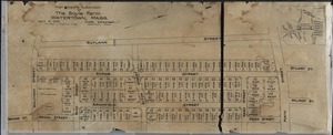
Plan showing subdivision of the Boyle Farm. Watertown, Mass.
66.
Properties around the eastern shoreline of the Shirley Reservoir
67.
Properties near Arbor Street and Pine Street
68.
Properties near Burrage Street
69.
Properties near Burrage Street and the Shirley town line
70.
Properties near Chase Road
71.
Properties near Chase Road
72.
Properties near Chase Road and the Townsend town line
73.
Properties near Chase Road and Town Forest
74.
Properties near Chase Road between Northfield Road and West Townsend Road
75.
Properties near Chase Road, Boucher Road, and Asplund Road
76.
Properties near Chestnut Street, Highland Street, Massachusetts Avenue and Main Street, including Marshall Park and Pond
77.
Properties near Cross Road and Leominster Road
78.
Properties near Electric Avenue, Upland Avenue, Eastern Avenue, Hollis Road
79.
Properties near Elmwood Road
80.
Properties near Elmwood Road and the Shirley town line
« Previous
Next »
1
2
3
4
5
6
7
8
…
277
278
Limit your search
Subject
Houses
698
Cities & towns
365
Hancock Street
260
Schools
233
Churches
232
Business enterprises
226
Stores & shops
220
Land subdivision
214
more
Subject
»
Place
North and Central America
5,536
United States
5,532
Massachusetts
5,531
Norfolk (county)
5,373
Quincy
5,370
Lunenburg
151
Worcester (county)
151
Cuba
4
more
Place
»
Format
Photographs
5,524
Documents
16
Manuscripts
16
Drawings/Illustrations
6
Maps/Atlases
5
Letters/Correspondence
2
Objects/Artifacts
2
Available to use
Creative Commons license
5,385
No known restrictions
154
Date
View distribution
Current results range from
1737
to
2005
Date range begin
Date range end
View larger »
Collection
Parker Collection
5,370
1950 Aerial Mapping of Lunenburg, Ma.
151
Watertown Miscellaneous
14
Plans & Drawings, c.1847-1979 (Bulk 1882-1970)
5
Peak House Institutional Records Collection
3
Digital Amherst Collection
2
Stereograph Collection
2
Arlington Historical Society Collection
1
more
Collection
»
Institution
Thomas Crane Public Library
5,370
Lunenburg Massachusetts Historical Society
151
Watertown Free Public Library
15
Frederick Law Olmsted National Historic Site
5
Peak House Heritage Center
3
Arlington Historical Society
2
Boston Public Library
2
Jones Library, Amherst
2
more
Institution
»