Skip to search
Skip to main content
Skip to first result
Digital Commonwealth
Folders
Sign Up / Log In
Search for
Search
Search
Search
Basic
Advanced
Explore
Map
Collections
Institutions
Formats
For Educators
Primary Source Sets
Lesson Plans
Using Primary Sources
Searching Digital Commonwealth
For Institutions
Join Digital Commonwealth
Conferences, Trainings, & Events
How to Contribute Collections
Digitization Services
Board & Committees
Frequently Asked Questions
About
About Digital Commonwealth
News & Announcements
Copyright & Terms of Use
Harmful Content Statement
Partners
API
Contact Us
Search
Search Constraints
Start Over
Save Search
Your search:
More Like
commonwealth:t435gf58m
✖
Remove constraint More Like: commonwealth:t435gf58m
« Prev.
|
101
-
150
of
1,162
|
Next »
Sort
by relevance
relevance
title
date (asc)
date (desc)
Number of results to display per page
50
per page
per page
10
per page
20
per page
50
per page
100
per page
View results as:
List
list view
Maps
map view
Gallery
grid view
Search Results
101.
B&M R.R. above W. entrance of tunnel
102.
Boston city street signs
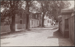
103.
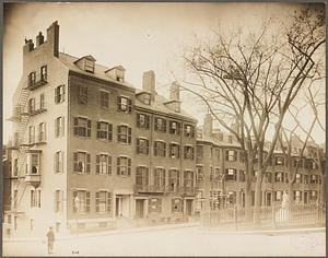
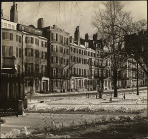
Boston. Louisburg Square - Beacon Hill
104.
Boston. Louisburg Square - Beacon Hill
105.
Boston, Massachusetts. Beacon Street, opposite Public Garden, 1887
106.
Boston, Massachusetts. Corner Boylston and Park Square
107.
Boston, Massachusetts. Louisburg Square. West side, showing corner of Mt. Vernon Street
108.
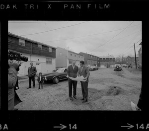
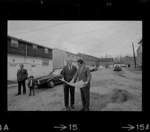
Boston Mayor Kevin White and another man looking at plans on tour of Stony Brook neighborhood
109.
Boston Mayor Kevin White and another man looking at plans on tour of Stony Brook neighborhood
110.
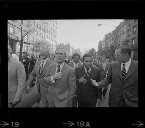
Boston Mayor Kevin White, left, Newark Mayor Kenneth Gibson, center, and Wilmington Mayor Harry Haskell, right talking while on...
111.
Boston Mayor Kevin White, right, points something out to Seattle Mayor Wesley C. Uhlman, left, and New Orleans Mayor Moon...
112.
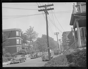
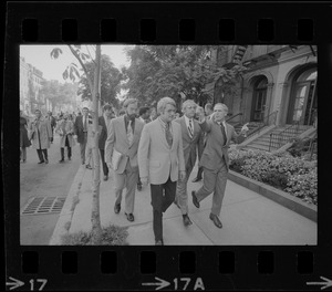
Boston misc
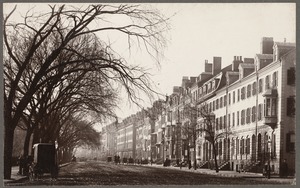
113.
Boston misc
114.
Boston police cruiser in front of building
115.
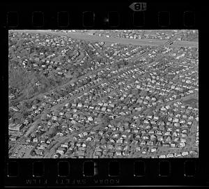
Boston suburban aerial view, Belmont
116.
Boston suburban aerial view, Belmont
117.
Boston suburban aerial view, Belmont
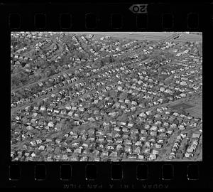
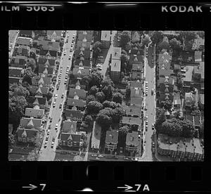
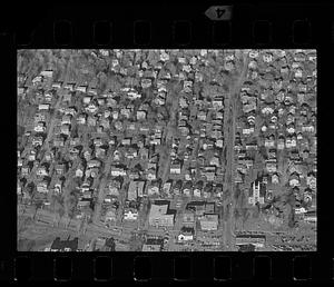
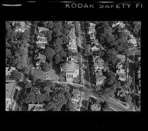
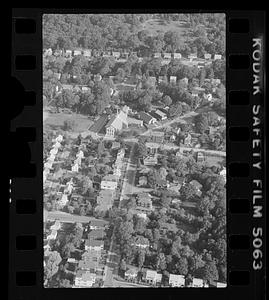
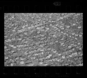
118.
Boston suburban aerial view, Belmont
119.
Boston suburban aerial view, Belmont
120.
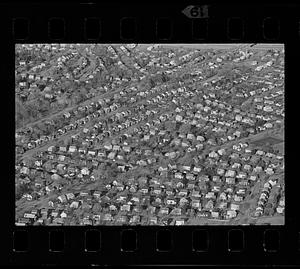
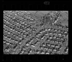
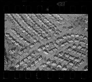
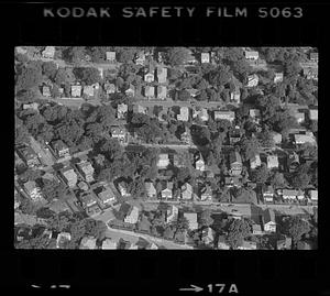
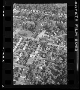
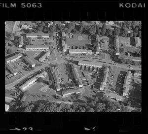
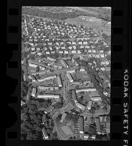
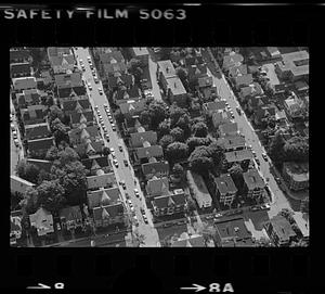
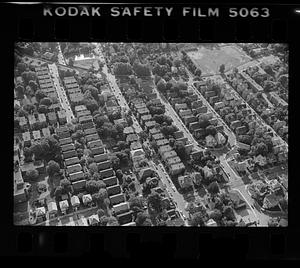
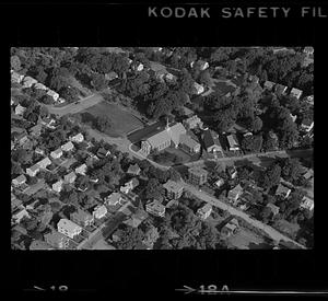
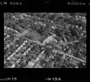
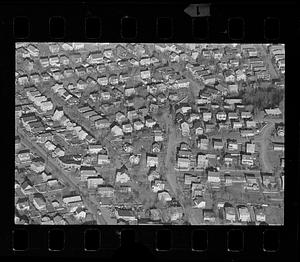
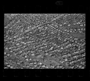
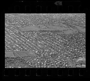
Boston suburban aerial view (unspecified location), unspecified Boston suburb
121.
Boston suburban aerial view (unspecified location), unspecified Boston suburb
122.
Boston suburban aerial view (unspecified location), unspecified Boston suburb
123.
Boston suburban aerial view (unspecified location), unspecified Boston suburb
124.
Boston suburban aerial view (unspecified location), unspecified Boston suburb
125.
Boston suburban aerial view (unspecified location), unspecified Boston suburb
126.
Boston suburban aerial view (unspecified location), unspecified Boston suburb
127.
Boston suburban aerial view (unspecified location), unspecified Boston suburb
128.
Boston suburban aerial view (unspecified location), unspecified Boston suburb
129.
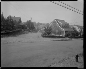
Boston suburban aerial view (unspecified location), unspecified Boston suburb
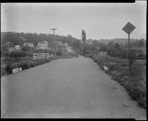
130.
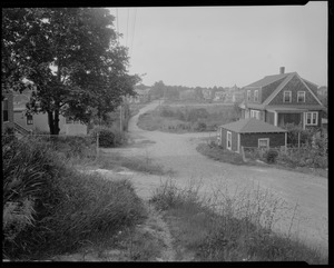
Boston suburban aerial view (unspecified location), unspecified Boston suburb
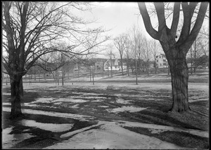
131.
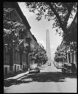
Boston suburban aerial view (unspecified location), unspecified Boston suburb
132.
Boston suburban aerial view (unspecified location), unspecified Boston suburb
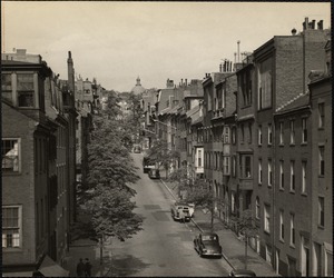
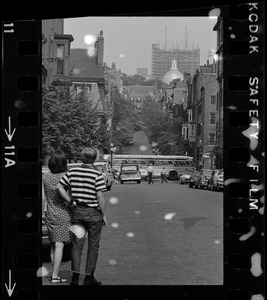
133.
Boston suburban aerial view (unspecified location), unspecified Boston suburb
134.
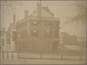
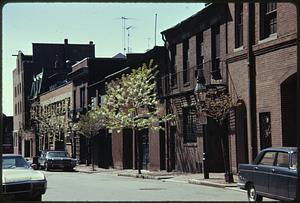
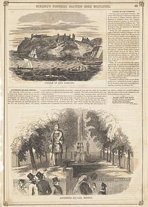
Boston suburban aerial view (unspecified location), unspecified Boston suburb
135.
Boston suburban aerial view (unspecified location), unspecified Boston suburb
136.
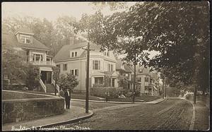
Boylston St. & Belmore Terrace, Jamaica Plain, Mass.
137.
Boylston St., Jamaica Plain, Mass.
138.
Brentwood St. and Salem St. SW corner view looking southerly, July 18, 1936
139.
Brentwood St. view looking northerly from street near Grant Rd., July 18, 1936
140.
Brentwood St. view looking Sly from in front of #12, July 18, 1936
141.
Brookline
142.
Bunker Hill Monument from shadow of elm on Monument Avenue
143.
Burr Street. Jamaica Plain, Massachusetts
144.
Burroughs Street. Jamaica Plain, Massachusetts
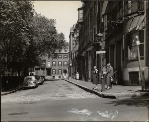
145.
Bus crossing intersection in Beacon Hill with view of Massachusetts State House dome in distance
146.
Byron St.
147.
Las Casas St., 10 July '97
148.
Castle of San Lorenzo ; Louisburg Square, Boston
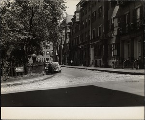
149.
Chambers Street in the West End, Boston
150.
Chandler Street - South End
« Previous
Next »
1
2
3
4
5
6
7
…
23
24
Limit your search
Subject
Residential streets
702
Houses
332
Trees
77
WHS student
76
Utility poles
61
Winter
33
Neighborhoods
31
Buildings
30
more
Subject
»
Place
North and Central America
845
United States
845
Massachusetts
828
Middlesex (county)
357
Suffolk (county)
324
Boston
321
Watertown
180
Malden
122
more
Place
»
Format
Photographs
928
Prints
101
Maps/Atlases
68
Manuscripts
23
Postcards/Cards
22
Documents
18
Posters
15
Newspapers
7
more
Format
»
Available to use
Creative Commons license
826
No known restrictions
176
Date
View distribution
Current results range from
1687
to
2000
Date range begin
Date range end
View larger »
Unknown
6
Collection
Watertown People
212
Malden Houses
122
Boston Pictorial Archive (Collection of Distinction)
110
Leslie Jones Collection
67
Watertown Maps
65
Watertown Miscellaneous
61
Emerson Collection
59
Press Photography from the Brearley Collection
53
more
Collection
»
Institution
Watertown Free Public Library
465
Boston Public Library
366
Malden Public Library
122
Longmeadow Historical Society
59
Jamaica Plain Historical Society
27
Phillips Library at the Peabody Essex Museum
22
Newton Free Library
20
Fall River Public Library
18
more
Institution
»